

Rain Late Tonight/Tomorrow Morning
THIS AFTERNOON: On the maps, a major storm system is developing over the Central U.S… producing snow for parts of Oklahoma and Kansas. We have a fairly odd cloud pattern over Alabama this afternoon; the sky is sunny over the western and eastern counties, but a narrow band of clouds extends through the central counties of the state. Clouds will increase statewide over the next few hours.
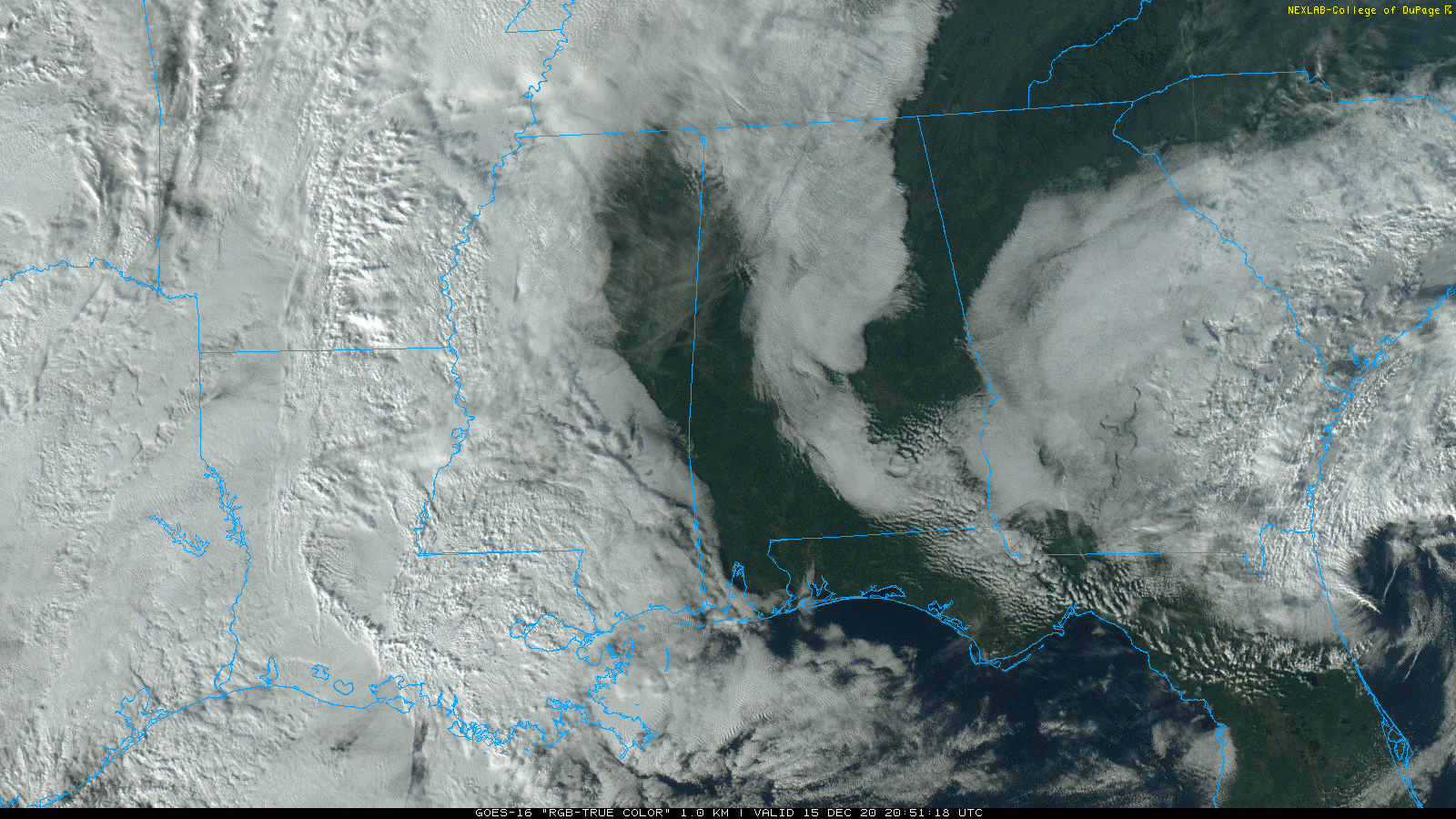
Rain will push into the state late tonight, mainly after midnight, and will continue through the morning hours tomorrow. Rain amounts should be generally 1/2 inch or less, and no thunder is expected with a cool and stable airmass holding in place. Areas north of Birmingham will hold in the 40s all day. Most of the rain will be out of the state by early afternoon, and we expect gradual clearing tomorrow night.
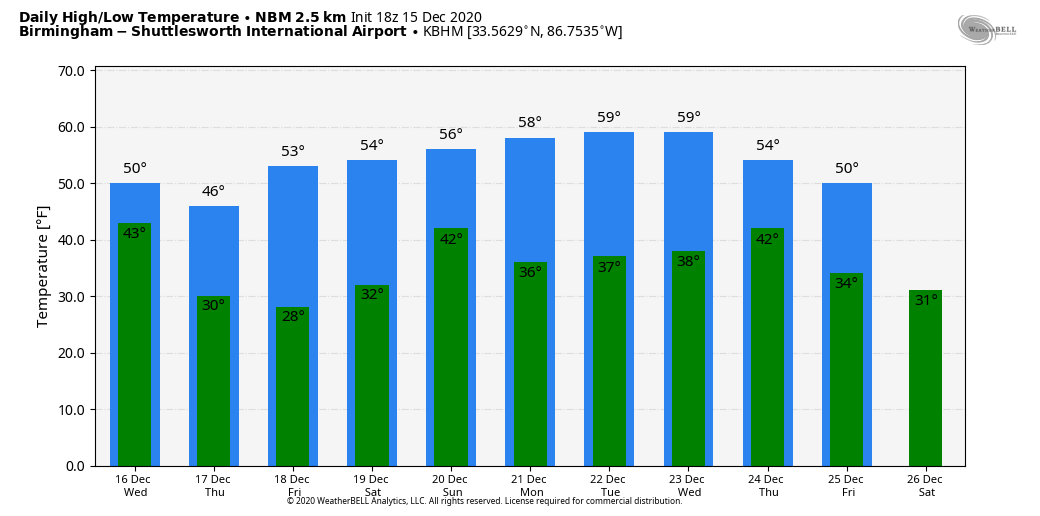
Thursday and Friday will be dry with a good supply of sunshine both days; the high Thursday will be in the upper 40s, followed by mid 50s Friday. Morning lows will be in the sub-freezing range; coldest morning will be early Friday with temperatures in the 20s.
THE ALABAMA WEEKEND: Clouds return to the state Saturday, and periods of light rain are likely late Saturday, Saturday night, and into Sunday morning. By Sunday afternoon the best chance of rain will shift down into the southern third of the state… rain amounts will be under 1/2 inch with limited moisture available. Otherwise, look for a cloudy sky both days with highs in the 50s.
CHRISTMAS WEEK: The weather looks dry and seasonal Monday through Wednesday with highs in the 50s and lows in the 30s. A cold front will bring a chance of showers Wednesday night or Thursday, followed by cold, dry air for Christmas Day on Friday. See the Weather Xtreme video for maps, graphics, and more details.
MAJOR EASTERN U.S. SNOW STORM: The system that will bring rain to Alabama tomorrow morning will become a major snow producer as it gains latitude. A high impact winter storm is likely from parts of Virginia and West Virginia into New England tomorrow through Thursday morning; some spots will see one to two feet of snow, including New York City.
ON THIS DATE IN 1992: Cyclone John hit the sparsely populated northwest coast of Australia with winds gusting to 185 mph. John was the strongest cyclone to hit Australia in over 100 years.
BEACH FORECAST: Click here to see the AlabamaWx Beach Forecast Center page.
WEATHER BRAINS: Don’t forget you can listen to our weekly 90 minute show anytime on your favorite podcast app. This is the show all about weather featuring many familiar voices, including our meteorologists here at ABC 33/40.
CONNECT: You can find me on all of the major social networks…
Look for the next Weather Xtreme video here by 7:00 a.m. tomorrow…
Category: Alabama's Weather, ALL POSTS, Weather Xtreme Videos
About the Author (Author Profile)
James Spann is one of the most recognized and trusted television meteorologists in the industry. He holds the AMS CCM designation and television seals from the AMS and NWA. He is a past winner of the Broadcast Meteorologist of the Year from both professional organizations.Subscribe
If you enjoyed this article, subscribe to receive more just like it.


