

Rain Tomorrow Night; Then Much Colder
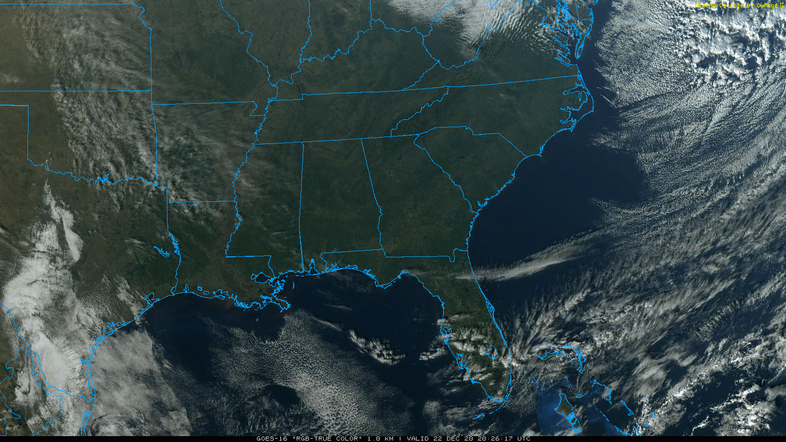
DELIGHTFUL DECEMBER DAY: Temperatures are in the 60s over most of Alabama this afternoon with a good supply of sunshine. The sky will stay mostly fair tonight with a low in the 30s.
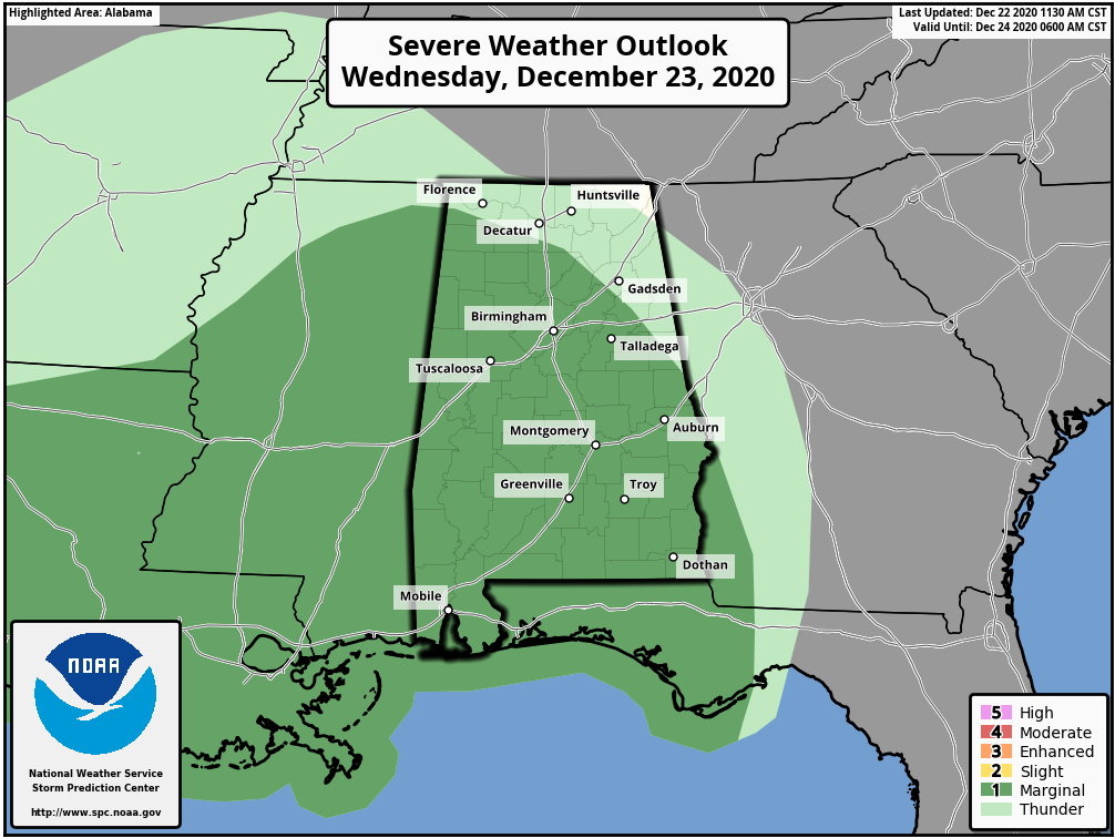
Clouds increase tomorrow ahead of a cold front that will bring rain back to Alabama tomorrow night. SPC maintains a low end, “marginal risk” (level 1/5) of severe thunderstorms for much of the state.
The best chance of rain will come from about 10:00 p.m. tomorrow through 8:00 a.m. Thursday. These middle of the night events can be tricky; there is basically no surface based instability, but lots of shear. I still think there will be very little thunder over the northern 2/3 of the state, and the main issue will come from strong gradient winds, not related to the rain. Winds could gust to 30/35 mph late tomorrow night as the showers pass through. Rain amounts of 1/2 to 1 inch look likely.
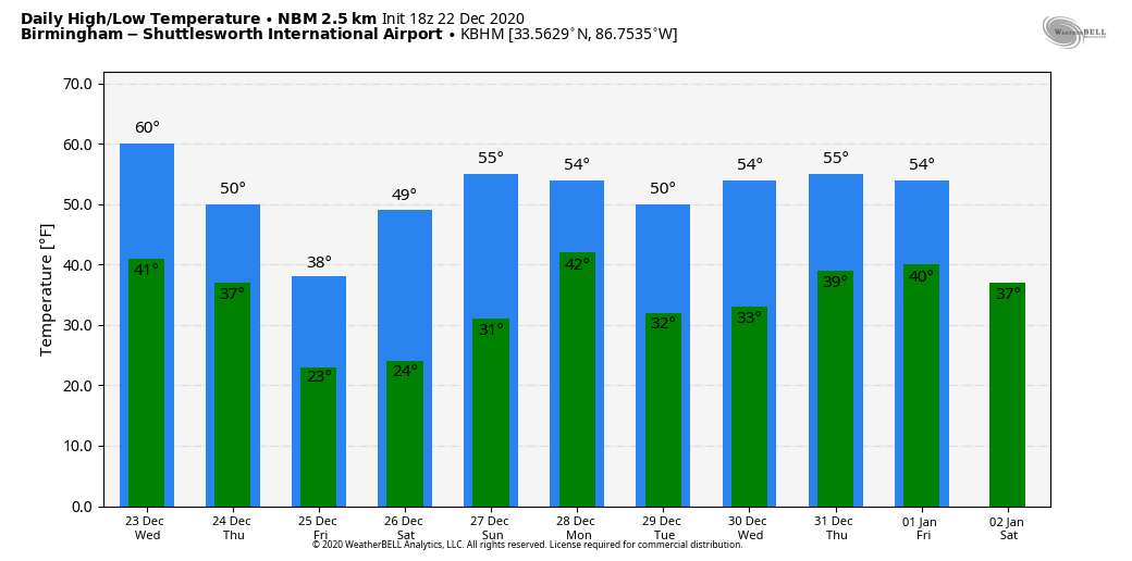
COLD AIR RETURNS: Temperatures go the wrong way Thursday. Rain ends during the morning, clouds linger, and temperatures fall into the 30s. In the cold air, some light sleet, snow flurries, or snow showers will be possible during the afternoon and evening hours. The deeper moisture will be long gone by then, and no meaningful accumulation or impact is expected. However, some grassy areas could become white briefly across higher terrain of Northeast Alabama. Even there, no travel issues are expected with temperatures in the mid 30s, above freezing.
The sky will clear tomorrow night, and by Friday morning we will drop into the 18-25 degree range over the northern half of the state. The roads will be dry by then, and again no travel issues are forecast. Then, during the day Christmas Day, the sky will be sunny with a high in the 37-42 degree range. If Birmingham holds below 40 degrees, it will be only the 12th time that has happened on December 25 since 1900.
THE ALABAMA WEEKEND: Saturday morning will feature another hard freeze with lows between 15 and 25 degrees. Then, with a sunny sky, temperatures rise into the mid 50s by afternoon. Sunday will be dry with a high between 57 and 60; clouds will slowly increase during the day. Some rain will likely reach Alabama late Sunday night, mainly after midnight.
NEXT WEEK: Rain ends early Monday, followed by a clearing sky and a high around 50 degrees. The weather will be dry and cool Tuesday and Wednesday; then rain returns later in the week on Thursday or Friday. For now we don’t expect any severe storms, or winter weather issues next week… See the Weather Xtreme video for maps, graphics, and more details.
ON THIS DATE IN 1989: Between December 22 and December 24, 1989, deepening low pressure pulled a frigid arctic air mass into the southeastern United States. The high in Birmingham on December 22, 1989 was 15 degrees; temperatures dropped to 1 degree the following morning, on December 23. This sequence of events produced a historic snowstorm and a rare white Christmas east of Alabama. At Charleston, South Carolina, the storm deposited 8 inches of snow – the greatest snowfall in modern history. At Savannah, Georgia, the storm total accumulation of 3.6 inches tied the greatest snowfall in modern history.
BEACH FORECAST: Click here to see the AlabamaWx Beach Forecast Center page.
WEATHER BRAINS: Don’t forget you can listen to our weekly 90 minute show anytime on your favorite podcast app. This is the show all about weather featuring many familiar voices, including our meteorologists here at ABC 33/40.
CONNECT: You can find me on all of the major social networks…
Look for the next Weather Xtreme video here by 7:00 a.m. tomorrow…
Category: Alabama's Weather, ALL POSTS, Weather Xtreme Videos
About the Author (Author Profile)
James Spann is one of the most recognized and trusted television meteorologists in the industry. He holds the AMS CCM designation and television seals from the AMS and NWA. He is a past winner of the Broadcast Meteorologist of the Year from both professional organizations.Subscribe
If you enjoyed this article, subscribe to receive more just like it.


