

A Quick Look at the Severe Weather Threat for Tonight & Through Midday Tomorrow
This mid-morning update on the developing severe weather potential show that there is not that big of changes with the forecast with the exception that pressure gradient winds should stay below advisory criteria outside of thunderstorms. The window for strong to severe storms remain from midnight tonight through 1:00 pm tomorrow afternoon. Damaging winds up to 60 MPH and a few tornadoes will be possible.
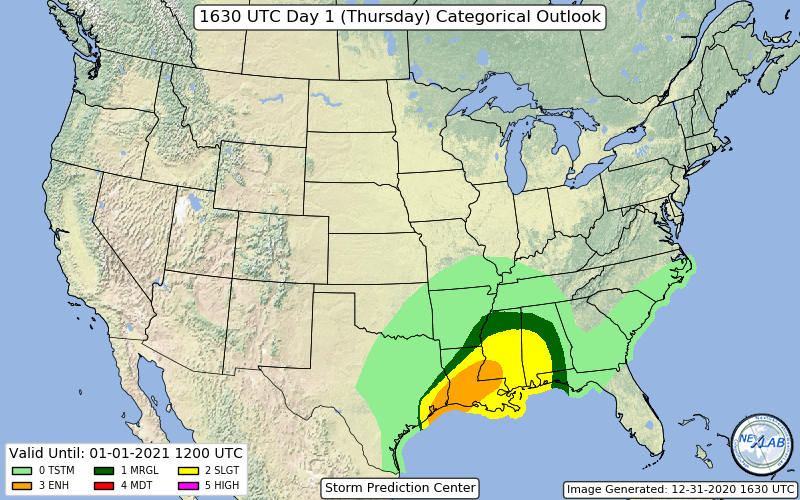
No changes to the latest update from the SPC… A level 2 Slight Risk for severe storms for the west and southwestern parts of the area; a level 1 Marginal Risk stretches outside of that and includes much of the rest of the area with the exception of the extreme eastern parts of Central Alabama
Here is a quick look at a few model images along with some thoughts.
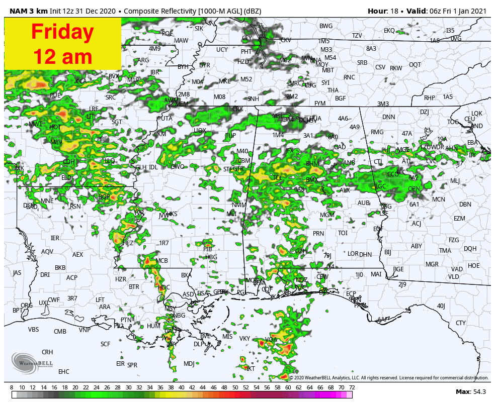
The latest run of the HRRR shows that the cold front will be over the western portions of Mississippi, but this will be when the stronger wind fields move into the western parts of Central Alabama, opening the window for strong to severe storms. It looks like at this point the prefrontal cells will be the ones we’ll have to watch.
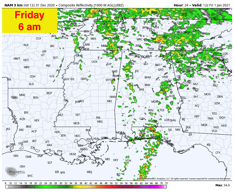
By 6:00 am, the front will begin to move into the western parts of Central Alabama, but the severe threat will generally be located in the central and eastern parts of the area. All of the models are showing the rain and thunderstorm activity starting to diminish along the front with all the focus shifting on the prefrontal activity.
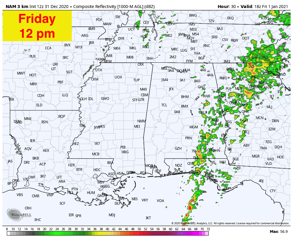
By midday, the front is now beginning to push into Georgia with rain and thunderstorm activity confined to the eastern and southeastern parts of the area. With the daytime heating, there may be a resurgence of instability over those locations and a few stronger to severe storms will be possible.
This is a messy and conditional setup, especially since this system is not as organized as you would like to see one for this time of the year. However, that doesn’t mead we can let our guard down. All it takes is for one tornado to come down your street to make it a disaster. Stay weather aware… be prepared… have multiple ways to receive warnings.
Category: Alabama's Weather, ALL POSTS, Severe Weather
About the Author (Author Profile)
Scott Martin is an operational meteorologist, professional graphic artist, musician, husband, and father. Not only is Scott a member of the National Weather Association, but he is also the Central Alabama Chapter of the NWA president. Scott is also the co-founder of Racecast Weather, which provides forecasts for many racing series across the USA. He also supplies forecasts for the BassMaster Elite Series events including the BassMaster Classic.Subscribe
If you enjoyed this article, subscribe to receive more just like it.


