

Strong Storms in Eastern Lee/Southeastern Chambers Counties
Strong storms are just about out of Alabama, but they are still impacting eastern Lee, and southeastern Chambers Counties. Watch out for 40 mph wind gusts, heavy rain, and lightning.
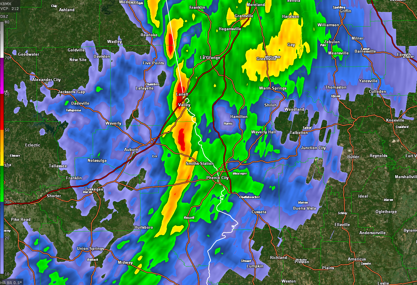
…SIGNIFICANT WEATHER ADVISORY FOR EASTERN LEE AND SOUTHEASTERN
CHAMBERS COUNTIES UNTIL 1045 AM CST…
AT 1009 AM CST, DOPPLER RADAR WAS TRACKING STRONG THUNDERSTORMS ALONG
A LINE EXTENDING FROM LAKEVIEW TO NEAR BLEECKER TO 6 MILES WEST OF
SEALE. MOVEMENT WAS NORTHEAST AT 60 MPH.
WINDS IN EXCESS OF 40 MPH WILL BE POSSIBLE WITH THESE STORMS.
LOCATIONS IMPACTED INCLUDE…
VALLEY, LANETT, SMITHS, SMITHS STATION, LAKEVIEW, BEULAH, HUGULEY,
FAIRFAX, RIVER VIEW, AMITY PARK, BLEECKER, GRIFFEN MILL, LADONIA,
SOUTHERN HARBOR, LANETT MUNICIPAL AIRPORT, I 85 WELCOME CENTER AT
LANETT, ROCKY POINT AND MONTEREY HEIGHTS.
PRECAUTIONARY/PREPAREDNESS ACTIONS…
TORRENTIAL RAINFALL IS ALSO OCCURRING WITH THESE STORMS, AND MAY LEAD
TO LOCALIZED FLOODING. DO NOT DRIVE YOUR VEHICLE THROUGH FLOODED
ROADWAYS.
Category: Alabama's Weather, ALL POSTS
About the Author (Author Profile)
Bill Murray is the President of The Weather Factory. He is the site's official weather historian and a weekend forecaster. He also anchors the site's severe weather coverage. Bill Murray is the proud holder of National Weather Association Digital Seal #0001 @wxhistorianSubscribe
If you enjoyed this article, subscribe to receive more just like it.


