

Midday Nowcast: Becoming Sunny
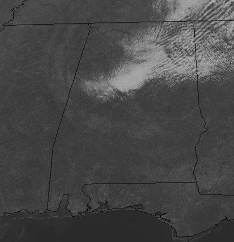
It was a foggy start to the day for many locations, but as we approach the midday hours, the fog has mixed out, and after seeing a band of clouds work across the state, we are seeing generally sunny conditions, allowing highs this afternoon to reach the mid 50s.
Tonight, expect a clear and cold night, with a freeze as temperatures will range from the mid 20s to low 30s across North/Central Alabama. Tomorrow will have a sunny start to the day, but clouds should begin to increase late in the day ahead of our next rain maker due in here Thursday. Highs tomorrow will range from the mid to upper 50s.
RAIN RETURNS: As the clouds return tomorrow night, rain will move into the state by Thursday morning. The surface low will track from northwest to southeast across the state, and that means no severe weather threat, but expect decent rain chances throughout the day. It will be a cloudy and chilly day with highs in the upper 40s and lower 50s. Rainfall amounts around 1/2 inches are likely. Light rain will linger into Thursday night as a deep, cold core upper low moves overhead. These systems can sometimes bring dynamic cooling and unexpected snow flakes, but for now all thermal values suggest just some cold rain for Alabama. The rain ends early Friday, followed by slow clearing. In fact, Friday looks to be a rather raw winter’s day, with the lingering clouds, cold temps in the 40s, and brisk northerly winds.
BEACH FORECAST CENTER: Get the latest weather and rip current forecasts for the beaches from Fort Morgan to Panama City on our Beach Forecast Center page. There, you can select the forecast of the region that you are interested in visiting.
WORLD TEMPERATURE EXTREMES: Over the last 24 hours, the highest observation outside the U.S. was 104.9F at Navrongo, Ghana. The lowest observation was -64.1F at Toko, Russia.
CONTIGUOUS TEMPERATURE EXTREMES: Over the last 24 hours, the highest observation was 88F at Falcon Lake, TX. The lowest observation was -2F at Cotton, MN.
WEATHER ON THIS DATE IN 1904: Bitterly cold air gripped the northeastern U.S. Morning lows of -42 degrees at Smethport PA and -34 at River Vale NJ established state records.
Category: Alabama's Weather, ALL POSTS
About the Author (Author Profile)
Macon, Georgia Television Chief Meteorologist, Birmingham native, and long time Contributor on AlabamaWX. Stormchaser. I did not choose Weather, it chose Me. College Football Fanatic. @Ryan_StinnetSubscribe
If you enjoyed this article, subscribe to receive more just like it.


