

Dry Tomorrow; Rain Returns To Alabama Thursday
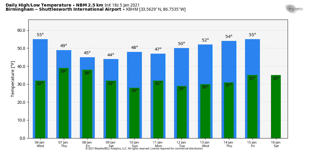
SUNNY WINTER DAY: Temperatures are mostly in the 50s across Alabama this afternoon with a good supply of sunshine; tonight will be fair and cold with a freeze likely early tomorrow. We project a low between 27 and 32 degrees for most communities early tomorrow… then we warm into the mid 50s with a partly to mostly sunny sky. Clouds will increase tomorrow night.
THURSDAY/FRIDAY: Thursday will be a cold, wet day for Alabama. Periods of rain are likely with temperatures not getting out of the 40s. No severe weather worries, and only those in far South Alabama could hear some thunder. Light rain will persist Thursday night as a deep cold core upper low moves over the northern half of the state. For now, low level thermal values suggest it will be all liquid, but sometimes these cold core systems can bring some surprises due to dynamic cooling. We will watch model trends closely, but for now we won’t mention any freezing or frozen precipitation.
Any lingering light rain will end early in the day Friday, followed by gradual clearing by afternoon. Temperatures will stay below average; the high Friday will in the mid 40s.
THE ALABAMA WEEKEND: After a low in the 20s, look for a high between 45 and 50 degrees Saturday afternoon with a mix of sun and clouds. Sunday will be dry with a high in the upper 40s. Clouds increase Sunday night.
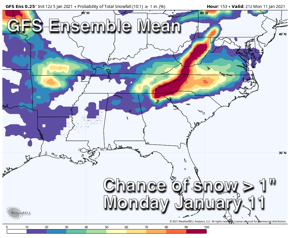
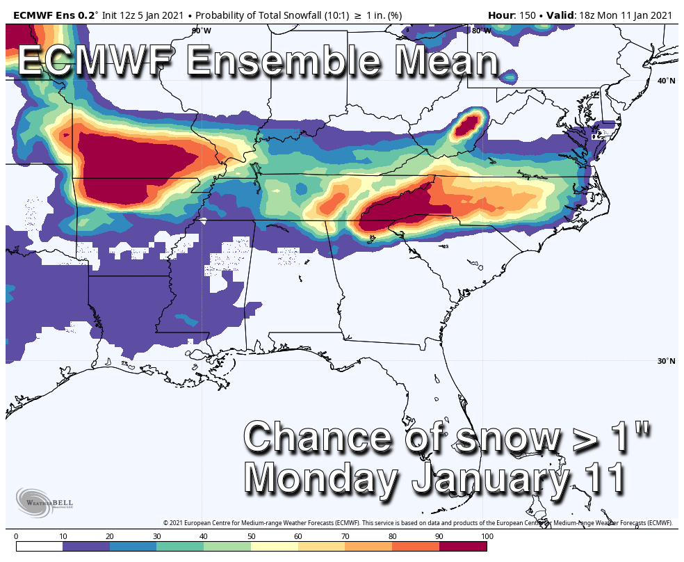
SNOW?????? The newer 12Z runs of both the American and European global models shunt the next wave far to the south, reducing any chance of snow for North Alabama late Sunday night and Monday morning. But, as we have pointed out here many times, using simple deterministic model output this far out isn’t very useful; that output will flip and flop like a fish out of water. It is best to use the ensemble approach and look at the range of possibilities, and a probabilistic outlook.
Both models still keep the chance of snow greater than one inch generally in the 10-20 percent chance of most of North Alabama Monday; not much change from yesterday. We will have a better grasp on the situation late this week, with the system will get into the American upper air network.
REST OF NEXT WEEK: For now the weather looks dry for most of Alabama Tuesday through Friday next week with temperatures at or a little below average values for January… See the Weather Xtreme video for maps, graphics, and more details.
ON THIS DATE IN 1962: Two tornadoes, about 100 yards apart and each making paths about 100 yards wide followed parallel paths from southeast to northwest through the edge of the Crestview, Florida’s residential area. These tornadoes killed one and injured 30 others.
BEACH FORECAST: Click here to see the AlabamaWx Beach Forecast Center page.
WEATHER BRAINS: Don’t forget you can listen to our weekly 90 minute show anytime on your favorite podcast app. This is the show all about weather featuring many familiar voices, including our meteorologists here at ABC 33/40.
CONNECT: You can find me on all of the major social networks…
Look for the next Weather Xtreme video here by 7:00 a.m. tomorrow….
Category: Alabama's Weather, ALL POSTS, Weather Xtreme Videos
About the Author (Author Profile)
James Spann is one of the most recognized and trusted television meteorologists in the industry. He holds the AMS CCM designation and television seals from the AMS and NWA. He is a past winner of the Broadcast Meteorologist of the Year from both professional organizations.Subscribe
If you enjoyed this article, subscribe to receive more just like it.


