

Portions of North/Central Alabama Have Been Upgraded to a Slight Risk for Tonight

The Storm Prediction Center has decided to upgrade the north and northwestern parts of North/Central Alabama to a Slight Risk (level 2 of 5) for severe storms for tonight through the overnight hours. The slight risk includes locations west of a line from Geiger to West Jefferson to Hytop. A Marginal Risk (level 1 of 5) extends south of that to the I-85 corridor in the southeastern parts of the area. Here is the latest update from the SPC:
A few severe thunderstorms are possible this evening within a corridor across northeastern Mississippi and northwestern Alabama into middle Tennessee. This includes a risk for potentially damaging wind gusts and perhaps a couple of tornadoes.
Low-level moisture return is ongoing on southerly return flow across the lower Mississippi into Tennessee Valleys. This appears to be contributing to modest boundary-layer destabilization (including CAPE up to 500-1000 J/kg), which is expected to continue developing northeastward as an initial short wave impulse, which has emerged from the Southwest, progresses east-northeast of the central Great Plains late this afternoon and evening. As the associated frontal wave migrates into the lower Ohio Valley, there appears a window of opportunity for vigorous convective development focused along/just ahead of the trailing surface trough across Tennessee into Mississippi. This may coincide with a 40-50 kt southerly 850 MB jet axis, along which enlarged low-level hodographs may become supportive of supercells structures accompanied by the risk for damaging wind gusts and/or a couple of tornadoes. With the influence of the mid/upper forcing on the warm sector expected to be glancing/short-lived, it appears this risk will be maximized this evening, but at least some severe weather potential may linger as remnant convection spreads eastward/southeastward overnight.
NWS Huntsville updated graphic:
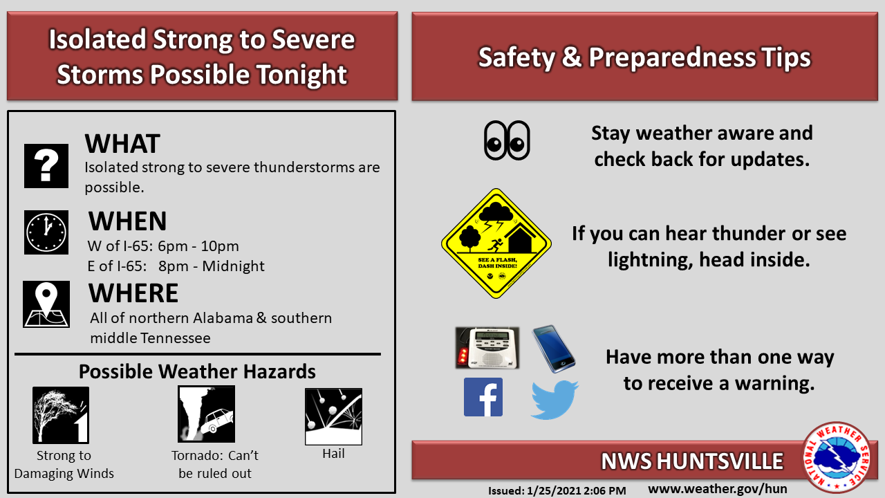
A few strong or severe thunderstorms are possible this evening into the overnight hours. The primary hazards will be strong (40-55 mph) to damaging winds (up to 60 mph) and small hail. There is a low risk of a tornado. A broken line of thunderstorms will move into northwest Alabama between 6-8 PM, cross the I-65 corridor between 8-10 PM, and exiting northeast Alabama by or shortly after Midnight. At this time, a Severe Weather Watch is not anticipated, but please keep aware of the weather situation and any updates this evening.
NWS Birmingham updated graphic:
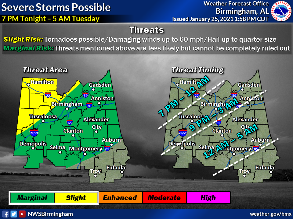
There is a risk of severe thunderstorms from 7 pm tonight to 5 am Tuesday for locations near and northwest of Interstate 85. Threats include a few tornadoes, damaging winds up to 60 mph, and hail up to quarter size.
Category: Alabama's Weather, ALL POSTS, Severe Weather
About the Author (Author Profile)
Scott Martin is an operational meteorologist, professional graphic artist, musician, husband, and father. Not only is Scott a member of the National Weather Association, but he is also the Central Alabama Chapter of the NWA president. Scott is also the co-founder of Racecast Weather, which provides forecasts for many racing series across the USA. He also supplies forecasts for the BassMaster Elite Series events including the BassMaster Classic.Subscribe
If you enjoyed this article, subscribe to receive more just like it.


