

Strong Storms Affecting Walker & Jefferson Counties
…SIGNIFICANT WEATHER ADVISORY FOR SOUTHEASTERN WALKER AND CENTRAL
JEFFERSON COUNTIES UNTIL 1245 AM CST…
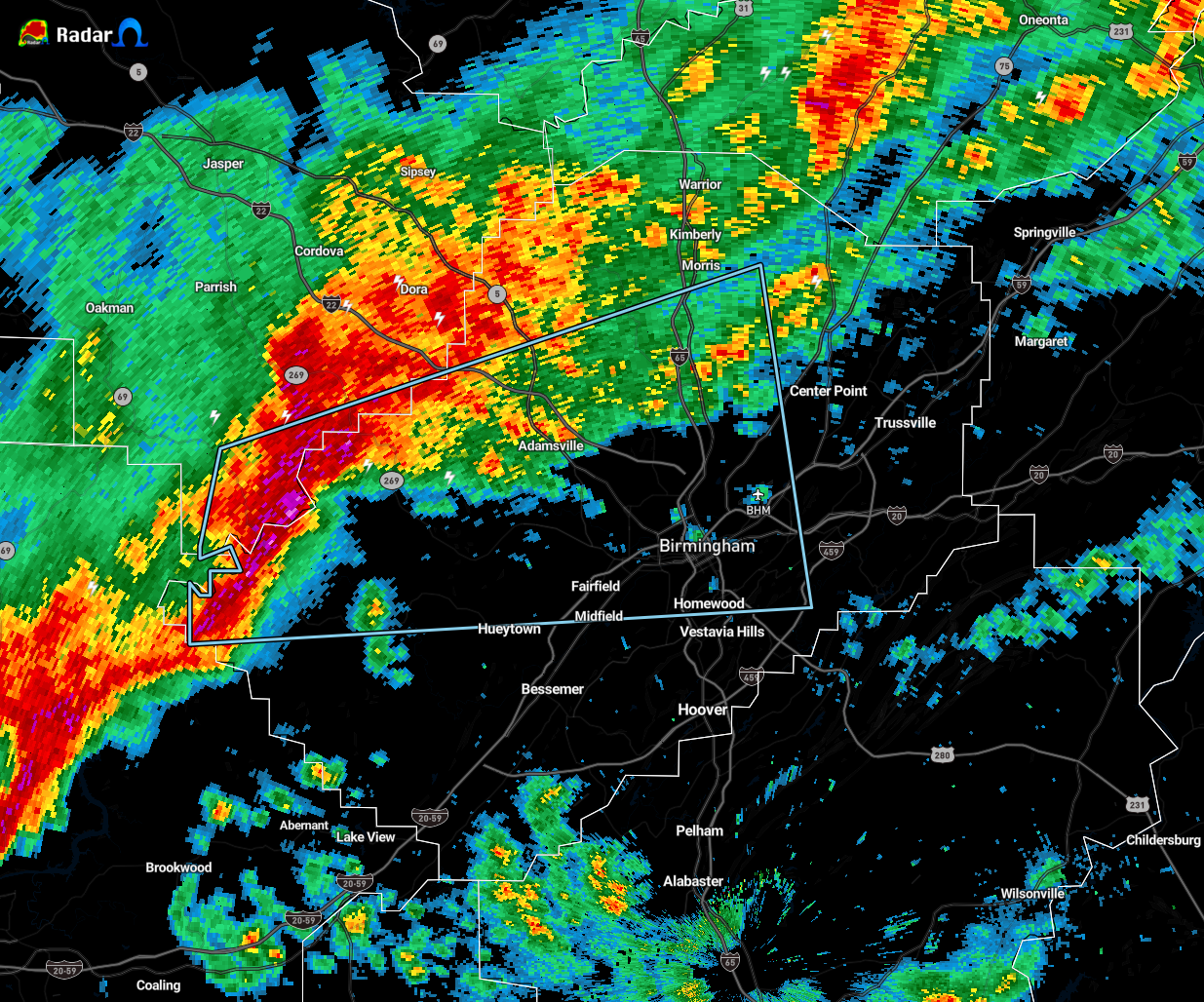
At 1153 PM CST, Doppler radar was tracking a strong thunderstorm near
Oak Grove, or 14 miles northwest of Hueytown, moving east at 40 mph.
Pea size hail and winds in excess of 40 mph will be possible with
this storm.
Locations impacted include…
Birmingham, Vestavia Hills, Homewood, Mountain Brook, Hueytown,
Gardendale, Irondale, Fairfield, Fultondale, Pleasant Grove, Tarrant,
Midfield, Adamsville, Graysville, Morris, Sylvan Springs, Brookside,
Mulga, Maytown and West Jefferson.
PRECAUTIONARY/PREPAREDNESS ACTIONS…
Torrential rainfall is also occurring with this storm, and may lead
to localized flooding. Do not drive your vehicle through flooded
roadways.
This storm may intensify, so be certain to monitor local radio
stations and available television stations for additional information
and possible warnings from the National Weather Service.
Category: Alabama's Weather, ALL POSTS, Severe Weather
About the Author (Author Profile)
Scott Martin is an operational meteorologist, professional graphic artist, musician, husband, and father. Not only is Scott a member of the National Weather Association, but he is also the Central Alabama Chapter of the NWA president. Scott is also the co-founder of Racecast Weather, which provides forecasts for many racing series across the USA. He also supplies forecasts for the BassMaster Elite Series events including the BassMaster Classic.Subscribe
If you enjoyed this article, subscribe to receive more just like it.


