

Clearing, Cold Tonight; Even Colder Early Next Week
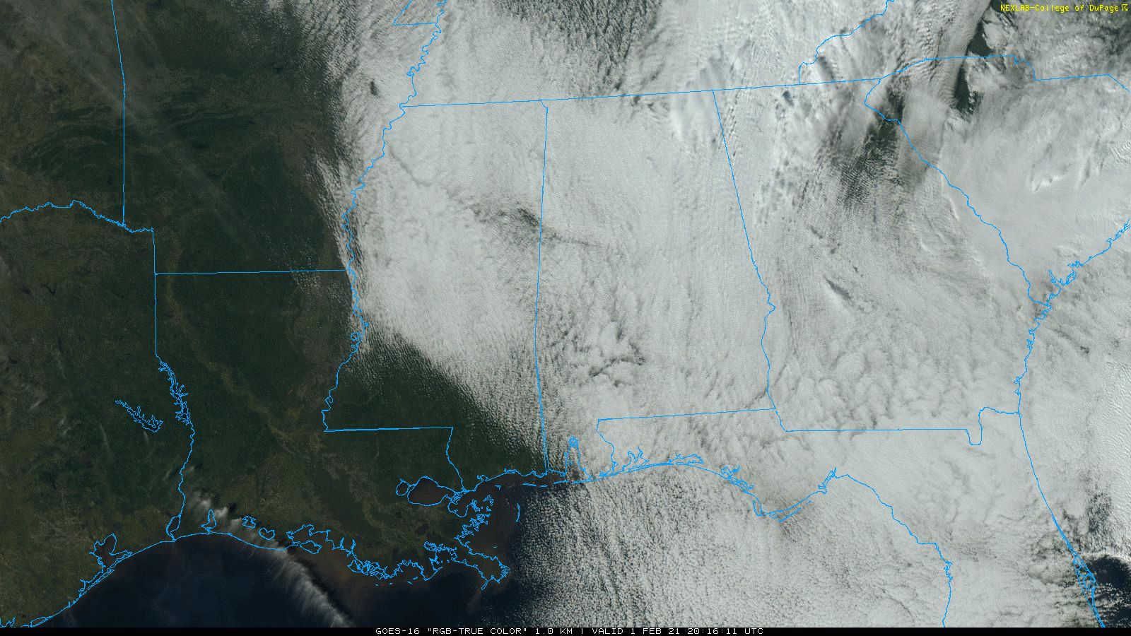
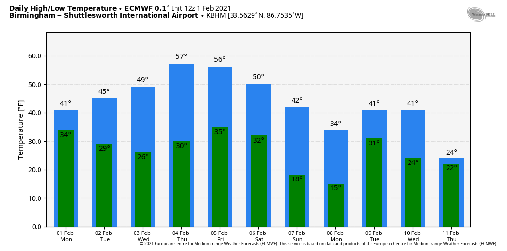
RAW WINTER DAY: Clouds persist over most of Alabama this afternoon, and temperatures have barely moved from early morning values. We are seeing mostly mid to upper 30s over North Alabama, with 40s to the south. A few snow flurries will remain possible this evening, but the sky will clear late tonight as dry air works in from the northwest. We project lows early tomorrow in the mid 20s for most communities.
TOMORROW/WEDNESDAY: Look for a brighter sky tomorrow and Wednesday… the sky will be sunny both days with a high between 45 and 55. The low early Wednesday will be back in the 20s.
RAIN RETURNS: The day Thursday will be dry with a high in the upper 50s, but clouds will increase by afternoon ahead of an approaching cold front. That front will bring rain to the state Thursday night into early Friday morning; amounts should be 1/2 inch or less, and there is no risk of severe storms. Friday will feature a clearing sky and colder temperatures… the high Friday will be in the mid to upper 40s.
THE ALABAMA WEEKEND: Saturday will be dry… after a low in the upper 20s the high will be close to 50 with a partly to mostly sunny sky. Then, a strong cold front will pass through Saturday night mostly in dry fashion. It might squeeze out a few flurries over the Tennessee Valley, but for now meaningful snow is not expected. The big story is the coldest air so far this season rolling into the state Sunday.
Temperatures during the day Sunday won’t get out of the 20s for the northern quarter of the state, and struggle to rise above freezing for places like Birmingham, Tuscaloosa, Anniston and Gadsden. The day will be dry with a partly sunny sky as the cold air rushes in.
We project lows in the 10-20 degree range by daybreak Monday (February 8) across North/Central Alabama… a few spots across the northern counties could reach the single digits. For some this will be the coldest air since 2014. During the day Monday the sky will be sunny with a high around 40 degrees.
REST OF NEXT WEEK: A wave of low pressure is forecast to develop near the Gulf Coast Tuesday, and will spread precipitation across the Deep South by Tuesday night. At the moment, it looks like thermal values will keep the main risk of ice and snow just north of here, over Tennessee and Kentucky, with rain for most of Alabama. But, of course, this event it 8 days away and it is simply too early to call. The weather will be dry Thursday and Friday of next week… the European global model suggests we could see another blast of very cold air toward the end of the week. See the Weather Xtreme video for maps, graphics, and more details.
ON THIS DATE IN 1955: Seen first as a “well defined cone-shaped funnel” over the Mississippi River, an F3 tornado cut a path from Commerce Landing to Clark in Northwest Mississippi.
ON THIS DATE IN 1996: Very cold, Arctic air covered Alabama, and an “overrunning” precipitation event started that night, the beginning of a significant ice storm for many places. A period of freezing rain followed by light snow brought traffic to a complete standstill across north Alabama. Ice accumulations up to 1 inch downed numerous trees and caused power outages. A number of chicken houses in the northern part of the state collapsed under the weight of the ice and snow. Ice and snow accumulations varied widely with some of the highest amounts reported in the 1 to 3 inch range.
BEACH FORECAST: Click here to see the AlabamaWx Beach Forecast Center page.
WEATHER BRAINS: Don’t forget you can listen to our weekly 90 minute show anytime on your favorite podcast app. This is the show all about weather featuring many familiar voices, including our meteorologists here at ABC 33/40.
CONNECT: You can find me on all of the major social networks…
Look for the next Weather Xtreme video here by 4:00 this afternoon… enjoy the day!
Category: Alabama's Weather, ALL POSTS, Weather Xtreme Videos
About the Author (Author Profile)
James Spann is one of the most recognized and trusted television meteorologists in the industry. He holds the AMS CCM designation and television seals from the AMS and NWA. He is a past winner of the Broadcast Meteorologist of the Year from both professional organizations.Subscribe
If you enjoyed this article, subscribe to receive more just like it.


