

Strong Storms Moving into the Birmingham Metro
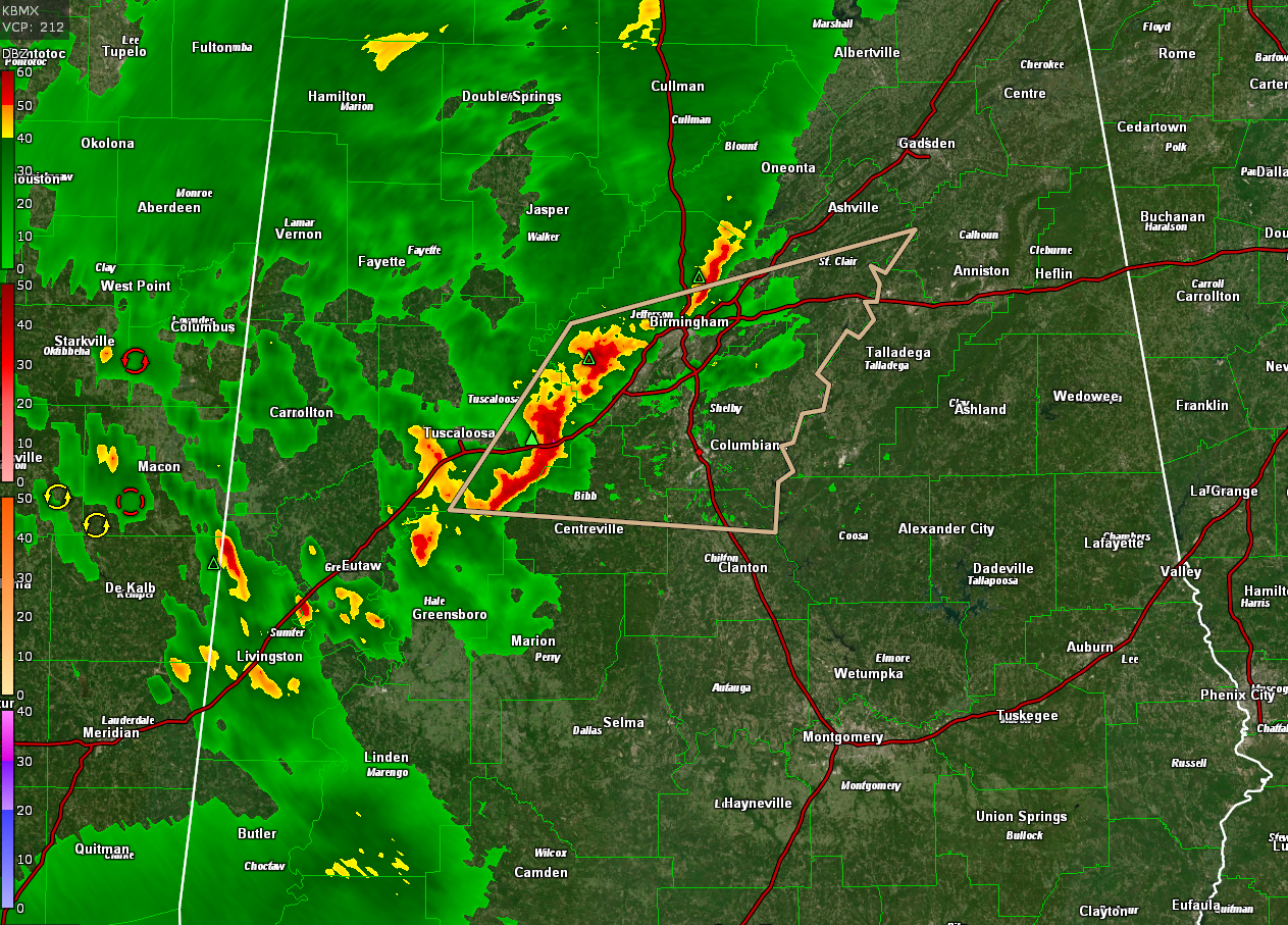
Strong storms extend from Hueytown and North Johns just west of Birmingham to west of Lake View and Woodstock onto Vance and on to US-82 east of Duncanville in Tuscaloosa County.
The product outlines on the radar image is a significant weather advisory from the National Weather Service in Birmingham.
The storms have a good bit of lightning and thunder. Winds could gust to 40 mph and there could be some small hail.
They are not expected to become severe.
Category: Alabama's Weather, ALL POSTS
About the Author (Author Profile)
Bill Murray is the President of The Weather Factory. He is the site's official weather historian and a weekend forecaster. He also anchors the site's severe weather coverage. Bill Murray is the proud holder of National Weather Association Digital Seal #0001 @wxhistorianSubscribe
If you enjoyed this article, subscribe to receive more just like it.


