

Winter Storm Watch Issued for Parts of North Alabama Ahead of Potential Icing Event
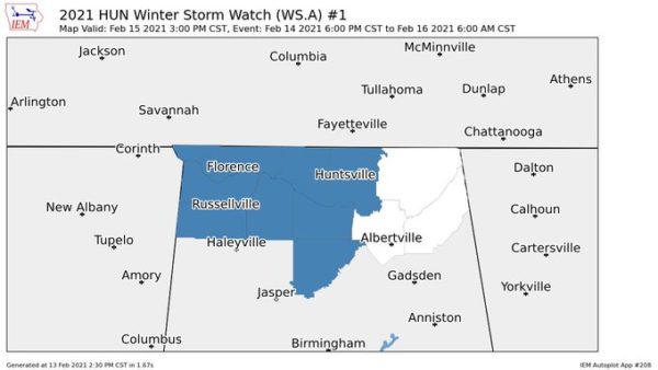
NWS Huntsville has placed much of North Alabama under a Winter Storm Watch that starts at 6:00 pm Sunday night and is expected to expire at 6:00 am Tuesday. Counties included in the watch are Colbert, Franklin, Lauderdale, Lawrence, and Limestone.
…WINTER STORM WATCH IN EFFECT FROM SUNDAY EVENING THROUGH LATE
MONDAY NIGHT…
* WHAT…Heavy mixed precipitation possible. Total snow and sleet
accumulations of up to 3 inches and ice accumulations of one tenth
to one quarter of an inch possible.
* WHERE…Lauderdale, Colbert, Franklin, Lawrence and Limestone
counties.
* WHEN…From Sunday evening through late Monday night.
* IMPACTS…Travel could become extremely hazardous.
* ADDITIONAL DETAILS…Two periods of wintry precipitation are
expected. A period of freezing rain or freezing drizzle is
expected to develop Sunday evening and overnight. This will
produce icy conditions, especially on bridges and overpasses.
A mixture of freezing rain and sleet will develop Monday
afternoon and last into Monday night. The precipitation may mix
with or change to snow for a period Monday night.
PRECAUTIONARY/PREPAREDNESS ACTIONS…
A Winter Storm Watch means there is a potential for significant
snow, sleet, or ice accumulations that may impact travel. Continue
to monitor the latest forecasts.
Category: Alabama's Weather, ALL POSTS, Winter Weather
About the Author (Author Profile)
Scott Martin is an operational meteorologist, professional graphic artist, musician, husband, and father. Not only is Scott a member of the National Weather Association, but he is also the Central Alabama Chapter of the NWA president. Scott is also the co-founder of Racecast Weather, which provides forecasts for many racing series across the USA. He also supplies forecasts for the BassMaster Elite Series events including the BassMaster Classic.Subscribe
If you enjoyed this article, subscribe to receive more just like it.


