

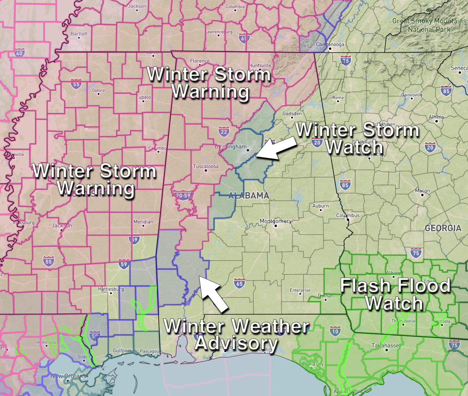
City By City Breakdown
Here is a look at what to expect for some of the larger cities in Alabama over the next 72 hours…
BIRMINGHAM: Scattered light rain is possible tonight… a cold rain is likely tomorrow and early tomorrow night. Temperatures will be in the mid to upper 30s; no icy travel is expected as the rain falls. But tomorrow night (after the rain ends), temperatures will fall through the 20s, and black ice will likely become an issue on bridges and perhaps some road surfaces. Be aware that travel impact is a definite possibility for the Birmingham metro tomorrow night and Tuesday morning. Temperatures will have a hard time climbing above freezing Tuesday, and some ice issues on roads could linger into Tuesday night and Wednesday morning. We rise into the 40s Wednesday and any lingering ice will melt.
TUSCALOOSA: Very close call. For now the situation looks much like Birmingham; mostly a cold rain, with potential for black ice on roads and bridges tomorrow night into Tuesday morning. However, the northwest part of Tuscaloosa County could see some scattered bridge icing late tonight and during the day tomorrow where the air will be colder and the impact will be greater. The NWS made the decision include Tuscaloosa County in the winter storm warning, probably a good call since temperatures just a few degrees below forecast will bring freezing rain and a more significant ice threat to the city of Tuscaloosa.
ANNISTON/GADSDEN: A cold rain is likely tomorrow, ending tomorrow night. Temperatures in East Alabama will be close to 40 as the rain falls, so there is no threat of freezing rain. But, we can’t rule out some scattered black ice Tuesday morning where water remains on roads as temperatures drop well below freezing. There are no advisories for this part of Alabama.
FLORENCE/MUSCLE SHOALS: Periods of freezing rain are likely tonight and tomorrow, with a potential change to snow tomorrow afternoon as the cold air deepens. Ice accumulation of around .15″ is forecast, with potential for around 2 inches of snow on top of the ice. Roads and bridges could become icy tonight after 6:00 p.m… and roads will be hazardous tomorrow. Travel will remain very difficult across this part of Alabama all the way through Wednesday morning with ice and snow covered roads. Power outages are also possible.
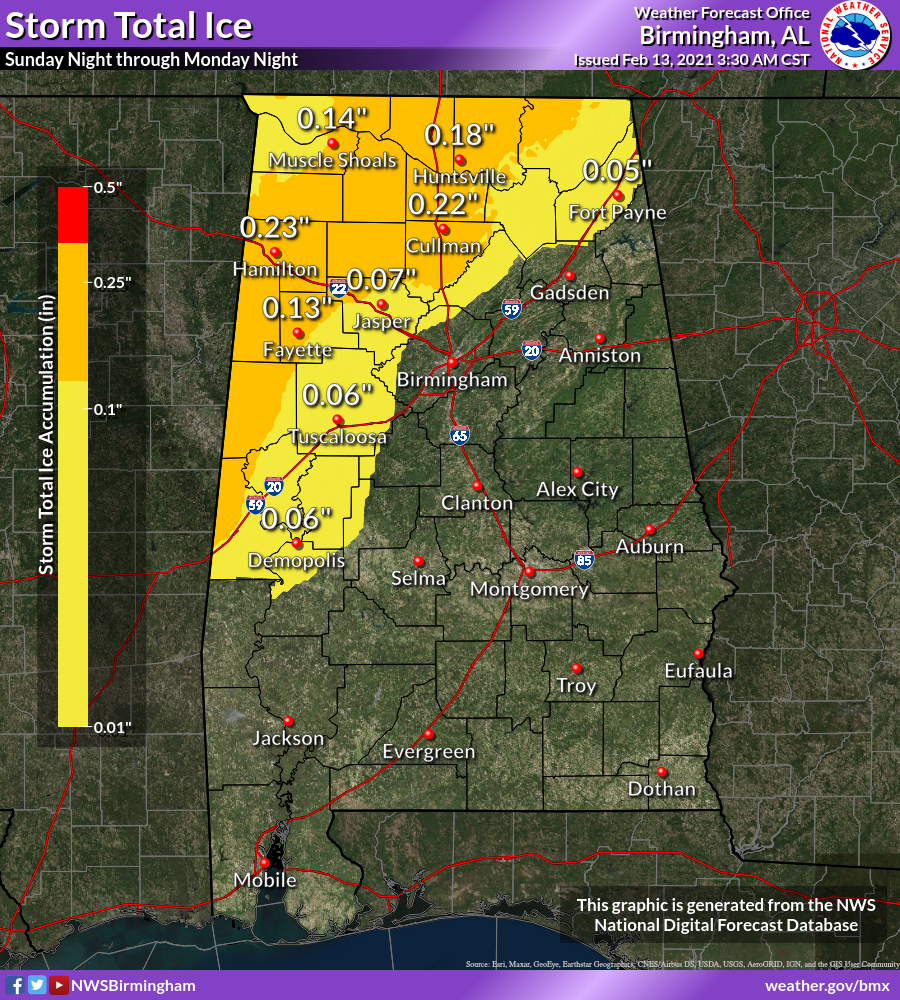
HUNTSVILLE: Light freezing rain or freezing drizzle is likely tonight, with freezing rain becoming heavier tomorrow. Ice accumulation of around .20″ is likely, with some potential for light snow as the precipitation ends tomorrow evening. Roads and bridges could become icy tonight after 8:00 p.m… and roads will be hazardous tomorrow. Travel will remain very difficult across the Tennessee Valley through Wednesday morning with ice and snow covered roads. Power outages are also possible.
The southern half of Alabama won’t have any ice issues… the rain could be heavy around Dothan, where a flash flood watch is in effect.
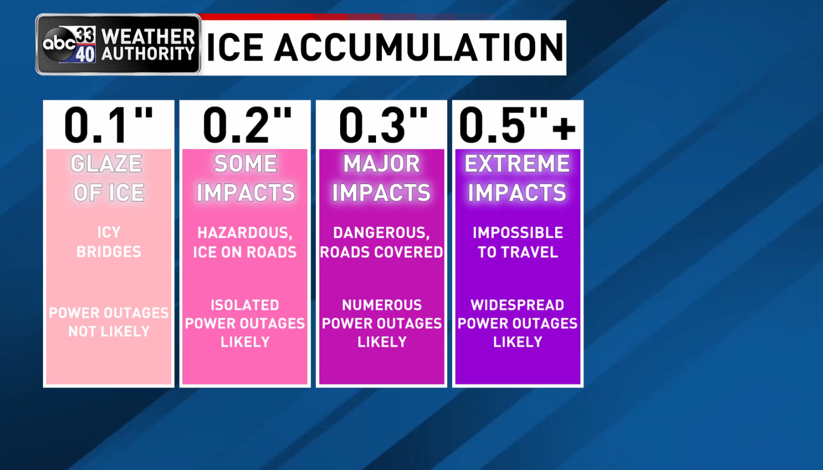
REMEMBER: It doesn’t take much ice for big problems to develop. Very difficult travel and scattered power outages are likely in the winter storm warning area across North and West Alabama.
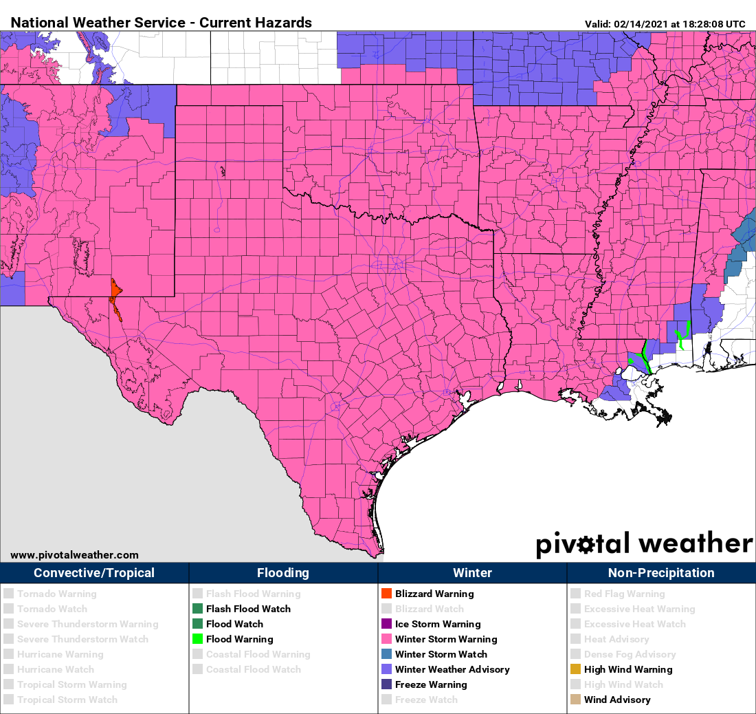
INTERESTING NOTE: Every single county in Texas, Oklahoma, and Arkansas is under a winter storm warning now. Not sure this has happened before.
Category: Alabama's Weather, ALL POSTS
About the Author (Author Profile)
James Spann is one of the most recognized and trusted television meteorologists in the industry. He holds the AMS CCM designation and television seals from the AMS and NWA. He is a past winner of the Broadcast Meteorologist of the Year from both professional organizations.Subscribe
If you enjoyed this article, subscribe to receive more just like it.


