

Midday Nowcast: Clearing Sky and Cold
The sky continues to clear across Alabama today, but despite the sunshine returning, it remains a rather cold day with temperatures well-below average as highs are struggling to reach the lower 40s, with 30s lingering across North Alabama.
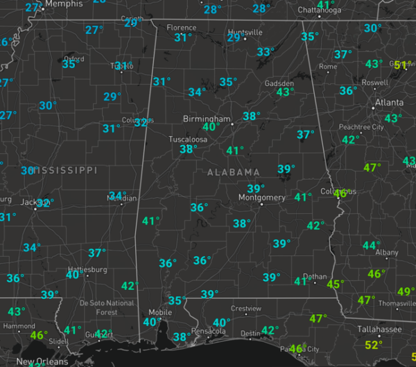
These are 15-20 degrees below normal for this time of year. Also, winds are brisk as well, gusting out of the north at 10-20 mph, giving the cold air more of a bite today. The sky will be clear tonight and we are expecting a significant freeze tomorrow morning as lows will be in the upper teens and lower 20s.
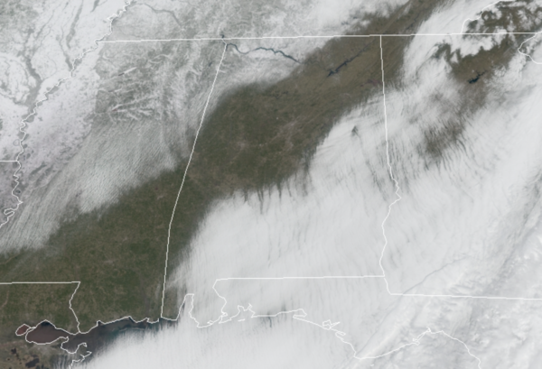
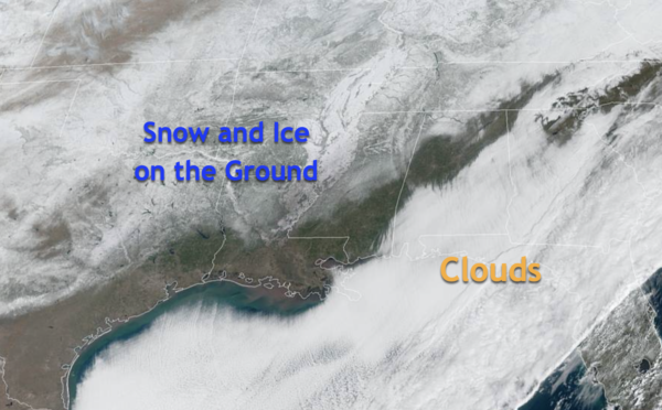
WEATHER NERD ALERT: As the sky continues to clear across the Southeast, you can see the extent of the snow and ice on the ground from Texas through the Mississippi and Tennessee River Valleys. This is where the bitterly cold air remains, and where all the travel headaches and other issues have occurred. The white over Alabama, Georgia, and Florida is clouds that continue to clear this afternoon.
WEEKEND WEATHER: After the frigid start to the day, the warming trend will finally begin tomorrow as Saturday will feature a good supply of sunshine with highs in the low and mid 50s. The sky remains mainly sunny Sunday, and it will be even warmer as highs surge into the lower and mid 60s. Late in the day, clouds will return to Alabama and some scattered light showers are expected overnight Sunday and early Monday due to a weak passing front through Alabama. Rainfall amounts look light due to limited moisture. The rain will end early Monday and we should see a clearing sky by the afternoon with highs in the upper 50s Monday afternoon.
BEACH FORECAST CENTER: Get the latest weather and rip current forecasts for the beaches from Fort Morgan to Panama City on our Beach Forecast Center page. There, you can select the forecast of the region that you are interested in visiting.
WORLD TEMPERATURE EXTREMES: Over the last 24 hours, the highest observation outside the U.S. was 105.6F at Oodnadatta Airport, Australia. The lowest observation was -66.6F at Vostok, Antarctica.
CONTIGUOUS TEMPERATURE EXTREMES: Over the last 24 hours, the highest observation was 90F at numerous locations across Florida. The lowest observation was -19F at Bermidji and International Falls, MN.
Category: Alabama's Weather, ALL POSTS
About the Author (Author Profile)
Macon, Georgia Television Chief Meteorologist, Birmingham native, and long time Contributor on AlabamaWX. Stormchaser. I did not choose Weather, it chose Me. College Football Fanatic. @Ryan_StinnetSubscribe
If you enjoyed this article, subscribe to receive more just like it.


