

Midday Nowcast: Sun Today, Rain Returns Tonight
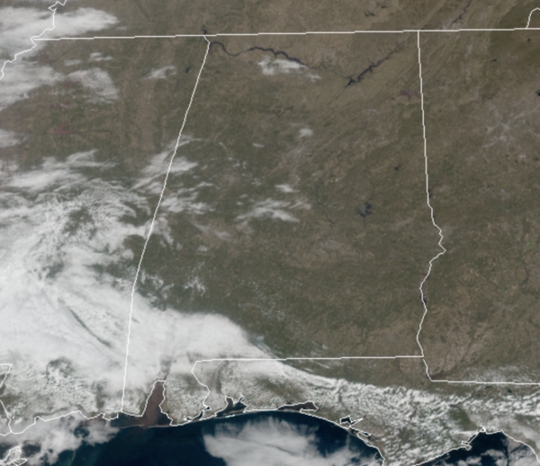
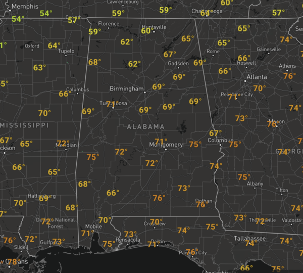
A weak boundary pushed south through the state overnight, allowing for a few more clouds and showers this morning, but these have since dissipated. For the rest of today, we are seeing more sun than clouds with temperatures ranging from the upper 60s to lower 70s. Another great-looking day of weather for Alabama.
TONIGHT/TOMORROW: Clouds will increase again tonight, and rain is likely over the northern half of the state after midnight, and into the day tomorrow as a wave of energy moves along the front. This will cause the front to move back north, so the rain will actually end from south to north through the day tomorrow, but many of us should see a nice soaking rainfall.
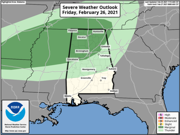
We do need to mention a few strong storms are possible over the northern third of the state, where SPC has defined a “marginal risk” (level 1/5) of severe thunderstorms tomorrow north of a line from Tuscaloosa to Birmingham to Anniston. A few storms could produce gusty winds and small hail in the risk area.
Temperatures will be wide ranging tomorrow across the state with 60s and 70s south of the front, while 50s will be common north of the front.
WEEKEND WEATHER: The front will hold in place over the Tennessee Valley of the state, and that means North Alabama, Tennessee, and Arkansas will experience periods of heavy rainfall at times over the weekend. South of the front, both Saturday and Sunday will feature more clouds than sun with scattered showers at times, but certainly no weekend “washout”. This is also shaping up to be the warmest weekend of 2021 so far across much of the state, with highs both days in the upper 70s and low 80s.
BEACH FORECAST CENTER: Get the latest weather and rip current forecasts for the beaches from Fort Morgan to Panama City on our Beach Forecast Center page. There, you can select the forecast of the region that you are interested in visiting.
WORLD TEMPERATURE EXTREMES: Over the last 24 hours, the highest observation outside the U.S. was 106.2F at Kaolack, Senegal. The lowest observation was -71.0F at Vostok, Antarctica.
CONTIGUOUS TEMPERATURE EXTREMES: Over the last 24 hours, the highest observation was 95F at Falcon Lake, TX. The lowest observation was -38F at Peter Sinks, UT.
WEATHER ON THIS DATE IN 1977: Dust reduced visibilities from eastern Virginia through the southeastern states to Florida between the 24th and the 28th. The dust originated in the western Great Plains on the 22nd and 23rd, with wind gusts above 100 mph reported at Guadalupe Pass TX, at White Sands NM, in Sherman County KS, and in eastern Colorado.
Category: Alabama's Weather, ALL POSTS
About the Author (Author Profile)
Macon, Georgia Television Chief Meteorologist, Birmingham native, and long time Contributor on AlabamaWX. Stormchaser. I did not choose Weather, it chose Me. College Football Fanatic. @Ryan_StinnetSubscribe
If you enjoyed this article, subscribe to receive more just like it.


