

Severe Threat Continues, But May Be Lessening Just a Little Quicker
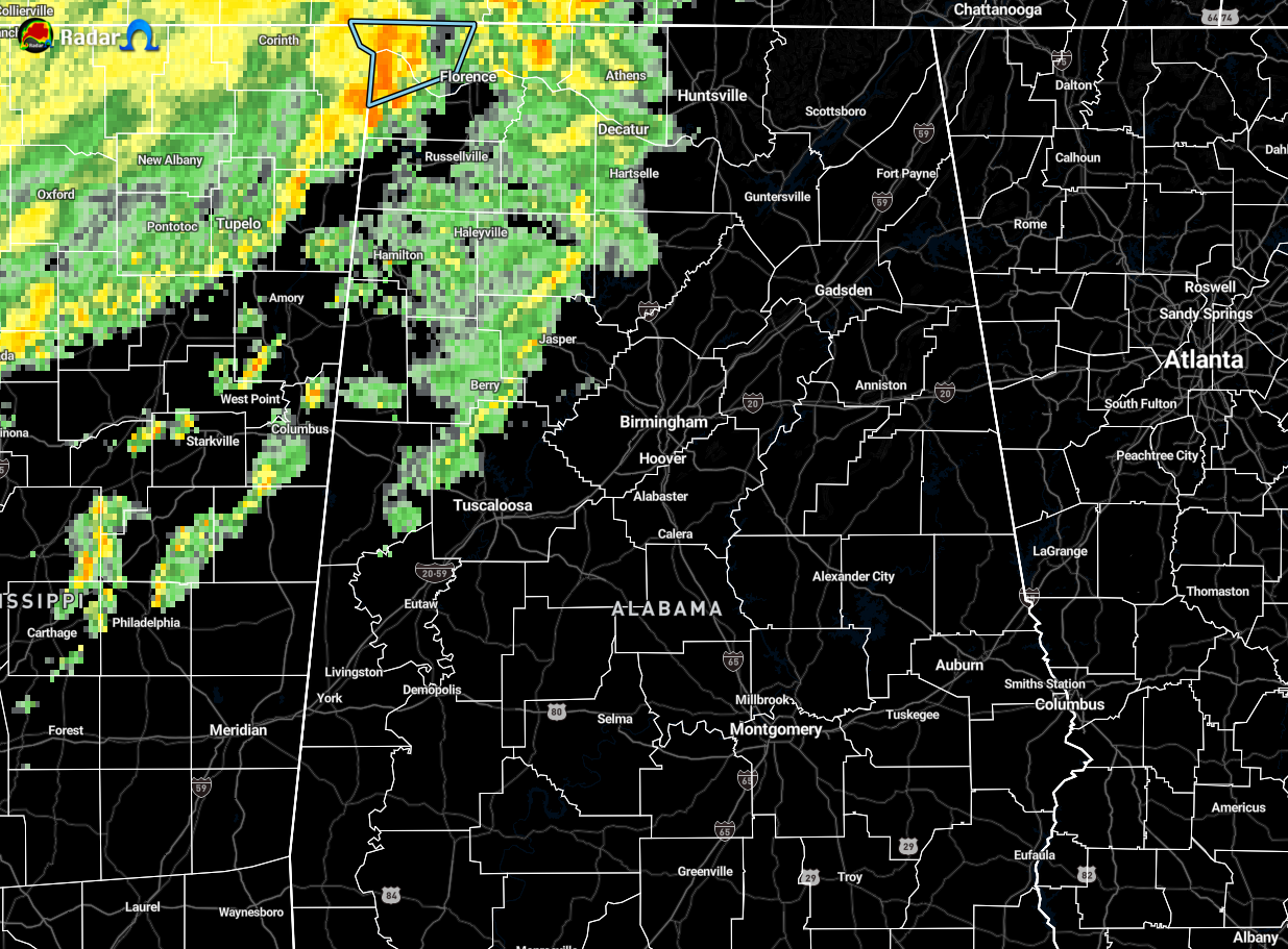
The latest local mesoscale discussion from NWS Birmingham confirms what NWS Huntsville was mentioning earlier about the severe weather threat diminishes quicker than first expected. We still have the potential for a few strong storms with gusty winds and an outside chance of a tornado, especially for the next 2-3 hours, but conditions are becoming a little less conducive for severe storms. Here is the text from the mesoscale discussion:
The severe area has been adjusted along with the timing. The late evening update did not completely remove isolated severe wording, but we are trending in that direction. The 9:00 pm SWIRLL sounding, which was launched at UAH, indicated very little MLCAPE (instability) and EML (elevated mixed layer) around 600 MB. Plenty of shear in the air with 0-1 SRH (storm-relative helicity values around 300 and bulk shear 60+. Low-level lapse rates are starting to decline with the loss of isolation and mid-level lapse rates are not too exciting. Surface dew points are slowly increasing but theta-e increases are absent.
The cold front was located in western Tennessee and will continue migrating southward overnight. Plenty of frontogenic forcing around 850 MB, increasing precip water values and limited surface and elevated instability should still kick off showers and thunderstorms into Monday. The low-level jet is being handled slightly different as an increased area exits into Tennessee shortly followed by an increase later tonight northeast.
With all this said, decreased the small chance of severe storms to the far northwest counties and also trimmed the timing, ending by 3 am. Further adjustments may be necessary for the next few hours if trends continue. QPF will be 1 to 2 inches in the watch area through noon Monday. Soil moisture values are in the 60th percentile and streamflows are above too much above normal in the northwest. Therefore, the watch will remain in effect overnight for some potential flooding issues. Otherwise, temperatures will be very warm overnight in most areas. This is partly due to the fact that all the official observation sites tied or broke record high temperatures today. In fact, overnight lows in many places will be warmer than the average high for the beginning of March. Behind the cold front, we should return closer to normal conditions.
We still have a couple of hours that we cannot let our guard down. We still have the potential for gusty winds and enough rotation for a brief tornado or two. Have those trusty devices charged and ready to inform you if your location goes under a warning.
Category: Alabama's Weather, ALL POSTS, Severe Weather
About the Author (Author Profile)
Scott Martin is an operational meteorologist, professional graphic artist, musician, husband, and father. Not only is Scott a member of the National Weather Association, but he is also the Central Alabama Chapter of the NWA president. Scott is also the co-founder of Racecast Weather, which provides forecasts for many racing series across the USA. He also supplies forecasts for the BassMaster Elite Series events including the BassMaster Classic.Subscribe
If you enjoyed this article, subscribe to receive more just like it.


