

Strong Storms Affecting Parts of Madison, Jackson, & Dekalb Counties
ALZ006-009-010-TNZ097-010545-
Madison AL-DeKalb AL-Jackson AL-Franklin TN-
1120 PM CST Sun Feb 28 2021
…SIGNIFICANT WEATHER ADVISORY FOR JACKSON…NORTHEASTERN MADISON…
NORTHEASTERN DEKALB AND SOUTHEASTERN FRANKLIN COUNTIES UNTIL 1145 PM
CST…
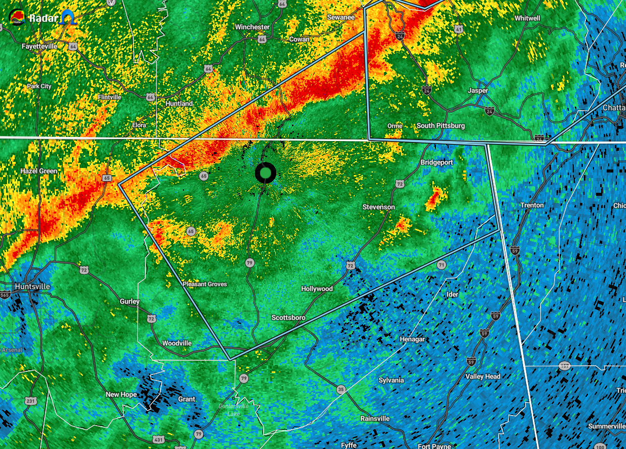
At 1119 PM CST, Doppler radar was tracking strong thunderstorms along
a line extending from 7 miles south of Sewanee to 8 miles east of New
Market. Movement was southeast at 25 mph.
Winds in excess of 40 mph will be possible with these storms.
Locations impacted include…
Scottsboro, Bridgeport, Stevenson, Hollywood, Skyline, Anderson,
Pleasant Groves, Hytop, Lim Rock and Jericho.
PRECAUTIONARY/PREPAREDNESS ACTIONS…
Strong gusty winds will be capable of knocking down small tree limbs
along with other small unsecured items. Seek safe shelter until this
line of storms has passed.
Category: Alabama's Weather, ALL POSTS, Severe Weather
About the Author (Author Profile)
Scott Martin is an operational meteorologist, professional graphic artist, musician, husband, and father. Not only is Scott a member of the National Weather Association, but he is also the Central Alabama Chapter of the NWA president. Scott is also the co-founder of Racecast Weather, which provides forecasts for many racing series across the USA. He also supplies forecasts for the BassMaster Elite Series events including the BassMaster Classic.Subscribe
If you enjoyed this article, subscribe to receive more just like it.


