

Dangerous Severe Weather Setup Tomorrow Afternoon/Night
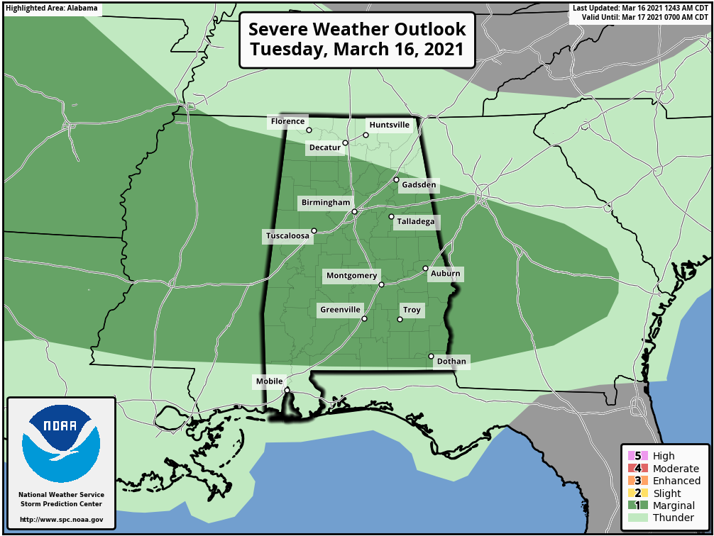
TODAY: Rain and thunderstorms continue across Alabama this morning; a flash flood warning is in effect for parts of Cullman County, where some spots have received over three inches of rain during the pre-dawn hours. Showers and storms will persist through much of the day, and SPC maintains a low end “marginal risk” of severe thunderstorms for much of the state. Heavier thunderstorms will be capable of producing small hail and strong gusty winds.
DANGEROUS SETUP TOMORROW AFTERNOON/NIGHT: A compact/vigorous upper low initially over the Oklahoma area is forecast to move steadily eastward through the day, spreading strong flow aloft and a broad zone of enhanced ascent across the Deep South. This, combined with unstable air and high shear values, will set the stage for strong to severe thunderstorms. SPC now has a decent part of the state in a “moderate risk” (level 4/5)… this includes Birmingham, Montgomery, Tuscaloosa, Anniston, Gadsden, and Florence. The rest of the state is in either an enhanced or slight risk.
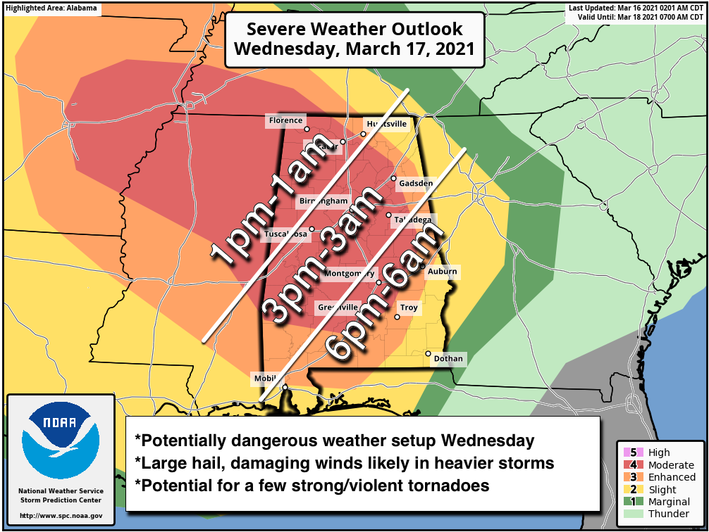
TIMING: Scattered storms could form tomorrow afternoon, but the main band of organized thunderstorms will come tomorrow night into the pre-dawn hours Thursday.
THREATS: Storms will be capable of producing large hail, damaging winds, and tornadoes. A few strong/violent, long track tornadoes are possible.
RAIN: Additional rain amounts of 1-2 inches are likely, and some isolated flash flooding issues are possible.
GET READY NOW: Here are some important points about preparedness…
*Have at least two ways of hearing warnings. Every Alabama home and business needs a NOAA Weather Radio; the model most used is the Midland WR-120, available at most local “big box” retailers. Weather radio receivers do not rely on cellular networks and are very reliable. The second way is your phone; be sure WEA (Wireless Emergency Alerts) are enabled, and have a reliable app like the ABC 33/40 Weather app, which also pushes warnings. NEVER rely on an outdoor siren. NEVER.
*Know your safe place. In a site built home, it is a small room, on the lowest floor, near the center of the house, away from windows. And, in that safe place, have helmets for everyone (this means adults too!). We also recommend a portable airhorn for everyone (to alert first responders if you need help), and hard soled shoes in case you have to walk over a tornado debris field.
*You can’t stay in a mobile home during a tornado warning. Know where you are going, and how to get there quickly. If there is no community shelter nearby, go to a business like a gas station, convenience store, or restaurant that is open 24/7.
*Be sure you can find your home on a map. Identify the county you are in, and the ones surrounding you. Map skill is very important on severe weather days!
Please help us by spreading the word about this serious threat. Many folks don’t pay close attention to the weather… tell your relatives, friends, and neighbors and help us get them ready. We don’t share this to scare anyone… we simply have a responsibility to let you know the danger.
For those with a weather phobia, or high anxiety, understand even on a big severe weather day odds of any one home being hit by a tornado are still very low. Just be sure you can hear warnings, have a good plan, and we will get through the day together.
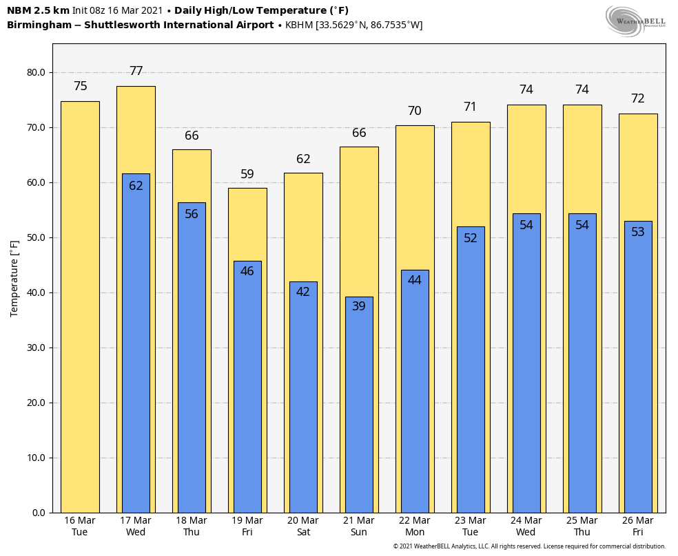
THURSDAY THROUGH THE WEEKEND: Rain and storms will end early in the day Thursday, but clouds will linger much of the day. A few showers are possible over the northern third of the state Thursday afternoon as the upper trough swings through; the high will be in the upper 60s. Friday will be a mostly cloudy day with only a small risk of a shower; the high will be close to 60 degrees.
The weekend will be cool and dry. Partly sunny Saturday, mostly sunny Sunday. The high Saturday will be in the upper 50s, and temperatures will dip into the mid to upper 30s early Sunday with potential for some light frost. The high Sunday afternoon will be in the mid 60s.
NEXT WEEK: A band of showers and storms will likely move in Tuesday afternoon or Tuesday night, followed by another round of storms later in the week Thursday night into Friday. See the Weather Xtreme video for maps, graphics, and more details.
ON THIS DATE IN 1942: A deadly tornado outbreak occurred over the Central and Southern US on March 16-17th. The tornado outbreak killed 153 people and injured at least 1,284. The best estimate indicates this event contained 13 F3 tornadoes, 6 F4s, and one F5. The F5 tornado occurred north of Peoria, Illinois, in the towns of Alta, Chillicothe, before crossing the Illinois River and striking the town of Lacon. A quarter of the homes in Lacon were destroyed, and debris was carried for 25 miles.
BEACH FORECAST: Click here to see the AlabamaWx Beach Forecast Center page.
WEATHER BRAINS: Don’t forget you can listen to our weekly 90 minute show anytime on your favorite podcast app. This is the show all about weather featuring many familiar voices, including our meteorologists here at ABC 33/40.
CONNECT: You can find me on all of the major social networks…
Look for the next Weather Xtreme video here by 3:00 this afternoon… enjoy the day!
Category: Alabama's Weather, ALL POSTS, Weather Xtreme Videos
About the Author (Author Profile)
James Spann is one of the most recognized and trusted television meteorologists in the industry. He holds the AMS CCM designation and television seals from the AMS and NWA. He is a past winner of the Broadcast Meteorologist of the Year from both professional organizations.Subscribe
If you enjoyed this article, subscribe to receive more just like it.


