

Brighter Weekend Ahead For Alabama
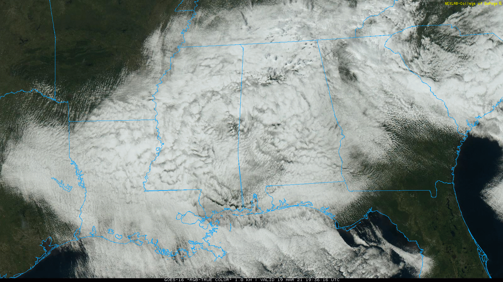
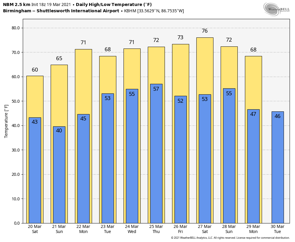
CLOUDS HANGING TOUGH: The sky is cloudy over almost all of Alabama this afternoon with temperatures in the 47-57 degree range. Clouds will linger tonight with temperatures early tomorrow in the upper 30s and low 40s. The weekend will be brighter… the sky becomes mostly sunny tomorrow with a high in the low to mid 60s, and Sunday will feature sun in full supply with a high in the mid to upper 60s.
Keep in mind Sunday morning will be cold with lows mostly in the 30s… some light frost is possible in scattered spots, and colder communities could see a light freeze.
NEXT WEEK: The weather stays dry Monday; with a partly sunny sky we project a high in the low 70s. Clouds will increase Monday night, and we will bring in the chance of showers and thunderstorms Tuesday with an approaching cold front. For now severe storms are not expected Tuesday as the main dynamic support will be well to the north. The front will stall out over the region Wednesday, and we will continue to see periods of rain. Then, a robust weather system will arrive Thursday with rain and thunderstorms. Still too early to determine if we will see a severe weather threat Thursday. Rain amounts next week for most of the state will be in the 2-3 inch range… See the Weather Xtreme video for maps, graphics, and more details.
ON THIS DATE IN 2003: One of the worst blizzards since records began in 1872, struck the Denver metro area and Colorado’s Front Range started with a vengeance. Denver International Airport was closed, stranding about 4,000 travelers. The weight of the snow caused a 40-foot gash in a portion of the roof, forcing the evacuation of that section of the main terminal building.
ON THIS DATE IN 2018: Six tornadoes and hail up to 5 inches in diameter affected the north half of Alabama. An EF-3 tornado moved through Jacksonville, producing major damage on the campus of Jacksonville State University. It was on the ground for 34 miles, with estimated winds peaking at 150 mph. Four people were injured; there were no fatalities. Large hail battered Cullman that night; the 5.38-inch hailstone recovered in the Walter community was declared the official Alabama state record and is the second-largest hailstone officially recorded east of the Mississippi River, behind a 5.7-inch stone that fell on Wausau, Wisconsin in 1921.
BEACH FORECAST: Click here to see the AlabamaWx Beach Forecast Center page.
WEATHER BRAINS: Don’t forget you can listen to our weekly 90 minute show anytime on your favorite podcast app. This is the show all about weather featuring many familiar voices, including our meteorologists here at ABC 33/40.
CONNECT: You can find me on all of the major social networks…
Look for my next Weather Xtreme video here by 6:00 a.m. Monday… enjoy the weekend!
Category: Alabama's Weather, ALL POSTS, Weather Xtreme Videos
About the Author (Author Profile)
James Spann is one of the most recognized and trusted television meteorologists in the industry. He holds the AMS CCM designation and television seals from the AMS and NWA. He is a past winner of the Broadcast Meteorologist of the Year from both professional organizations.Subscribe
If you enjoyed this article, subscribe to receive more just like it.


