

Midday Nowcast: Tons of Sunshine
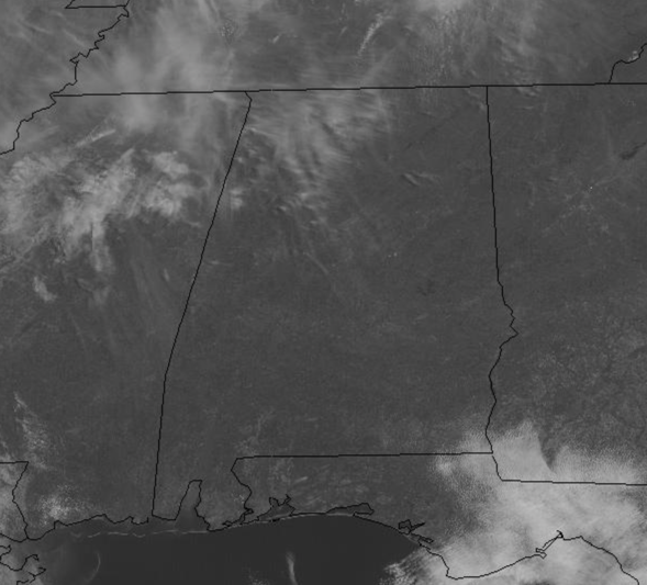
It is looking great and feeling great across the Alabama this afternoon as we are dealing with more sun than clouds with temperatures surging into the 70s. Of course, everything is covered in pollen so some rain is needed, and that is in the forecast the rest of this week.
RAIN RETURNS: Clouds will increase tonight ahead of a cold front that will bring a chance of showers, and possibly a thunderstorm or two, to the state tomorrow and tomorrow night. The main dynamic forcing will remain well to the north of Alabama, and severe storms are not expected, but don’t surprised to hear some rumbles of thunder. The front will stall out across the area, so showers will remain possible Wednesday. The weather will remain mild with highs in the 70s both days.
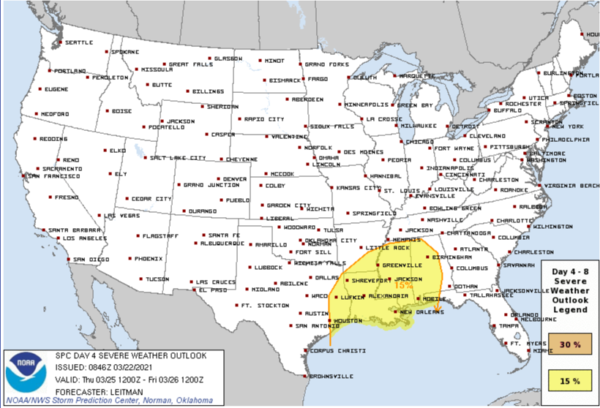
SEVERE STORMS POSSIBLE THURSDAY/THURSDAY NIGHT: A potent upper air trough will generate a deepening surface low west of Alabama, and will bring a risk of strong to severe thunderstorms to the state Thursday afternoon and Thursday night. SPC has much of Alabama, and all of Mississippi and Louisiana in a severe weather risk on their “Day 4” severe weather outlook.
There is still differences in the models in terms of how the system evolves, but tomorrow, the short range and mesoscale models will begin picking up on the system and will give us a better handle on the magnitude of the threat, and the exact timing. For now, there does appear to be a threat for damaging winds and tornadoes, which are not unusual for Alabama this time of year. So just make sure you pay attention to future forecasts in the coming days.
Along with with potential severe storm threat, we need to mention that some flooding issues are possible later this week as well as rain amounts of 2-4 inches are likely across much of Alabama through Thursday night.
BEACH FORECAST CENTER: Get the latest weather and rip current forecasts for the beaches from Fort Morgan to Panama City on our Beach Forecast Center page. There, you can select the forecast of the region that you are interested in visiting.
WORLD TEMPERATURE EXTREMES: Over the last 24 hours, the highest observation outside the U.S. was 113.4F at Maine-Soroa, Niger. The lowest observation was -82.5F at Vostok, Antarctica.
CONTIGUOUS TEMPERATURE EXTREMES: Over the last 24 hours, the highest observation was 93F at Rio Grande Village, TX. The lowest observation was -2F at Copper Basin, ID.
Category: Alabama's Weather, ALL POSTS
About the Author (Author Profile)
Macon, Georgia Television Chief Meteorologist, Birmingham native, and long time Contributor on AlabamaWX. Stormchaser. I did not choose Weather, it chose Me. College Football Fanatic. @Ryan_StinnetSubscribe
If you enjoyed this article, subscribe to receive more just like it.


