

A Brief Look at Our Weather Situation Just After 10:45 am
I may have a difficult time to post updates in between all of the warnings and advisories that are being issued at this point, and we haven’t even reached the main window for the threat of severe storms. Here is what I have for you right now.
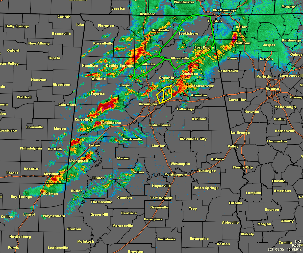
Several counties in North Alabama are under Flash Flood Warnings due to very heavy rainfall that has already occurred or is currently going on.
No one in North/Central Alabama is currently in a Severe Thunderstorm or a Tornado Warning as of 10:33 am. The Severe Thunderstorm Warning for St. Clair County has been canceled.
Scattered thunderstorms continue to move rather quickly to the northeast over the northern half of the area. Very little is occurring south of the I-20/59 corridor.
As reported earlier, I-65 in both directions at exit 308 in Cullman County has been shut down due to flooding. Traffic is being diverted onto HWY-278 and onto US-31 in Cullman.
A Tornado Watch will be issued sometime around noon or just after. We have no indication at this point if it will be a PDS watch (particularly dangerous situation).
Instability continues to quickly rise over the west and southern parts of North/Central Alabama, and it will continue to work to the north and east.
We have plenty of shear and helicity in place. Once the instability works more into the area and temperatures get just a few degrees warmer, we may see more severe thunderstorm activity.
STP values are rising along with that instability. We are seeing values ranging from 1.0 to nearly 4.0 across the west and southwestern portions of the area. Those values, just like the instability, is expected to continue to rise and move north and eastward.
Important wording from the SPC on their latest severe weather outlook update:
This is an uncommon, upper-echelon parameter space. In such an
environment, any relatively discrete supercells will be capable of
multiple tornadoes, some long-tracked and strong to violent (EF2-5
possible), with considerable destructive potential. A very moist
boundary layer also will reduce potential cold-pool/outflow strength
via less subcloud evaporation, so that even closely spaced storms
may have substantial tornado threats. Forecast wind fields and
model soundings reasonably suggest any sustained supercells and
their tornadoes will be fast-moving (45-55 kt), with individual
tornado paths nearly as long in miles as their duration in minutes.
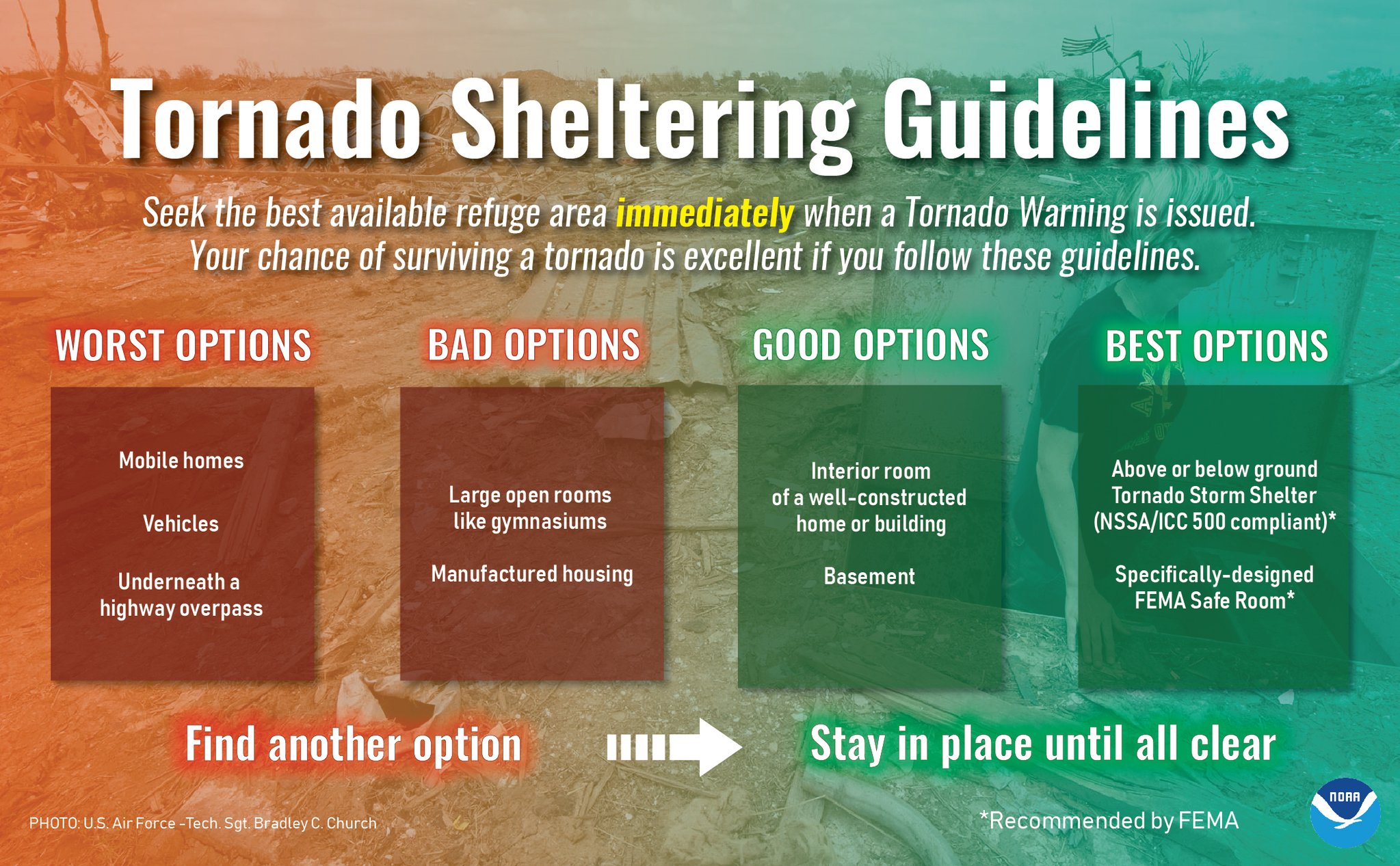
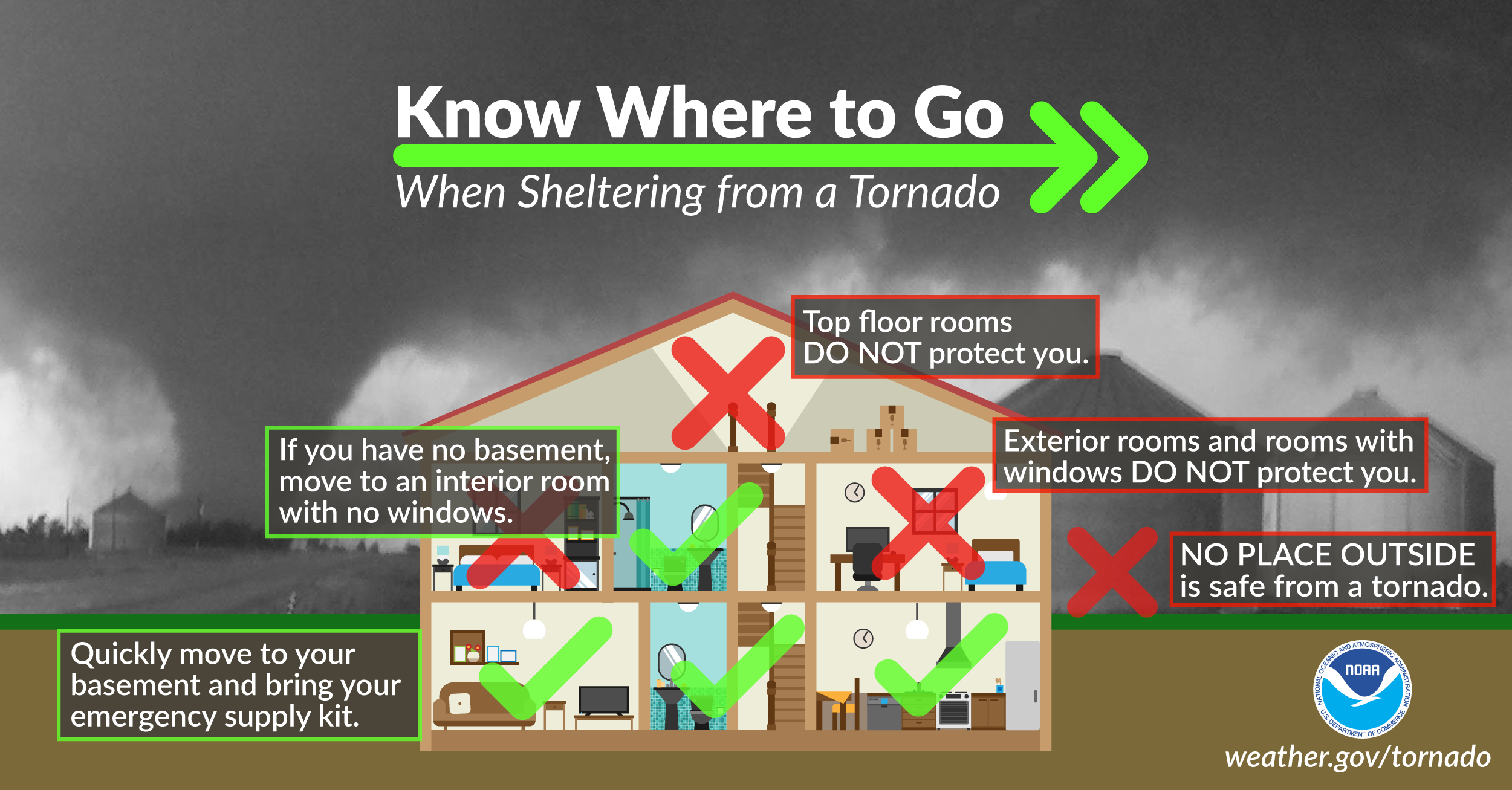
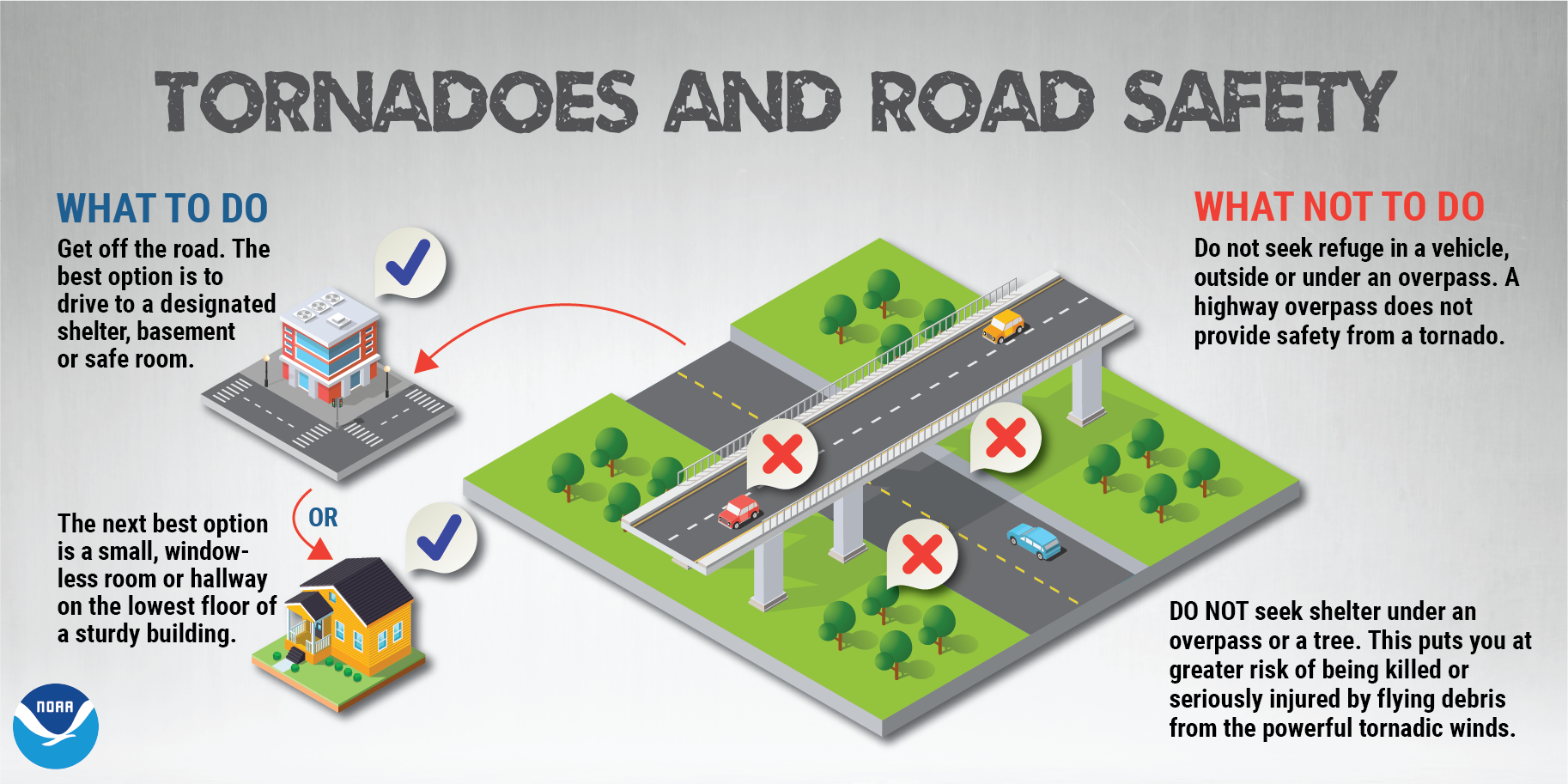
Please be sure that you have multiple ways of receiving alerts. Know where to seek shelter should a Tornado Warning be issued for your location.
Category: Alabama's Weather, ALL POSTS, Severe Weather
About the Author (Author Profile)
Scott Martin is an operational meteorologist, professional graphic artist, musician, husband, and father. Not only is Scott a member of the National Weather Association, but he is also the Central Alabama Chapter of the NWA president. Scott is also the co-founder of Racecast Weather, which provides forecasts for many racing series across the USA. He also supplies forecasts for the BassMaster Elite Series events including the BassMaster Classic.Subscribe
If you enjoyed this article, subscribe to receive more just like it.


