

SPC Upgrades Parts of Central Alabama to a Slight Risk for Wednesday
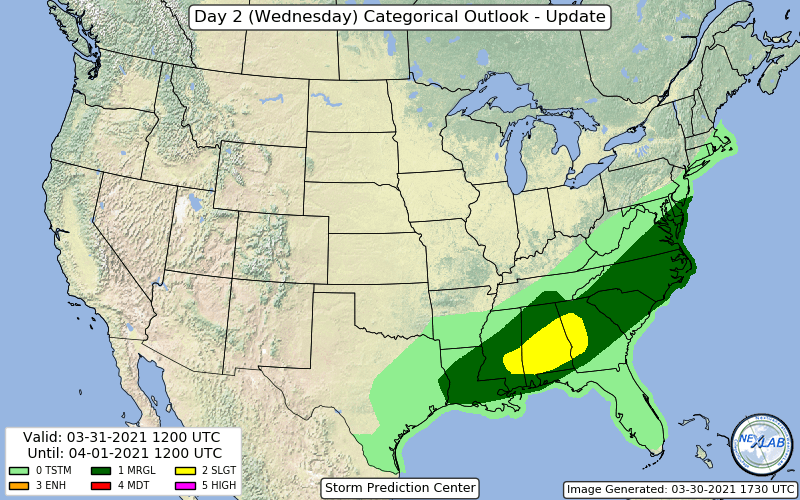
The Storm Prediction Center has just released their update to the Day 2 Severe Weather Outlook, and they have upgraded the southern half of Central Alabama, much of South Alabama, the southeastern parts of Mississippi, and the western parts of Georgia to a level 2/5 Slight Risk for severe storms on Wednesday.
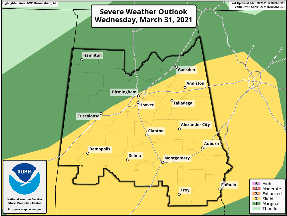
For Central Alabama, this includes locations along and south of a line from Geiger (Sumter Co.) to North Birmingham (Jefferson Co.) to Forney (Cherokee Co.), which includes the larger cities of Tuscaloosa, Demopolis, Birmingham, Hoover, Selma, Clanton, Montgomery, Anniston, Talladega, Alexander City, Auburn, Troy, and Eufaula.
A level 1/5 Marginal Risk continues for locations north of that line in the northern and northwestern parts of Central Alabama, including the cities of Hamilton, Haleyville, Jasper, Berry, Oneonta, Gadsden, Vernon, Carrollton, and Centre.
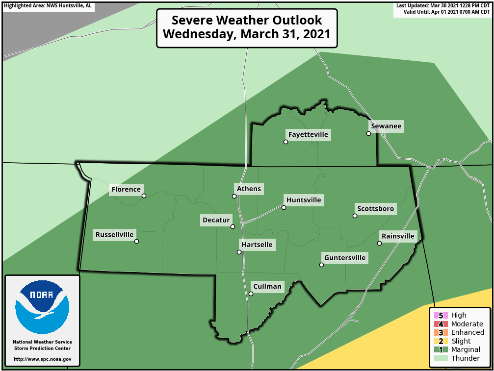
For North Alabama, nearly all of the area continues in a level 1/5 Marginal Risk for severe storms throughout Wednesday, including the cities of Florence, Tuscumbia, Russellville, Athens, Moulton, Hartselle, Cullman, Huntsville, Guntersville, Scottsboro, and Rainsville.
The threat for severe storms from northwest to southeast will most likely take place in a window from 10 am to 3 pm north of the I-59 corridor, and from roughly 1 pm to 8 pm south of the I-59 corridor.
Damaging winds up to 60 mph and hail up to quarter size in diameter will be possible in all risk areas, with a very low brief spin-up tornado potential over the slight risk locations.
Projected sounding valid at 2 pm from the 12z high-resolution NAM for the Birmingham metropolitan area shows that threat of severe storms as instability values will be elevated above 2,600 J/kg, shear values around 52 knots at the 0-6 km layer, and storm-relative helicity around 240 m2s2 in the 0-3 km layer. Those first two values well exceed the minimums for severe weather output, but the helicity is just below the 250 m2s2 we would want to see for tornadic development. However, the Energy-Helicity Index is showing a 4.0 value, which any values above 2.0 have been associated with significant tornadoes in supercells. That is why there is a tornado threat for tomorrow.
No change in preparation… just like with any other severe weather threat, have your safety kits and your plan of action ready to go just in case your location goes under a warning.
We’ll keep you posted.
Category: Alabama's Weather, ALL POSTS, Severe Weather
About the Author (Author Profile)
Scott Martin is an operational meteorologist, professional graphic artist, musician, husband, and father. Not only is Scott a member of the National Weather Association, but he is also the Central Alabama Chapter of the NWA president. Scott is also the co-founder of Racecast Weather, which provides forecasts for many racing series across the USA. He also supplies forecasts for the BassMaster Elite Series events including the BassMaster Classic.Subscribe
If you enjoyed this article, subscribe to receive more just like it.


