

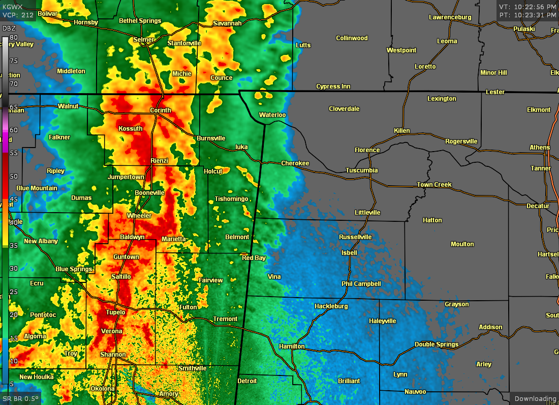
Strong Storms Moving into Colbert, Franklin, & Lauderdale Counties
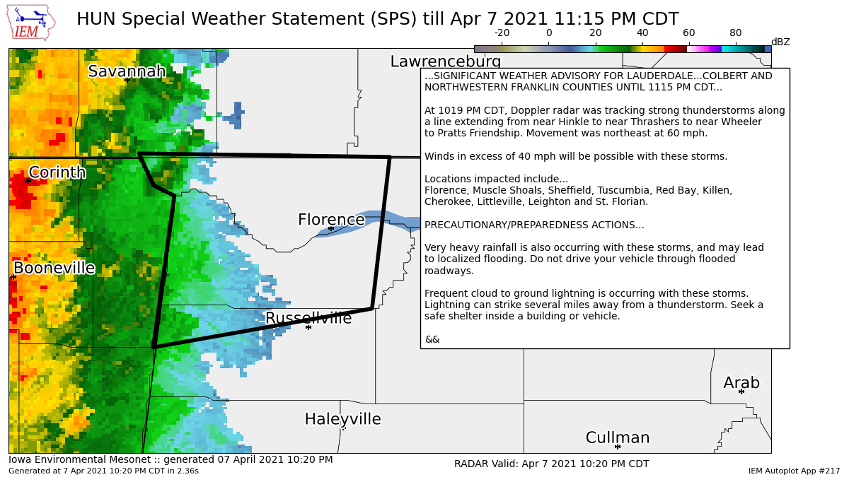
…SIGNIFICANT WEATHER ADVISORY FOR LAUDERDALE…COLBERT AND
NORTHWESTERN FRANKLIN COUNTIES UNTIL 1115 PM CDT…
At 1019 PM CDT, Doppler radar was tracking strong thunderstorms along
a line extending from near Hinkle to near Thrashers to near Wheeler
to Pratts Friendship. Movement was northeast at 60 mph.
Winds in excess of 40 mph will be possible with these storms.
Locations impacted include…
Florence, Muscle Shoals, Sheffield, Tuscumbia, Red Bay, Killen,
Cherokee, Littleville, Leighton and St. Florian.
PRECAUTIONARY/PREPAREDNESS ACTIONS…
Very heavy rainfall is also occurring with these storms, and may lead
to localized flooding. Do not drive your vehicle through flooded
roadways.
Frequent cloud to ground lightning is occurring with these storms.
Lightning can strike several miles away from a thunderstorm. Seek a
safe shelter inside a building or vehicle.
Category: Alabama's Weather, ALL POSTS, Severe Weather
About the Author (Author Profile)
Scott Martin is an operational meteorologist, professional graphic artist, musician, husband, and father. Not only is Scott a member of the National Weather Association, but he is also the Central Alabama Chapter of the NWA president. Scott is also the co-founder of Racecast Weather, which provides forecasts for many racing series across the USA. He also supplies forecasts for the BassMaster Elite Series events including the BassMaster Classic.Subscribe
If you enjoyed this article, subscribe to receive more just like it.


