

Midday Nowcast: Quiet Afternoon Ahead
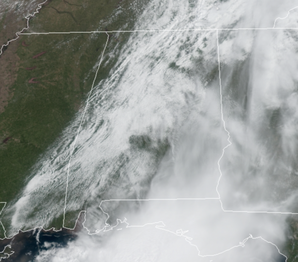
The morning rain and storms are out of here, and the rest of the day is featuring pretty decent weather as a dry slot of air moves into the state, and we are seeing a gradually clearing sky and very warm temperatures as highs are climbing into the lower 80s. Tonight will feature passing clouds and lows around 60°.
MORE RAIN/STORMS: A warm front begins to lift north out of the Gulf tonight, bringing an unstable air mass back to Alabama, and occasional rain and storms will highlight the forecast for tomorrow, especially during the afternoon and evening hours. Where these pulse-like storms form they could be strong, and could become severe, the SPC has defined an “enhanced risk” (level 3/5) of severe storms for a few counties in West Alabama… there is a “slight risk” (level 2/5) as far east as Decatur, Ashland, Troy, and Foley… and a “marginal risk” (level 1/5) for the rest of the state.
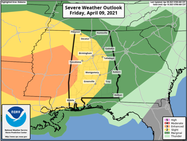
The main threat from these storms will be large hail and damaging wind gusts, pretty typical of what we see on a summer day in Alabama.
Then tomorrow night, we will be watching clusters of storms work across the Mississippi Valley along the warm front and these are expected to move into Alabama late Friday night and into the first half of Saturday. The SPC has has much of the state in a “marginal” to “slight risk” to start our Saturday.
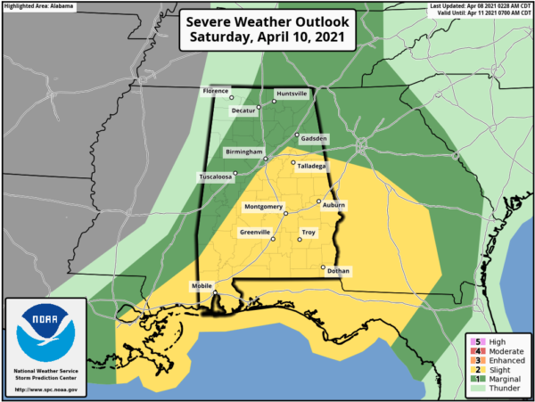
These cluster of storms will be pushing rapidly east across Alabama and will be capable of producing large hail, strong, potentially damaging winds, and a few tornadoes are possible. The storm threat winds down by the midday hour, and Saturday afternoon looks dry with highs in the 70s.
Rainfall totals between now and midday Saturday afternoon could be in the 1-3 inch range across the state, so some isolated flooding is possible, but of course the main concern will continue to be numerous rivers across the state, which continue to run full from recent rains.
BEACH FORECAST CENTER: Get the latest weather and rip current forecasts for the beaches from Fort Morgan to Panama City on our Beach Forecast Center page. There, you can select the forecast of the region that you are interested in visiting.
WORLD TEMPERATURE EXTREMES: Over the last 24 hours, the highest observation outside the U.S. was 114.1F at Kayes, Mali. The lowest observation was -95.1F at University Dome, Antarctica.
CONTIGUOUS TEMPERATURE EXTREMES: Over the last 24 hours, the highest observation was 103F at Falcon Lake, TX. The lowest observation was 6F Perter Sinks, UT.
WEATHER ON THIS DATE IN 1926: The lightning-set oil depot fire near San Luis Obispo CA boiled over and engulfed 900 acres. Many tornado vorticies resulted from the intense heat of the fire. One such tornado traveled 1000 yards, picked up a house and carried it 150 feet, killing the two occupants inside.
Category: Alabama's Weather, ALL POSTS
About the Author (Author Profile)
Macon, Georgia Television Chief Meteorologist, Birmingham native, and long time Contributor on AlabamaWX. Stormchaser. I did not choose Weather, it chose Me. College Football Fanatic. @Ryan_StinnetSubscribe
If you enjoyed this article, subscribe to receive more just like it.


