


The National Weather Service in Birmingham has issued a
* Severe Thunderstorm Warning for…
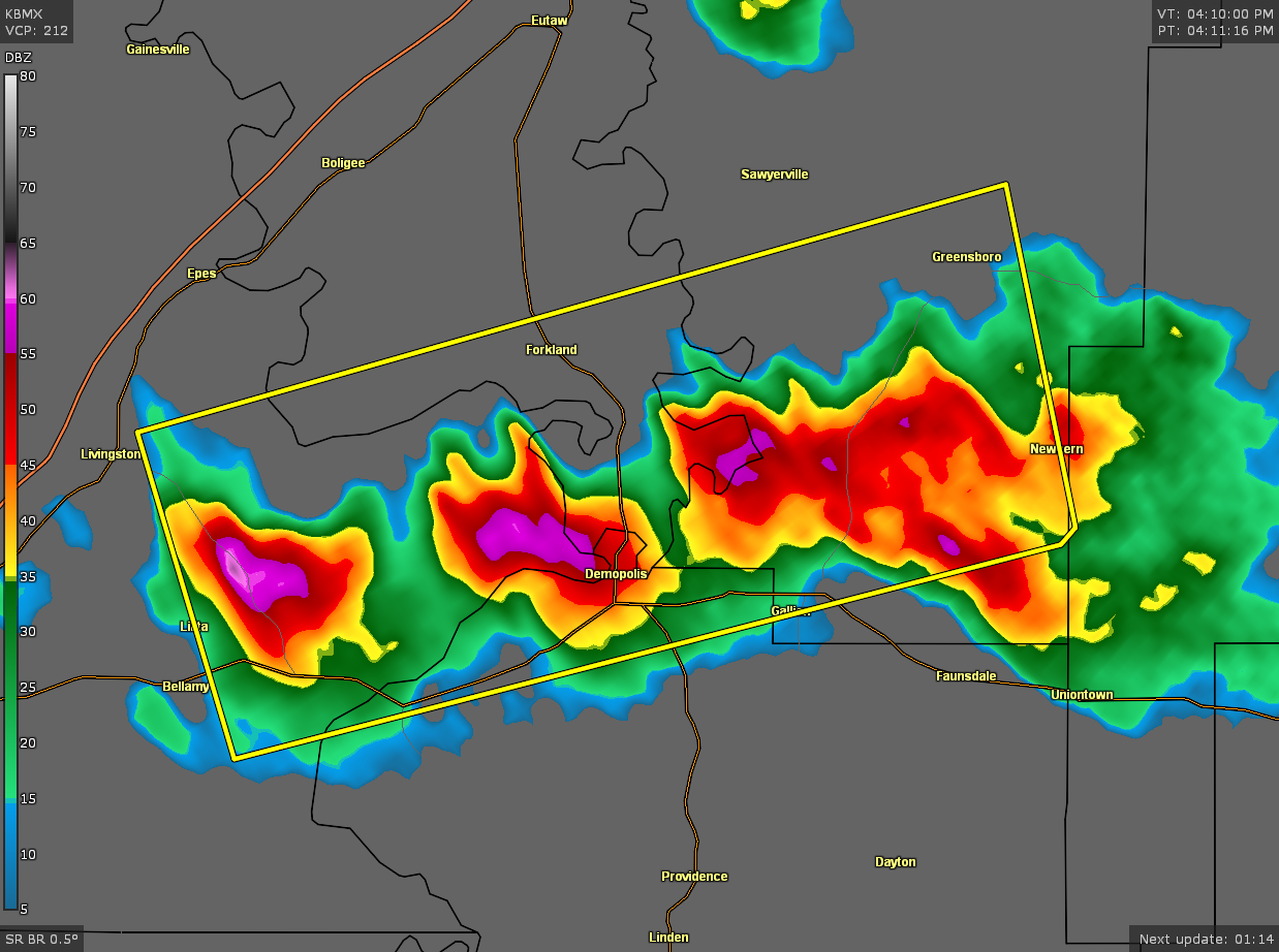
Northwestern Marengo County in southwestern Alabama…
Southeastern Greene County in west central Alabama…
Southwestern Hale County in west central Alabama…
Southeastern Sumter County in west central Alabama…
* Until 500 PM CDT.
* At 413 PM CDT, severe thunderstorms were located along a line
extending from near Duffys Bend to near Coatopa, moving east at 15
mph.
HAZARD…60 mph wind gusts and quarter size hail.
SOURCE…Radar indicated.
IMPACT…Hail damage to vehicles is expected. Expect wind damage
to roofs, siding, and trees.
* Locations impacted include…
Demopolis, Greensboro, Forkland, Newbern, Greensboro Municipal
Airport, Duffys Bend, Bluffport, Arcola, Coatopa, Dug Hill,
Tishabee, U.S. 80 and AL 28, Belmont, Demopolis Lock And Dam,
McDowell, Birdine, Cedarville, Demopolis Municipal Airport, Lilita
and Gallion.
PRECAUTIONARY/PREPAREDNESS ACTIONS…
For your protection move to an interior room on the lowest floor of a
building.


