

Radar Update Just After 10 p.m.
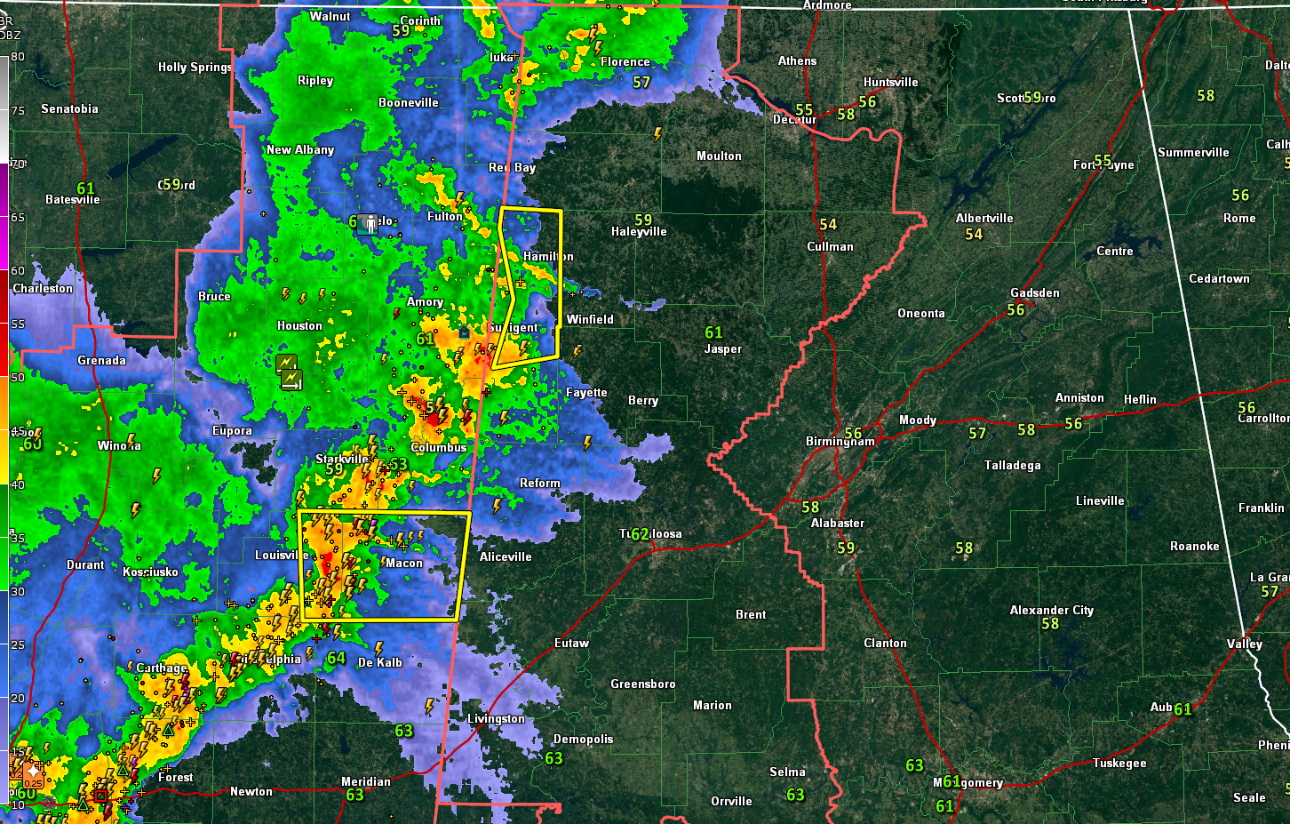
The storms over Northwest Alabama and Northeast Mississippi are weakening a bit, as we expected.
But they are still packing a punch in spots, including Lamar and Marion Counties, where a severe thunderstorm warning will expire at 10:15 p.m. These storms produced significant wind damage in Chickasaw County Mississippi, where trees fell on several homes. The NWS in Birmingham says they will not issue any more severe thunderstorm warnings with these storms unless they re-intensify.
The storms extending from Columbus MS to Philadelphia and southwest to the east of Jackson are strong and will have to be monitored. A severe thunderstorm warning is in effect for portions of Winston and Noxubee Counties. The NWS in Jackson just added a new severe thunderstorm warning for portions of Scott,
A severe thunderstorm watch continues for the western half of North and Central Alabama until 4 a.m.
We still have a couple of rounds of storms to go through, including this first one, and another that will come in later tonight. They could produce damaging winds and hail, as well as a couple of embedded tornadoes as they push eastward.
Category: Alabama's Weather, ALL POSTS, Severe Weather
About the Author (Author Profile)
Bill Murray is the President of The Weather Factory. He is the site's official weather historian and a weekend forecaster. He also anchors the site's severe weather coverage. Bill Murray is the proud holder of National Weather Association Digital Seal #0001 @wxhistorianSubscribe
If you enjoyed this article, subscribe to receive more just like it.


