

Midday Nowcast: Terrific Tuesday Underway
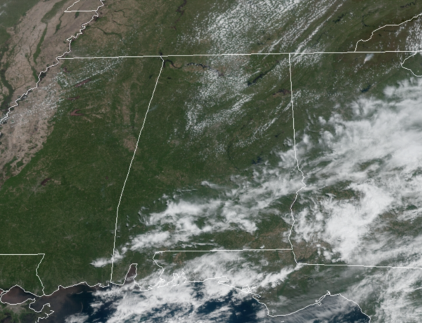
Overall, it is another great day of weather across Alabama with ample sunshine and temperatures are surging into the mid and upper 70s this afternoon. Clouds will increase tonight ahead of a strong cold front which will pass through the state mostly in dry fashion during the early morning hours tomorrow. A few sprinkles are possible over the northern third of the state, but measurable rain isn’t expected. Lows tonight will be chilly with upper 30s to the north, while most locations remain in the 40s.
MUCH COOLER WEDNESDAY: Behind the front tomorrow, expect a sunny, beautiful day, but it will be much cooler and breezy, which will make it feel cooler. Highs tomorrow over North Alabama will remain in the 50s, while Central Alabama will only see low 60s. And again, breezy conditions will occur as northwesterly winds gusts 15-25 mph.
FROSTY THURSDAY MORNING: As the winds go light and with a clear sky, temperatures will have no problems falling into the 30s by Thursday morning. Most places will stay above freezing with a low in the 33-40 degree range, but colder spots could hit 32 degrees or lower. Quite a bit of frost is likely across the North and Central Alabama landscape…Growers beware!!! Thursday afternoon will feature tons of sunshine with highs in the low to mid 60s.
FOR FRIDAY: For Alabama, Friday will be another dry day with highs in the upper 60s, but clouds will increase through the day as a surface low will be getting its act together off to our west. Friday night the sky will become overcast and some rain is possible after midnight.
BEACH FORECAST CENTER: Get the latest weather and rip current forecasts for the beaches from Fort Morgan to Panama City on our Beach Forecast Center page. There, you can select the forecast of the region that you are interested in visiting.
WORLD TEMPERATURE EXTREMES: Over the last 24 hours, the highest observation outside the U.S. was 113.7F at Matam, Senegal. The lowest observation was -96.5F at Vostok, Antarctica.
CONTIGUOUS TEMPERATURE EXTREMES: Over the last 24 hours, the highest observation was 98F at Death Valley, CA. The lowest observation was 8F at Neihart, MT.
WEATHER ON THIS DATE IN 1901: A spring storm produced unusually heavy snow in northeast Ohio. Warren received 35.5 inches in thirty-six hours, and 28 inches fell at Green Hill. Akron OH established April records of 15.6 inches in 24 hours, and 26.6 inches for the month. Pittsburgh PA established April records of 12.7 inches in 24 hours, and 13.5 inches for the month.
Category: Alabama's Weather, ALL POSTS
About the Author (Author Profile)
Macon, Georgia Television Chief Meteorologist, Birmingham native, and long time Contributor on AlabamaWX. Stormchaser. I did not choose Weather, it chose Me. College Football Fanatic. @Ryan_StinnetSubscribe
If you enjoyed this article, subscribe to receive more just like it.


