

A Brief Update on Our Weather Situation Just After 7:00 am
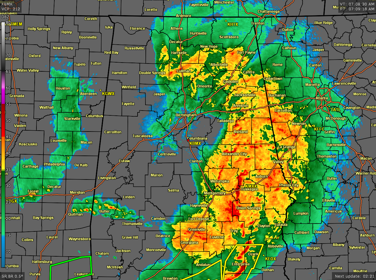
Much of the rain and thunderstorm activity has moved into the eastern half of North/Central Alabama east of the I-65 corridor, with much of the western half getting a brief respite from the rain. The strongest storms in our area are located in the southeastern parts, mainly over portions of Pike, Lee, Elmore, Bullock, Macon, Barbour, and Russell counties. Gusty winds up to 50 mph will be possible with this segment of the line and was moving to the east at 65 mph.
No watches or warnings are in effect for North/Central Alabama, but a few severe thunderstorm warnings are in effect over portions of Southeast Alabama and for the western parts of the Florida Panhandle.
The rainfall over the area has kept the warm front from advancing northward at this point, which has kept the stronger storms south of Central Alabama. The good news is that there is a line of showers that are moving eastward across the eastern parts of Mississippi that will move into the western parts of Central Alabama within the next 60-90 minutes. While gusty wind may be possible with this new line, the atmosphere hasn’t had enough time to really destabilize.
We’ll continue to keep you posted throughout the day.
Category: Alabama's Weather, ALL POSTS, Severe Weather
About the Author (Author Profile)
Scott Martin is an operational meteorologist, professional graphic artist, musician, husband, and father. Not only is Scott a member of the National Weather Association, but he is also the Central Alabama Chapter of the NWA president. Scott is also the co-founder of Racecast Weather, which provides forecasts for many racing series across the USA. He also supplies forecasts for the BassMaster Elite Series events including the BassMaster Classic.Subscribe
If you enjoyed this article, subscribe to receive more just like it.


