

Alabama Weather Update at 8 a.m.
We expect two rounds of potential severe weather across Alabama today and this evening, and the second appears to present the threat of a widespread damaging wind event. There is a chance of an isolated tornado this morning, but the greatest threat is over Tennessee, but tornadoes will be possible across all of the area this afternoon and evening.
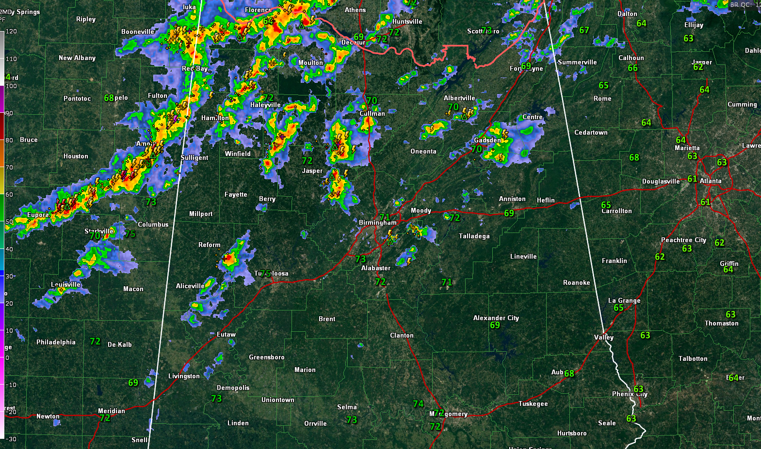
A severe thunderstorm watch is in effect for four counties in North Alabama including Jackson, Lauderdale, Limestone, and Madison. That watch continues up into Tennessee and southern Kentucky. There are a couple of tornado warnings east of Nashville and severe thunderstorm warnings along the organized line of severe storms from Cookeville down to Tullahoma and Fayetteville in Tennessee.
That line curves back to the Northwest corner of Alabama where significant weather advisories are in effect for parts of Colbert and Lauderdale Counties. A new significant weather advisory was just issued for Cullman County.
To the south of that, a line of storms is over eastern Mississipi from Fulton back to Eupora. Over North Central Alabama, scattered storms are over Marion, Winston, Cullman, Walker, Fayette, Lamar, Pickens, Etowah, and Blount Counties. Storms in Walker County were moving into Western Jefferson County and new storms have formed quickly over southern Jefferson and northern Shelby Counties. The strongest storms are over Marion and Lamar Counties at this hour.
These storms aren’t severe but are generating lots of lightning and loud thunder. We will monitor these storms as they drag slowly east and southeastward across the remainder of North and Central Alabama through early afternoon. They could produce some large hail, damaging winds, and there is a threat of an isolated tornado as they do.
Meanwhile, another push of storms will form over Louisiana later this morning and track across Mississippi and into Alabama by mid-afternoon. We were hoping morning storms would stabilize the atmosphere in their wake, but that doesn’t appear likely now, so the afternoon storms will be severe. The storms this afternoon look like they could produce a widespread damaging wind event, along with quarter-sized hail, and possible tornadoes.
The SPC has almost all of Alabama in an Enhanced (level 3 out of 5) Risk area for this possibility.
We will have frequent updates throughout the day and this evening.
Category: ALL POSTS
About the Author (Author Profile)
Bill Murray is the President of The Weather Factory. He is the site's official weather historian and a weekend forecaster. He also anchors the site's severe weather coverage. Bill Murray is the proud holder of National Weather Association Digital Seal #0001 @wxhistorianSubscribe
If you enjoyed this article, subscribe to receive more just like it.


