

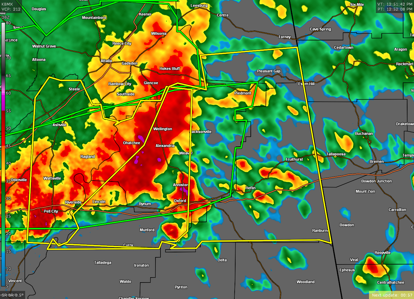
Severe T-Storm Warning for Parts of Talladega, Calhoun, Cleburne, Cherokee Co. Until 2:00 pm
The National Weather Service in Birmingham has issued a
* Severe Thunderstorm Warning for…
Northeastern Talladega County in east central Alabama…
Calhoun County in east central Alabama…
Cleburne County in east central Alabama…
Southeastern Cherokee County in northeastern Alabama…
* Until 200 PM CDT.
* At 1255 PM CDT, severe thunderstorms were located along a line
extending from 6 miles southwest of Ball Flat to Pell City, moving
east at 45 mph.
HAZARD…60 mph wind gusts and quarter size hail.
SOURCE…Radar indicated.
IMPACT…Hail damage to vehicles is expected. Expect wind damage
to roofs, siding, and trees.
* Locations impacted include…
Anniston, Oxford, Jacksonville, Piedmont, Heflin, West End-Cobb
Town, Cobb Town, Fort McClellan, Saks, Lincoln, Weaver, Munford,
Hobson City, Ranburne, Fruithurst, Edwardsville, Talladega
Superspeedway, Pleasant Gap, Alexandria and Talladega Municipal
Airport.
PRECAUTIONARY/PREPAREDNESS ACTIONS…
A Tornado Watch remains in effect until 400 PM CDT for central,
northeastern and east central Alabama.
For your protection move to an interior room on the lowest floor of a
building.
Category: Alabama's Weather, ALL POSTS, Severe Weather
About the Author (Author Profile)
Scott Martin is an operational meteorologist, professional graphic artist, musician, husband, and father. Not only is Scott a member of the National Weather Association, but he is also the Central Alabama Chapter of the NWA president. Scott is also the co-founder of Racecast Weather, which provides forecasts for many racing series across the USA. He also supplies forecasts for the BassMaster Elite Series events including the BassMaster Classic.Subscribe
If you enjoyed this article, subscribe to receive more just like it.


