

CANCELED Severe T-Storm Warning for Parts of Tuscaloosa Co. Until 5:15 pm
The National Weather Service in Birmingham has issued a
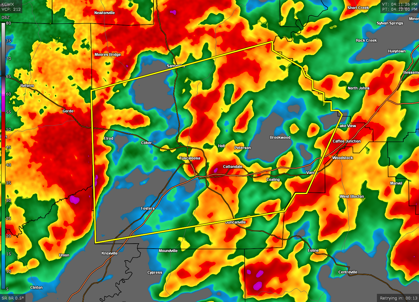
* Severe Thunderstorm Warning for…
Tuscaloosa County in west central Alabama…
* Until 515 PM CDT.
* At 413 PM CDT, severe thunderstorms were located along a line
extending from near Gordo to near Knoxville, moving east at 40 mph.
HAZARD…60 mph wind gusts.
SOURCE…Radar indicated.
IMPACT…Expect damage to roofs, siding, and trees.
* Locations impacted include…
Tuscaloosa, Northport, Holt, Brookwood, Coaling, Vance, Coker,
Samantha, McFarland Mall, Lake Lurleen State Park, Tuscaloosa
Amphitheater, Tuscaloosa Regional Airport, Lake Wildwood, Mercedes
Benz Of Alabama, Binion Creek Landing, Abernant, Shelton State
Community College, Bryant Denny Stadium, University Mall and
Deerlick Creek Campgrounds.
PRECAUTIONARY/PREPAREDNESS ACTIONS…
A Tornado Watch remains in effect until 1000 PM CDT for central and
west central Alabama.
For your protection move to an interior room on the lowest floor of a
building.
Category: Alabama's Weather, ALL POSTS, Severe Weather
About the Author (Author Profile)
Scott Martin is an operational meteorologist, professional graphic artist, musician, husband, and father. Not only is Scott a member of the National Weather Association, but he is also the Central Alabama Chapter of the NWA president. Scott is also the co-founder of Racecast Weather, which provides forecasts for many racing series across the USA. He also supplies forecasts for the BassMaster Elite Series events including the BassMaster Classic.Subscribe
If you enjoyed this article, subscribe to receive more just like it.


