

EXPIRED Severe T-Storm Warning for Parts of Greene Co. Until 5:15 pm
The National Weather Service in Birmingham has issued a
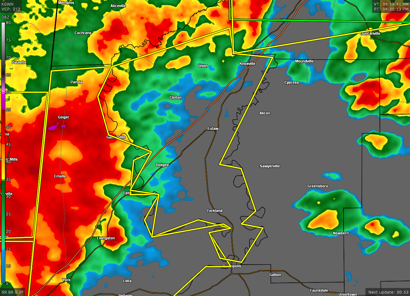
* Severe Thunderstorm Warning for…
Greene County in west central Alabama…
* Until 515 PM CDT.
* At 420 PM CDT, a severe thunderstorm was located near Emelle, or 12
miles north of Livingston, moving east at 50 mph.
HAZARD…60 mph wind gusts.
SOURCE…Radar indicated.
IMPACT…Expect damage to roofs, siding, and trees.
* Locations impacted include…
Eutaw, Forkland, Boligee, Union, Gainesville, Epes, New West
Greene, Mantua, Allison, Walden Quarters, West Greene, Knoxville,
Thornhill, Tishabee, Snoddy, New Mount Hebron, Eutaw Municipal
Airport, Clinton, Five Points Intersection and I 20 Rest Area Near
Eutaw.
PRECAUTIONARY/PREPAREDNESS ACTIONS…
A Tornado Watch remains in effect until 1000 PM CDT for southwestern
and west central Alabama.
For your protection move to an interior room on the lowest floor of a
building.
Category: Alabama's Weather, ALL POSTS, Severe Weather
About the Author (Author Profile)
Scott Martin is an operational meteorologist, professional graphic artist, musician, husband, and father. Not only is Scott a member of the National Weather Association, but he is also the Central Alabama Chapter of the NWA president. Scott is also the co-founder of Racecast Weather, which provides forecasts for many racing series across the USA. He also supplies forecasts for the BassMaster Elite Series events including the BassMaster Classic.Subscribe
If you enjoyed this article, subscribe to receive more just like it.


