

Severe T-Storm Warning for Parts of Pike, Bullock, Macon Co. Until 8:00 pm
The National Weather Service in Birmingham has issued a
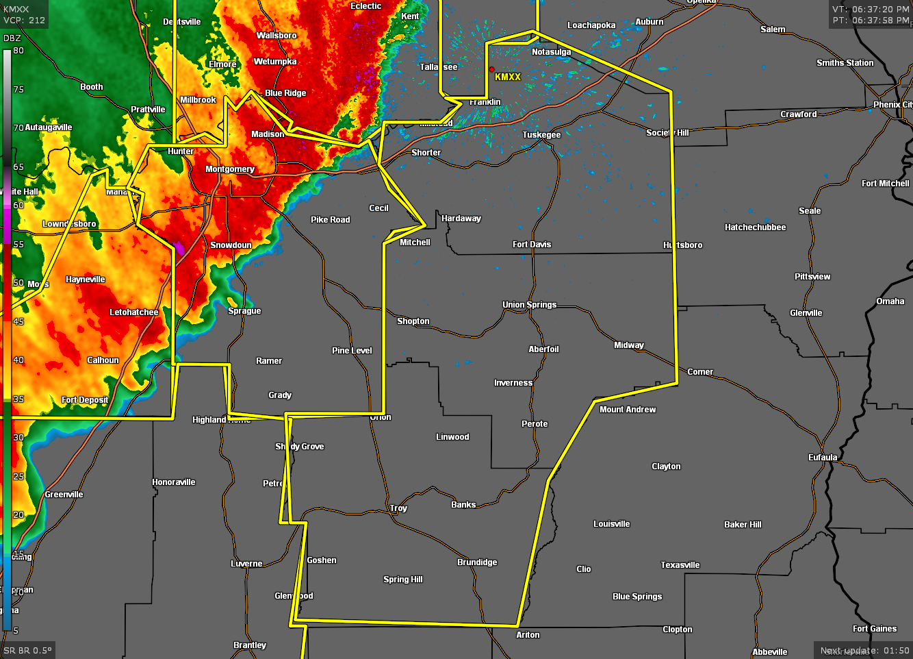
* Severe Thunderstorm Warning for…
Pike County in southeastern Alabama…
Bullock County in southeastern Alabama…
Macon County in southeastern Alabama…
* Until 800 PM CDT.
* At 636 PM CDT, severe thunderstorms were located along a line
extending from near Southern Lake Martin to Greenville, moving east
at 40 mph.
HAZARD…60 mph wind gusts. A wind gust to 58 mph was recently
recorded at the Montgomery airport. Wind damage has also
been reported with this line of storms.
SOURCE…Radar indicated.
IMPACT…Expect damage to roofs, siding, and trees.
* Locations impacted include…
Troy, Tuskegee, Union Springs, Brundidge, Notasulga, Midway,
Goshen, Milstead, Shorter, Banks, Franklin, Pickett, Lake Tuskegee,
Beans Crossroads, Guerryton, Shopton, Tuskegee National Forest,
Liverpool, Liberty City and Hardaway.
PRECAUTIONARY/PREPAREDNESS ACTIONS…
A Tornado Watch remains in effect until 1000 PM CDT for south central
and east central Alabama.
For your protection move to an interior room on the lowest floor of a
building.
Category: Alabama's Weather, ALL POSTS, Severe Weather
About the Author (Author Profile)
Scott Martin is an operational meteorologist, professional graphic artist, musician, husband, and father. Not only is Scott a member of the National Weather Association, but he is also the Central Alabama Chapter of the NWA president. Scott is also the co-founder of Racecast Weather, which provides forecasts for many racing series across the USA. He also supplies forecasts for the BassMaster Elite Series events including the BassMaster Classic.Subscribe
If you enjoyed this article, subscribe to receive more just like it.


