

Severe Thunderstorm Watch Has Been Canceled; Severe Threat Has Ended
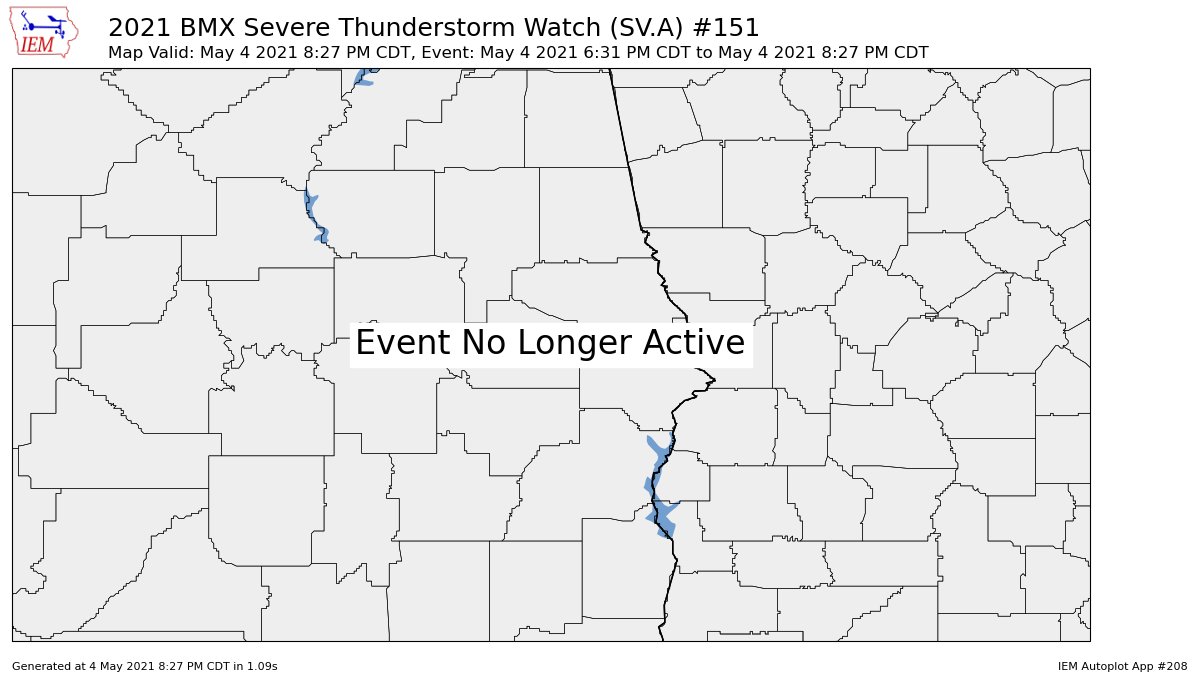
NWS Birmingham has removed the following counties in Central Alabama from the Severe Thunderstorm Watch as the threat for severe storms has passed: Barbour, Bullock, Chambers, Lee, Macon, Pike, Russell.
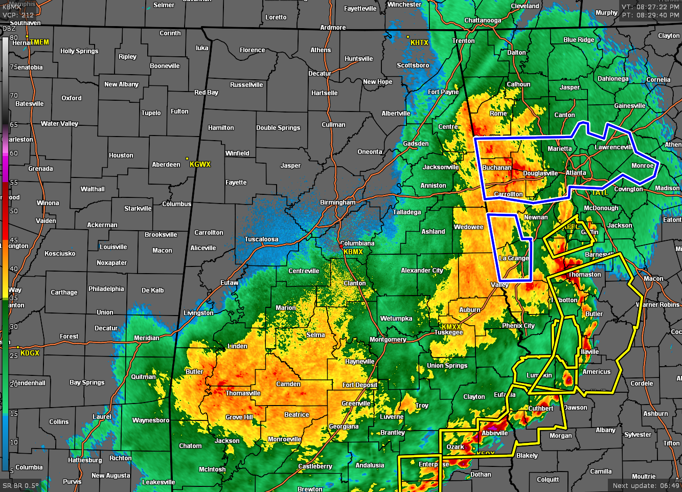
The line of strong to severe storms have moved out of the area and has pushed over into west and southwestern Georgia, leaving us with light to moderate rainfall for most locations south of the I-59 corridor. All of this activity will be out of the area by 1-2 am Wednesday morning, but there could be a few stray showers moving into the western and southwestern parts of the area and will move across the extreme southern parts of the area during the rest of the morning hours.
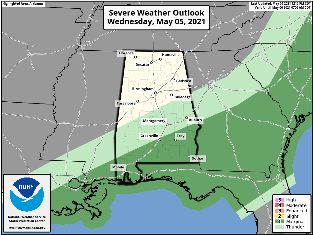
We do note that there is a level 1/5 Marginal Risk for severe storms for the extreme southeastern parts of the area that includes portions of Bullock, Macon, Lee, and Russell counties, along with all of Pike and Barbour counties on Wednesday. Gusty winds will be the main threat across the risk area.
Category: Alabama's Weather, ALL POSTS, Severe Weather
About the Author (Author Profile)
Scott Martin is an operational meteorologist, professional graphic artist, musician, husband, and father. Not only is Scott a member of the National Weather Association, but he is also the Central Alabama Chapter of the NWA president. Scott is also the co-founder of Racecast Weather, which provides forecasts for many racing series across the USA. He also supplies forecasts for the BassMaster Elite Series events including the BassMaster Classic.Subscribe
If you enjoyed this article, subscribe to receive more just like it.


