

Marginal Risk Shifted Eastward & Southward Farther Into the Area
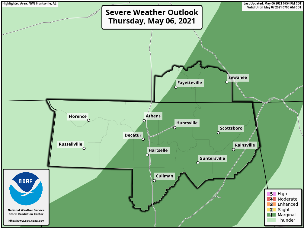
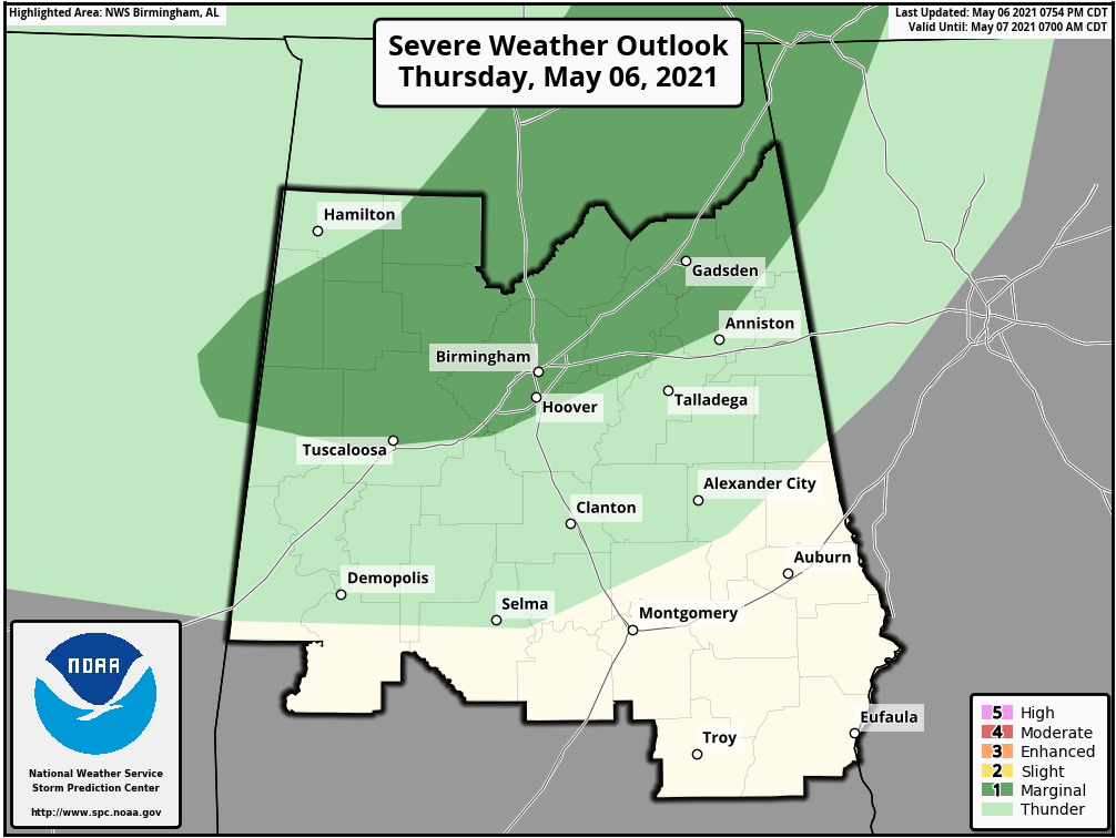
The Storm Prediction Center just released the latest update on their Day One Severe Weather Outlook, and we see that the Marginal Risk has been shifted farther to the east and south to now include the cities of Decatur, Hartselle, Cullman, Huntsville, Scottsboro, Rainsville, Guntersville, Birmingham, Hoover, and Gadsden.
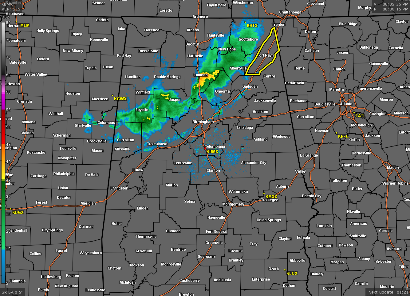
The line of showers on radar is not all that impressive at all, but the gust front out ahead of the line is where we are seeing wind gusts high enough to topple over trees and cause some damage. Here is a sample (raw format) of damage reports straight from NWS Chat:
Local Storm Report by NWS HUN: 5 SW Skyline [Jackson Co, AL] emergency mngr reports TSTM WND DMG at 07:08 PM CDT — tree down across county road 8 in the pleasant grove area. time estimated from radar.
Local Storm Report by NWS HUN: 2 NNW Scottsboro [Jackson Co, AL] emergency mngr reports TSTM WND DMG at 07:23 PM CDT — tree down on old larkinsville road near scottsboro. time estimated from radar.
Local Storm Report by NWS HUN: 1 NW Section [Jackson Co, AL] emergency mngr reports TSTM WND DMG at 07:30 PM CDT — trees and power lines down near highway 35 near the top of sand mountain. time estimated from radar.
Local Storm Report by NWS HUN: Winchester [Franklin Co, TN] emergency mngr reports TSTM WND DMG at 07:10 PM CDT — trees down throughout winchester. time estimated from radar.
Local Storm Report by NWS HUN: Grant [Marshall Co, AL] broadcast media reports TSTM WND DMG at 07:22 PM CDT — multiple trees down around grant. time estimated from radar.
Local Storm Report by NWS HUN: 1 SSE Scottsboro [Jackson Co, AL] emergency mngr reports TSTM WND DMG at 07:27 PM CDT — trees down across bob jones road near scottsboro. time estimated from radar.
Local Storm Report by NWS HUN: 8 NNE Skyline [Jackson Co, AL] emergency mngr reports TSTM WND DMG at 07:18 PM CDT — tree down across hytop road in the hytop area. time estimated from radar.
Local Storm Report by NWS HUN: 4 NE Stevenson [Jackson Co, AL] emergency mngr reports TSTM WND DMG at 07:36 PM CDT — tree down across the road near the corner of steam plant road and al hwy 277. time estimated from radar.
Local Storm Report by NWS HUN: 4 E Pisgah [Jackson Co, AL] emergency mngr reports TSTM WND DMG at 07:40 PM CDT — trees down across the road near the corner of county roads 83 and 456. time estimated from radar.
Category: Alabama's Weather, ALL POSTS, Severe Weather
About the Author (Author Profile)
Scott Martin is an operational meteorologist, professional graphic artist, musician, husband, and father. Not only is Scott a member of the National Weather Association, but he is also the Central Alabama Chapter of the NWA president. Scott is also the co-founder of Racecast Weather, which provides forecasts for many racing series across the USA. He also supplies forecasts for the BassMaster Elite Series events including the BassMaster Classic.Subscribe
If you enjoyed this article, subscribe to receive more just like it.


