

Strong Storms Soon to Be moving Into Eastern Fayette and Northwestern Tuscaloosa Counties
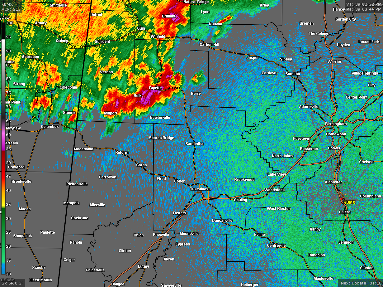
…SIGNIFICANT WEATHER ADVISORY FOR WALKER…NORTHWESTERN TUSCALOOSA
AND EASTERN FAYETTE COUNTIES UNTIL 1000 PM CDT…
At 906 PM CDT, Doppler radar was tracking strong thunderstorms along
a line extending from Winston County southwest to Fayette County.
Movement was southeast at 45 mph.
Winds in excess of 40 mph will be possible with these storms. Gusty
winds may arrive before any heavy rainfall.
Locations impacted include…
Jasper, Sumiton, Cordova, Dora, Carbon Hill, Berry, Parrish, Oakman,
Sipsey, Kansas, Nauvoo, Eldridge, Curry, Gorgas Steam Plant,
Samantha, Lake Lurleen State Park, Boley Springs, Burnwell, Beloit
and Binion Creek Landing.
Category: Alabama's Weather, ALL POSTS, Severe Weather
About the Author (Author Profile)
Scott Martin is an operational meteorologist, professional graphic artist, musician, husband, and father. Not only is Scott a member of the National Weather Association, but he is also the Central Alabama Chapter of the NWA president. Scott is also the co-founder of Racecast Weather, which provides forecasts for many racing series across the USA. He also supplies forecasts for the BassMaster Elite Series events including the BassMaster Classic.Subscribe
If you enjoyed this article, subscribe to receive more just like it.


