


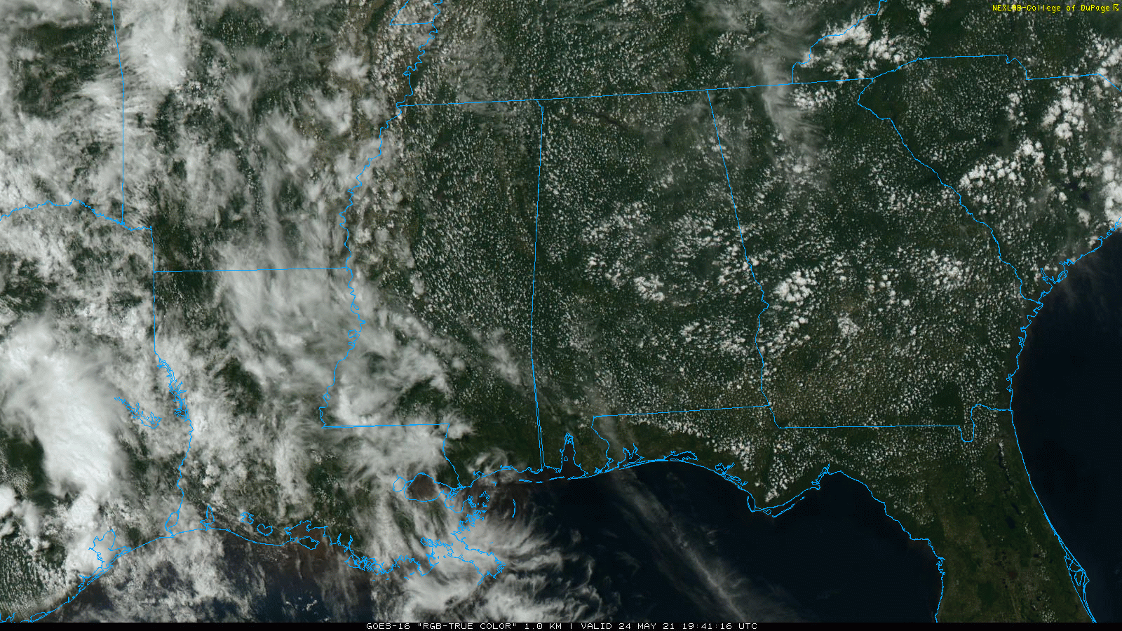
HOT MAY DAY: Today is the 12th consecutive day without measurable rain in Birmingham, and many other communities across North/Central Alabama. Temperatures are mostly in the 89-92 degree range across Alabama this afternoon with a good supply of sunshine; the average high for Birmingham on May 24 is 84. Tonight will be mostly fair with a low in the mid to upper 60s.
The weather won’t change much tomorrow and Wednesday… mostly sunny weather continues with highs in the low 90s for most communities.
THURSDAY THROUGH THE WEEKEND: The strong upper ridge will weaken a bit, allowing us to mention some risk of isolated showers or storms each day during the peak of the daytime heating process over the northern half of the state. The rain won’t be widespread, and many places won’t see a drop. Odds of any one place seeing rain over North/Central Alabama will be in the 15-25 percent range daily. Otherwise, look for partly sunny days and fair nights with highs mostly in the upper 80s.
NEXT WEEK: Still some evidence of a pattern flip, now in both major global models. The ridge shifts to the western U.S… with an upper trough over the eastern states. This, if it happens, would open the door for a much better chance of showers and storms across the state during the latter half of next week; See the Weather Xtreme video for maps, graphics, and more details.
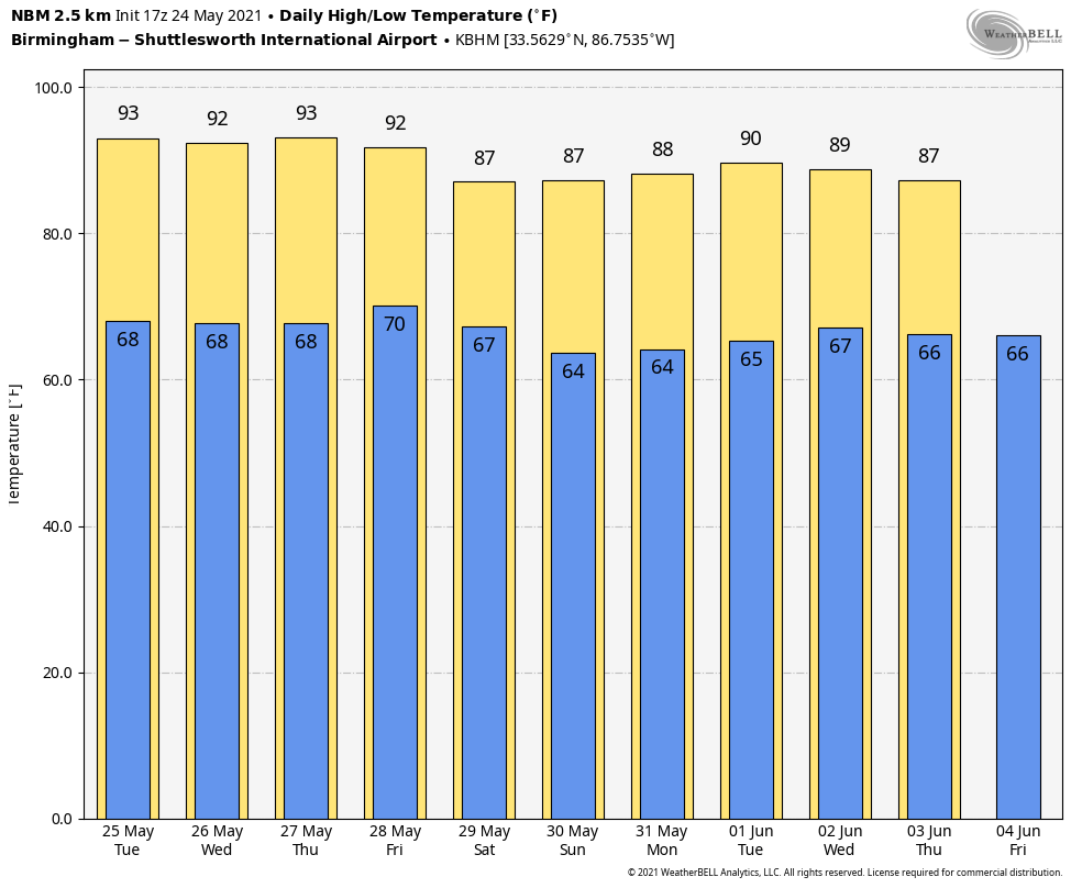
SEC BASEBALL: The weather will be mostly hot and dry for the SEC baseball tournament that begins at the Hoover Met tomorrow, continuing through Sunday. A few isolated showers could pop up later this week and over the weekend, but probably nothing widespread. Highs will be in the low 90s tomorrow and Wednesday, and in the upper 80s Thursday through Sunday.
TROPICS: The Atlantic basin is quiet, and tropical storm formation is not expected this week. The official start to the Atlantic season is 8 days away.
ON THIS DATE IN 1973: An F4 tornado tore through the small town of Union City, Oklahoma, killing two and injuring four others. This tornado was the first storm to be studied in detail by the National Severe Storms Laboratory Doppler Radar Unit at Norman, OK and an armada of researchers in the field. Research of the radar data from the storm would lead to the discovery of a “TVS,” or Tornado Vortex Signature.
ON THIS DATE IN 2011: A tornado outbreak occurred over parts of northern and central Oklahoma during the day on May 24, 2011, with violent tornadoes devastating several communities. By the end of the day, one EF-5, two EF-4, and two EF-3 tornadoes destroyed buildings, ripped up trees and power poles, and unfortunately, resulted in 11 deaths and 293 injuries.
BEACH FORECAST: Click here to see the AlabamaWx Beach Forecast Center page.
WEATHER BRAINS: Don’t forget you can listen to our weekly 90 minute show anytime on your favorite podcast app. This is the show all about weather featuring many familiar voices, including our meteorologists here at ABC 33/40.
CONNECT: You can find me on all of the major social networks…
Look for the next Weather Xtreme video here by 6:00 a.m. tomorrow….


