

A Few Scattered Showers Over West Alabama This Afternoon
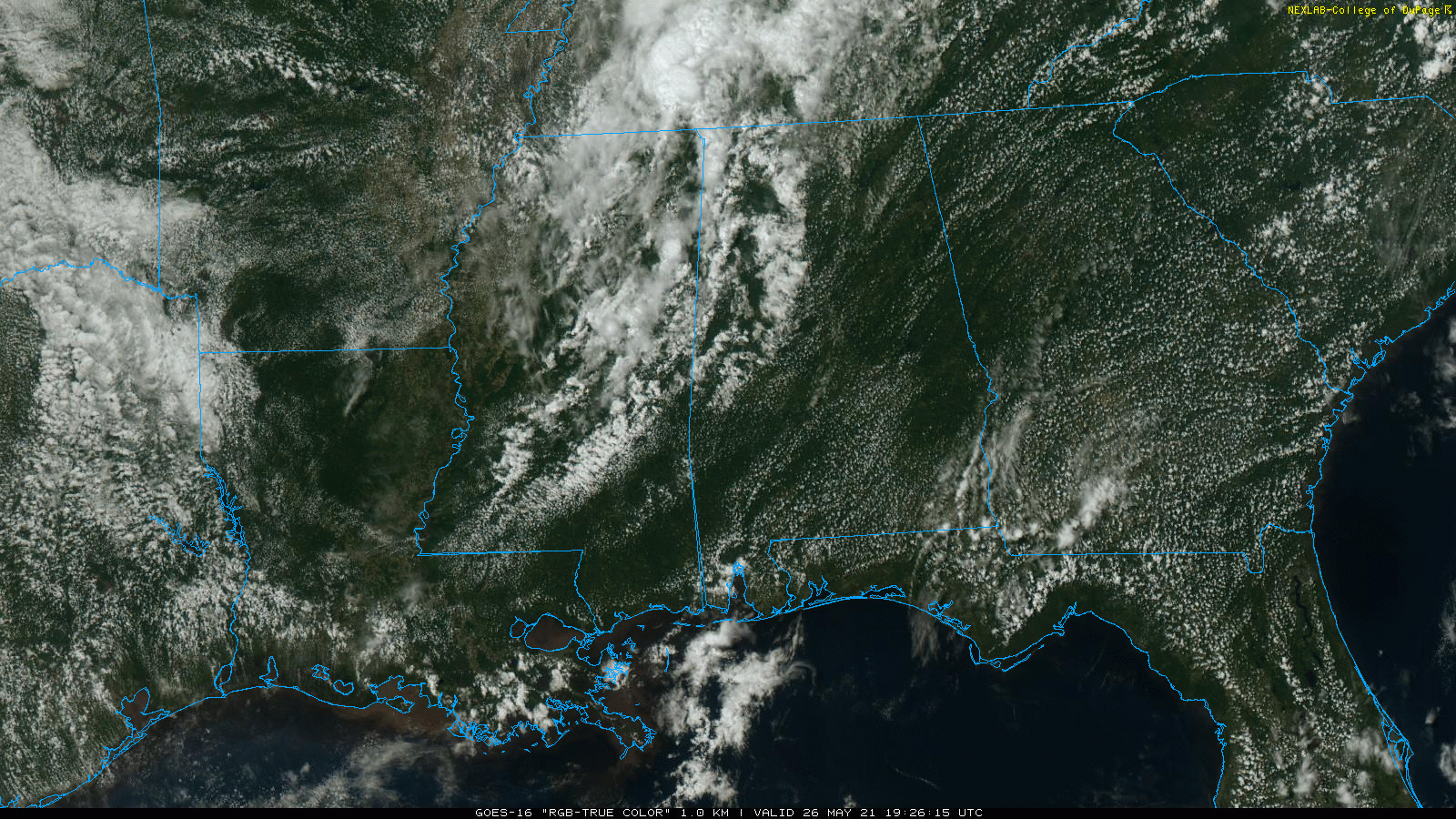
RADAR CHECK: We have a few scattered showers on radar over the western half of the state this afternoon… most of them are north of I-59/20 and west of I-65. The rest of the state is mostly sunny and very warm with temperatures in the 86-91 degree range. The showers will fade away later this evening after sunset, and tonight will be mostly fair with a low in the 60s.
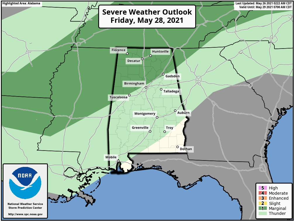
Tomorrow will be a partly sunny, warm day with only isolated afternoon showers; odds of any one spot getting wet tomorrow are only in the 10-20 percent range. The high will once again be somewhere between 85 and 90 degrees for most communities. But, on Friday, we expect an increase in the number of scattered showers and thunderstorms over the northern half of Alabama ahead of a cold front. Still, its won’t rain everywhere, but the chance of rain for any one spot Friday afternoon will be in the 35-45 percent range. The best chance of showers Friday will come about about 1:00 until 10:00 p.m…. and a few heavier storms over North Alabama could produce gusty winds or small hail.
SPC maintains a low end “marginal risk” (level 1/5) for that part of North Alabama north of I-59 (north of a line from Tuscaloosa to Birmingham to Gadsden).
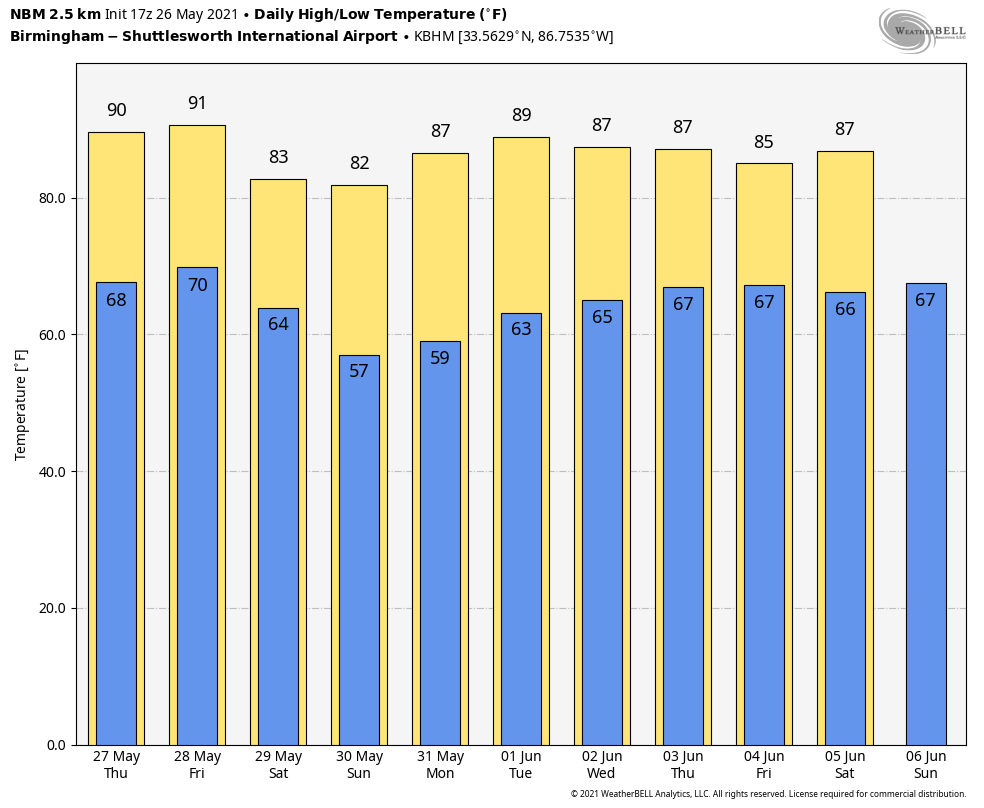
MEMORIAL DAY WEEKEND: A drier, cooler airmass will cover most of Alabama Saturday through Monday, meaning mostly sunny pleasant days and clear cooler nights. Highs Saturday and Sunday will be between 76 and 83 degrees over North/Central Alabama, with lows dropping into the cool 50s early Sunday and Monday. A few brief isolated showers can’t be ruled out near the coast over the weekend, but even there most places will be dry. The weather doesn’t get much better in late May in Alabama.
REST OF NEXT WEEK: Global models continue the idea of increased rain chances for Alabama and the Deep South over the latter half of next week, especially Thursday and Friday (June 3-4), as an upper trough approaches from the west. See the Weather Xtreme video for maps, graphics, and more details.
SEC BASEBALL TOURNAMENT: Very warm and generally dry weather continues in Hoover tonight and tomorrow with only a very small risk of a shower… highs will be in the 85-90 degree range. A brief passing shower or storm is possible late Friday or Friday night, then the weekend will feature beautiful weather with sunny days, fair nights, and lower heat levels. Highs Saturday and Sunday will be around 80 degrees.
TROPICS: All is quiet across the Atlantic basin, and tropical storm formation is not expected through the holiday weekend.
ON THIS DATE IN 1917: A major tornadic thunderstorm took a 293-mile track across parts of central Illinois and Indiana. Once believed to be a single tornado, the later study indicated it was likely at least eight separate tornadoes. The first touchdown was about 50 miles south-southeast of Quincy, Illinois. The tornadic storm tracked due east, before beginning a northeast curve near Charleston; separate tornadic storms then curved southeast from Charleston. The towns of Mattoon and Charleston bore the brunt of the tornado.
BEACH FORECAST: Click here to see the AlabamaWx Beach Forecast Center page.
WEATHER BRAINS: Don’t forget you can listen to our weekly 90 minute show anytime on your favorite podcast app. This is the show all about weather featuring many familiar voices, including our meteorologists here at ABC 33/40.
CONNECT: You can find me on all of the major social networks…
Look for the next Weather Xtreme video here by 6:00 a.m. tomorrow…
Category: Alabama's Weather, ALL POSTS, Weather Xtreme Videos
About the Author (Author Profile)
James Spann is one of the most recognized and trusted television meteorologists in the industry. He holds the AMS CCM designation and television seals from the AMS and NWA. He is a past winner of the Broadcast Meteorologist of the Year from both professional organizations.Subscribe
If you enjoyed this article, subscribe to receive more just like it.


