

Midday Nowcast: Some Rain and Storms this Afternoon
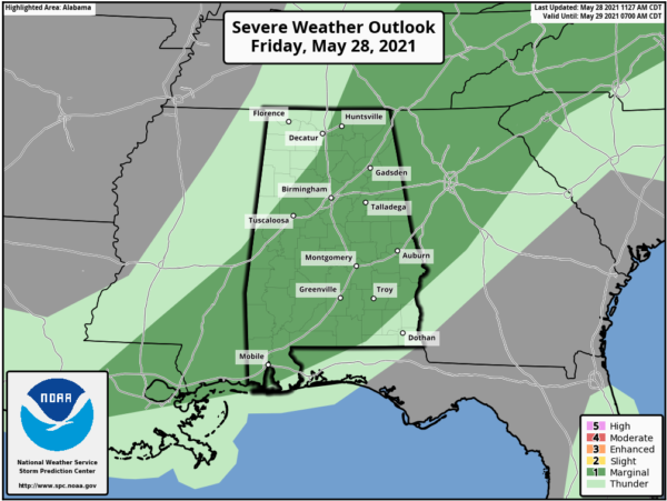
An approaching cold front will cause showers and storms to become widespread across Alabama later today and into the evening hours. A few strong storms can’t be ruled out and the SPC maintains a “marginal risk” (level 1/5) for much of Alabama this afternoon as a few storms could produce gusty winds and hail.
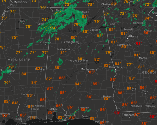
Though most locations will receive rain today, not every location will as rain distribution will be very uneven across the, but some areas could see over 1/2 inch of rain, especially with some of the stronger thunderstorms. At the midday hour, we are seeing more clouds than sun with temperatures heading into the low to mid-80s. Most of the rain/storm activity will shift down into the South Alabama early tonight, as the front pushes south.
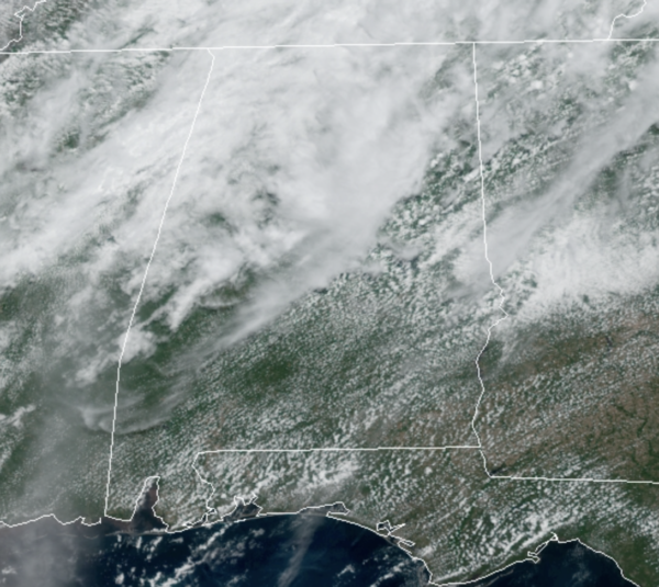
RADAR CHECK: At the midday hours, we are seeing scattered areas of rain across much of North Alabama. Over the next few hours, this activity should continue to expand in coverage and intensity, and again a few stronger storms are possible the rest of today. Also, storms this time of year, produce tremendous amounts of lightning.
MEMORIAL DAY WEEKEND: Behind the front, a cooler and drier air settles into Alabama for the long holiday weekend. Tomorrow through Monday, expect a sunny sky, pleasant conditions with highs Saturday and Sunday in the 70s, followed by 80s Monday. Nights will be rather cool and very refreshing with widespread 50s, with some 40s in colder spots.
IN THE TROPICS: All is quiet across the Atlantic Basin and tropical cyclone development is not expected the next five days. Hurricane “officially” begins next Tuesday, June 1st.
SEC BASEBALL TOURNAMENT: A passing shower or storm is likely at the Hoover Met later today, but the weather will be dry and pleasant tonight through the weekend. Expect lots of sunshine tomorrow and Sunday with highs in the 70s along with lower humidity levels.
BEACH FORECAST CENTER: Get the latest weather and rip current forecasts for the beaches from Fort Morgan to Panama City on our Beach Forecast Center page. There, you can select the forecast of the region that you are interested in visiting.
WORLD TEMPERATURE EXTREMES: Over the last 24 hours, the highest observation outside the U.S. was 118.8F at Jacobabad, Pakistan. The lowest observation was -100.8F at Vostok, Antarctica.
CONTIGUOUS TEMPERATURE EXTREMES: Over the last 24 hours, the highest observation was 110F at Death Valley, TX. The lowest observation was 20F at Peter Sinks, UT.
Category: Alabama's Weather, ALL POSTS
About the Author (Author Profile)
Macon, Georgia Television Chief Meteorologist, Birmingham native, and long time Contributor on AlabamaWX. Stormchaser. I did not choose Weather, it chose Me. College Football Fanatic. @Ryan_StinnetSubscribe
If you enjoyed this article, subscribe to receive more just like it.


