

Midday Nowcast: Rinse and Repeat Weather
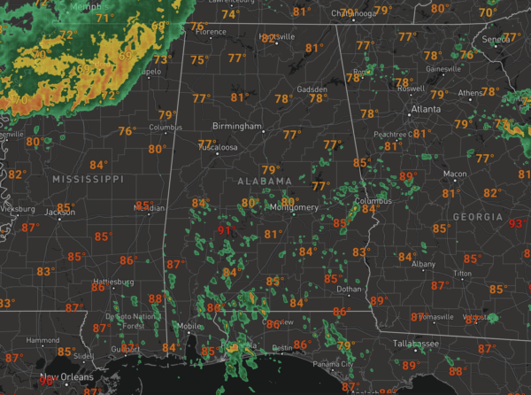
Not much change in the forecast today as very muggy conditions persist and we are seeing more clouds than sun again with temperatures heading into the 80s for most of locations.
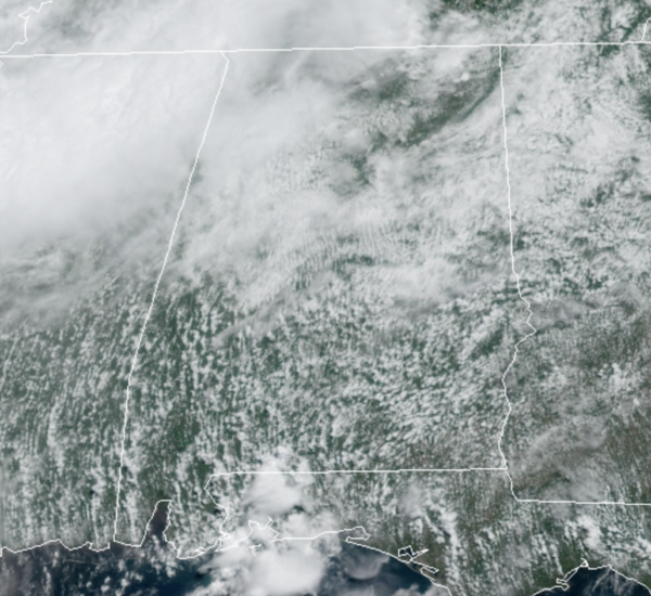
We are watching the radar as showers and storms are developing, and like yesterday they will be completely random in placement. Many locations will get wet this afternoon and evening, while many others stay dry.
Where the rain falls, it could be very heavy with areas of isolated flash flooding, and rainfall totals will again vary greatly across the area, with some spots staying dry, and others possible getting 2-3 inches. The rain/storms gradually decrease in coverage overnight, but still lingering areas of rain will persist.
REST OF WEEK: Rain chances will decrease a bit the rest of the week, as the upper-low lifts towards the Ohio Valley, but the overall pattern really won’t change much. Moist, unstable air will stay in place, and we will continue to deal with scattered showers and thunderstorms on a daily basis. The best chance of rain each day will come during the afternoon and evening hours, but we can’t rule out a few late night or morning showers along the way. The sun will be out at times, but the sky will be generally cloudy with highs in the mid 80s on most days.
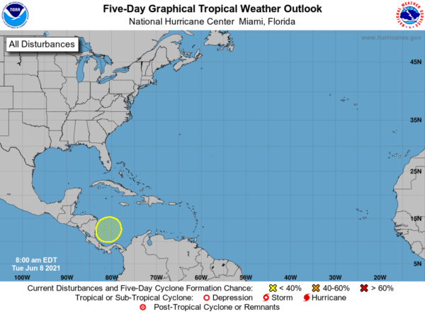
IN THE TROPICS: An area of low pressure is expected to develop over the southwestern Caribbean Sea during the next couple of days. Some gradual development will be possible thereafter while the system moves slowly northwestward toward Central America. Regardless of development, this system could produce heavy rainfall across northern Colombia and portions of Central America from Honduras southward later this week and into the weekend. Formation chance through 5 days…low…30 percent.
BEACH FORECAST CENTER: Get the latest weather and rip current forecasts for the beaches from Fort Morgan to Panama City on our Beach Forecast Center page. There, you can select the forecast of the region that you are interested in visiting.
WORLD TEMPERATURE EXTREMES: Over the last 24 hours, the highest observation outside the U.S. was 119.8F at Zabol, Iran. The lowest observation was -100.1F at Vostok, Antarctica.
CONTIGUOUS TEMPERATURE EXTREMES: Over the last 24 hours, the highest observation was 115F at Rio Grande Village, TX. The lowest observation was 22F at Sand Creek Station, OR.
WEATHER ON THIS DATE IN 1966: A tornado ripped right through the heart of the capitol city of Topeka KS killing sixteen persons and causing 100 million dollars damage. The tornado, which struck during the evening, cut a swath of near total destruction eight miles long and four blocks wide. It was the most destructive tornado of record up until that time.
Category: Alabama's Weather, ALL POSTS
About the Author (Author Profile)
Macon, Georgia Television Chief Meteorologist, Birmingham native, and long time Contributor on AlabamaWX. Stormchaser. I did not choose Weather, it chose Me. College Football Fanatic. @Ryan_StinnetSubscribe
If you enjoyed this article, subscribe to receive more just like it.


