

Large Area of Rain Moving Through Central Alabama with Flooding Threat: Flash Flood Warning Continues for Pickens County Until 1130 am
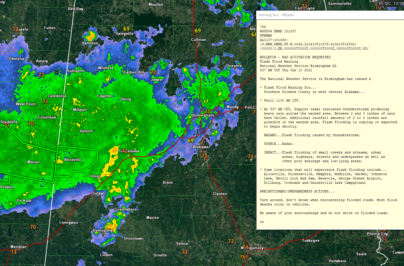
Moderate to heavy rain now covers much of Lamar, Fateyye, Walker, Pickens, and Tuscaloosa Counties at this hour. The precipitation is moving to the east-northeast. It has spread as far east as the Birmingham Metro area.
A band of heavier rain is along the forward flank f the mass extending from the Tuscaloosa/Northport area southward to Greensboro and Demopolis.
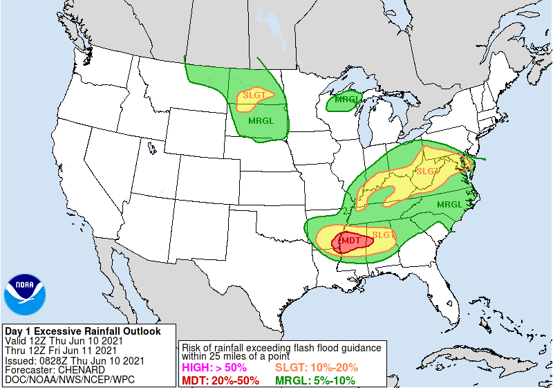
There is a risk of flash flooding today across much of the northern two-thirds of the state. Here is the WPC Excessive Rainfall Outlook, which works like the SPC Severe Weather Outlooks.
Mesoscale modeling indicates that this rain area will begin to dissipate as we go through the morning hours and most of the rain should be gone by lunchtime.
But until then, there is a threat for flooding in areas that have seen significant rainfall over the past week. A Flash Flood Watch continues for Blount, Fayette, Jefferson, Lamar, Marion, Pickens, Tuscaloosa, Walker, and Winston Counties till 7:00 PM CDT. The southern half of Pickens County has a Flash Flood Warning until 11L30 a.m.
Category: Alabama's Weather, ALL POSTS
About the Author (Author Profile)
Bill Murray is the President of The Weather Factory. He is the site's official weather historian and a weekend forecaster. He also anchors the site's severe weather coverage. Bill Murray is the proud holder of National Weather Association Digital Seal #0001 @wxhistorianSubscribe
If you enjoyed this article, subscribe to receive more just like it.


