

Severe Thunderstorm Watch for Western Alabama Until 7 p.m.
The SPC has issued a severe thunderstorm watch for parts of West Alabama. It is in effect until 7 p.m. CDT.
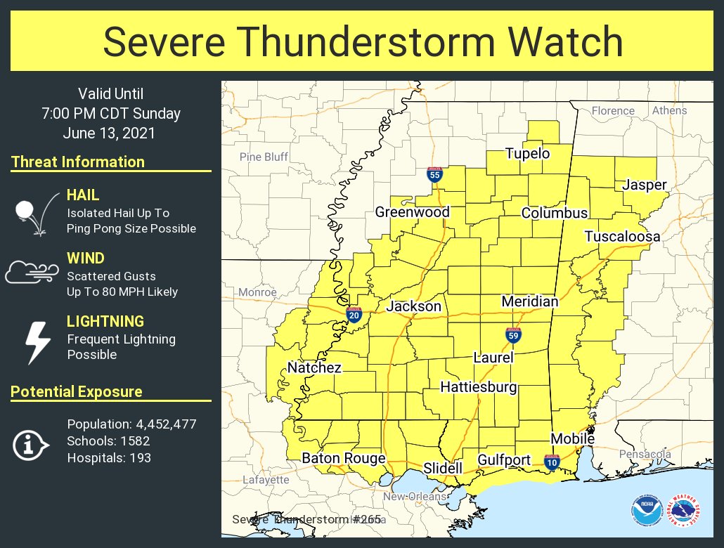
Alabama counties include Walker, Marion, Winston, Fayette, Greene, Hale, Lamar, Marengo, Pickens, Sumter, and Tuscaloosa.
Some of the communities include Aliceville, Carrollton, Demopolis, Eutaw, Fayette, Greensboro, Haleyville, Hamilton, Jasper, Linden, Livingston, Moundville, Suligent, Tuscaloosa, Vernon, and York.
It also includes much of Mississippi and even parts of eastern Louisiana.
Storms have developed rapidly in the past hour over northwestern Alabama with clusters of multicellular storms producing lots of heavy rain and lightning. These storms and others will continue to develop and collapse, dumping their heavy loads of rain, some hail, and producing strong microbursts of wind.
Be alert through the remainder of the afternoon and into early evening. Be in a sturdy structure if any of these storms approach your location.
Category: Alabama's Weather, ALL POSTS, Severe Weather
About the Author (Author Profile)
Bill Murray is the President of The Weather Factory. He is the site's official weather historian and a weekend forecaster. He also anchors the site's severe weather coverage. Bill Murray is the proud holder of National Weather Association Digital Seal #0001 @wxhistorianSubscribe
If you enjoyed this article, subscribe to receive more just like it.


