

1:35 pm Radar Update: New Severe Thunderstorm Warning, Flood Advisory
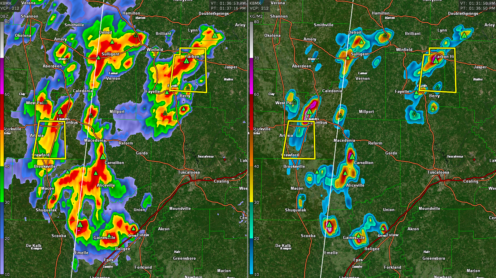
Clusters of strong storms continue over West Central Alabama this afternoon.
They are numerous over parts of Marion, Winston, Lamar, Fayette, Walker, Pickens, Greene, and Sumter Counties. They are capable of producing damaging winds, small hail, heavy rain, and deadly lightning.
The strongest ones are over northwestern Walker and northern Fayette counties just southwest of Carbon Hill. A severe thunderstorm warning was just issued for these storms.
The National Weather Service in Birmingham has issued a
* Severe Thunderstorm Warning for…
Northwestern Walker County in central Alabama…
Northeastern Fayette County in west central Alabama…
* Until 215 PM CDT.
* At 133 PM CDT, a severe thunderstorm was located over Kansas, or
near Carbon Hill, moving south at 15 mph.
HAZARD…60 mph wind gusts and penny size hail.
SOURCE…Radar indicated.
IMPACT…Expect damage to roofs, siding, and trees.
* Locations impacted include…
Carbon Hill, Kansas, Eldridge, Corona, West Corona, and Fowlers
Crossroads.
Other strong storms are over Pickens County from west of Carrollton to west of Aliceville. Another strong storm is near Geiger in Sumter County.
A flood advisory has been issued for parts of Marion and Fayette County.
Category: Alabama's Weather, ALL POSTS, Severe Weather
About the Author (Author Profile)
Bill Murray is the President of The Weather Factory. He is the site's official weather historian and a weekend forecaster. He also anchors the site's severe weather coverage. Bill Murray is the proud holder of National Weather Association Digital Seal #0001 @wxhistorianSubscribe
If you enjoyed this article, subscribe to receive more just like it.


