

EXPIRED Severe Thunderstorm For Parts of Walker and Winston Counties Until 230 pm
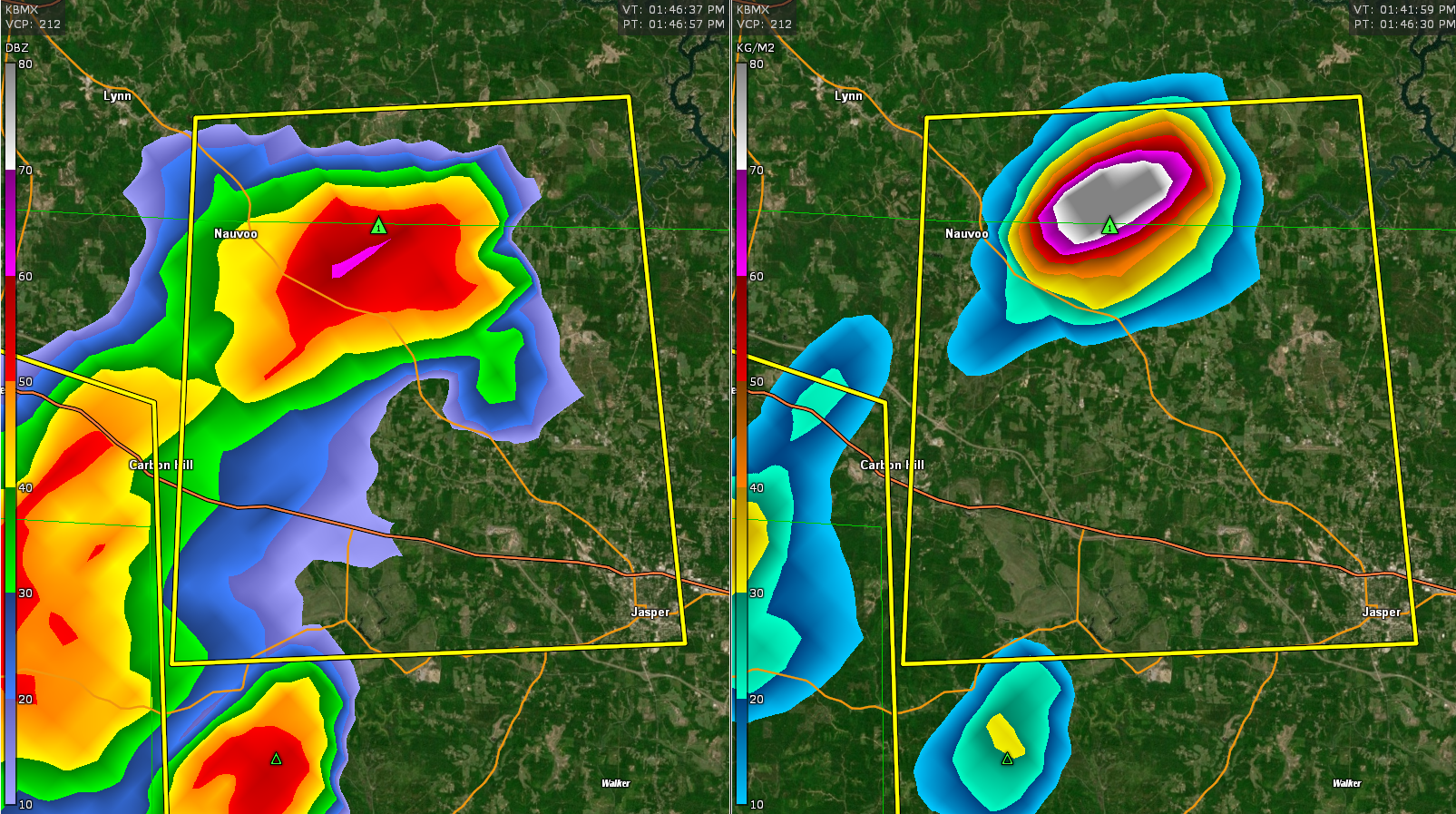
The strongest part of the storm is east of Nauvoo. It will move south-southwest in the general direction of AL-118 and Saragossa. High winds, hail, torrential rain, and deadly lightning accompany the storm.
The National Weather Service in Birmingham has issued a
* Severe Thunderstorm Warning for…
Northwestern Walker County in central Alabama…
South central Winston County in northwestern Alabama…
* Until 230 PM CDT.
* At 145 PM CDT, a severe thunderstorm was located near Poplar
Springs, or 9 miles southeast of Lynn, moving south at 15 mph.
HAZARD…60 mph wind gusts and penny size hail.
SOURCE…Radar indicated.
IMPACT…Expect damage to roofs, siding, and trees.
* Locations impacted include…
Jasper, Carbon Hill, Nauvoo, Camp McDowell, Ashbank, Poplar
Springs, Smith Lake, Seymour Branch, Coon Creek, Cedrum Area, Holly
Grove, Lupton, Gamble, Townley and Walker County Airport.
Category: Alabama's Weather, ALL POSTS
About the Author (Author Profile)
Bill Murray is the President of The Weather Factory. He is the site's official weather historian and a weekend forecaster. He also anchors the site's severe weather coverage. Bill Murray is the proud holder of National Weather Association Digital Seal #0001 @wxhistorianSubscribe
If you enjoyed this article, subscribe to receive more just like it.


