

5 p.m. Update: Severe Thunderstorm Watch Canceled for all Central Alabama Counties
The severe thunderstorm watch has been canceled for all Central Alabama Counties. It does remain in effect for a few southwest Alabama counties down to Mobile.
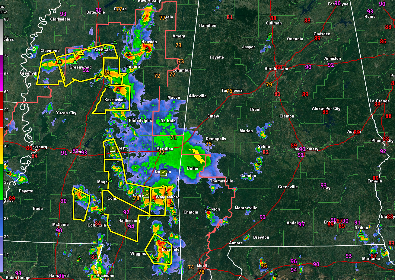
The active storms have moved in Mississippi now.
The rest of the night should be calm. A few showers could move into North Alabama overnight ahead of a frontal system that is sagging into North Alabama. That front will stall over the Tennessee valley by morning before moving south again tomorrow.
It looks like tomorrow’s showers and storms will form south of I-20. Drier air will work into Alabama starting tomorrow afternoon. Tuesday, Wednesday, and Thursday will be mostly dry and less humid across North and Central Alabama.
It still looks like we might see a tropical depression or tropical storm form in the southwestern Gulf by midweek. The latest runs of the GFS still show a tropical storm moving into the North Central Gulf Coast, most likely Central Louisiana late Saturday or Sunday.
Category: Alabama's Weather, ALL POSTS, Severe Weather
About the Author (Author Profile)
Bill Murray is the President of The Weather Factory. He is the site's official weather historian and a weekend forecaster. He also anchors the site's severe weather coverage. Bill Murray is the proud holder of National Weather Association Digital Seal #0001 @wxhistorianSubscribe
If you enjoyed this article, subscribe to receive more just like it.


