

Midday Nowcast: Sunny, but Watching the Gulf
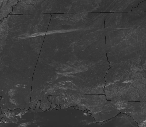
Drier air is slowly filtering into the state today as our dew points are falling. Though it is still hot, it is not as humid as it has been recently with highs today approaching the lower 90s for most locations. The next few days will remain mainly sunny and dry, with slightly cooler temperatures. Highs will be in the mid to upper 80s, while nights will be pleasant with widespread 60s and some 50s. By Friday, things start to change on the forecast for the upcoming weekend will all depend on the likely system approaching the Gulf Coast.
LATEST ON INVEST 92-L: Disorganized showers and thunderstorms continue over the Bay of Campeche and southern Mexico in association with a broad low pressure area.
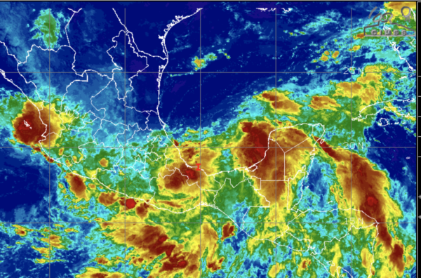
This system is expected to move little during the next day or two, and any development should be slow to occur during that time period. However, the disturbance should begin to move northward by Thursday, and a tropical depression is likely to form late in the week when the low moves across the central or northwestern Gulf of Mexico. Regardless of development, heavy rainfall will continue over portions of Central America and southern Mexico during the next several days. Heavy rains could also begin to impact portions of the northern Gulf Coast on Friday. Formation chance through 5 days…high…70 percent. If this system develops it would get the name Claudette.
WEEKEND WEATHER: For now, with the current forecast model outputs, it looks like we will quite a bit of tropical moisture to deal with by Saturday. As the system moves onshore and moves east through Alabama, the forecast for much of the weekend looks generally cloudy with occasional showers and storms and temperatures in the 70s and 80s. The heaviest of the rainfall will be down across South Alabama and along the Gulf Coast, where rainfall totals could easily be over five inches.
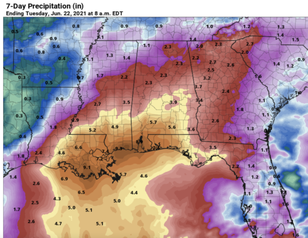
For North/Central Alabama, lighter amounts are expected. Again, this forecast will change in the coming days as the system finally develops and gets better organized. As we approach the weekend, we will have a better handle on the track and intensity of the the system.
ELSEWHERE IN THE TROPICS: Tropical Storm Bill formed yesterday and is not threat to the U.S. Bill is moving very quickly to the northeast near 38 mph and a continued fast northeastward motion is expected through Wednesday. Maximum sustained winds are near 60 mph with higher gusts. Little change in strength is expected today, but Bill is forecast to become a post-tropical low by this evening and dissipate on Wednesday.The estimated minimum central pressure is 998 mb (29.47 inches).
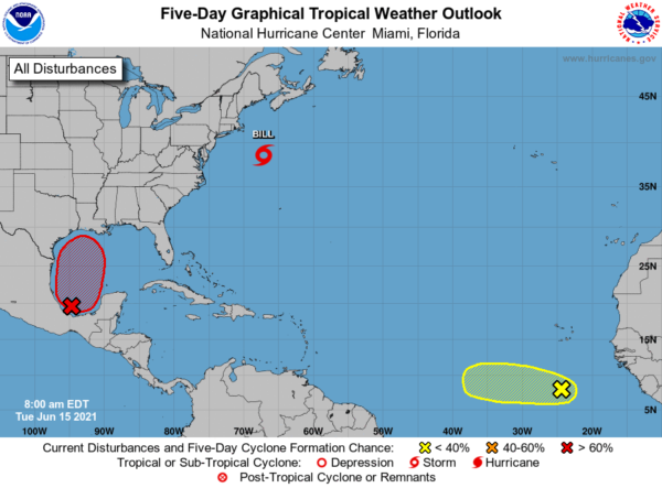
Farther out in the Atlantic, we have Invest 94L. Showers and thunderstorms have decreased and become less organized during the past several hours in association with a tropical wave located a few hundred miles south of the Cabo Verde Islands. Development, if any, should be slow to occur during the next couple of days while the wave moves westward. Thereafter, a combination of dry air aloft and strong upper-level winds should limit the chances of formation when the wave reaches the central tropical Atlantic. Formation chance through 5 days…low…10 percent.
BEACH FORECAST CENTER: Get the latest weather and rip current forecasts for the beaches from Fort Morgan to Panama City on our Beach Forecast Center page. There, you can select the forecast of the region that you are interested in visiting.
WORLD TEMPERATURE EXTREMES: Over the last 24 hours, the highest observation outside the U.S. was 120.4F at Ibri, Oman. The lowest observation was -105.3F at University Dome, Antarctica.
CONTIGUOUS TEMPERATURE EXTREMES: Over the last 24 hours, the highest observation was 118F at Death Valley and Stovepipe Wells, CA. The lowest observation was 24F at Peter Sinks, UT.
WEATHER ON THIS DATE IN 1957: East Saint Louis was deluged with 16.54 inches of rain in 24 hours, a record for the state of Illinois.
Category: Alabama's Weather, ALL POSTS
About the Author (Author Profile)
Macon, Georgia Television Chief Meteorologist, Birmingham native, and long time Contributor on AlabamaWX. Stormchaser. I did not choose Weather, it chose Me. College Football Fanatic. @Ryan_StinnetSubscribe
If you enjoyed this article, subscribe to receive more just like it.


