

PTC#3 Running out of Time and Water
Potential Tropical Cyclone #3 is more of an open trough than a closed low. There is a low-level center, but it is totally exposed.
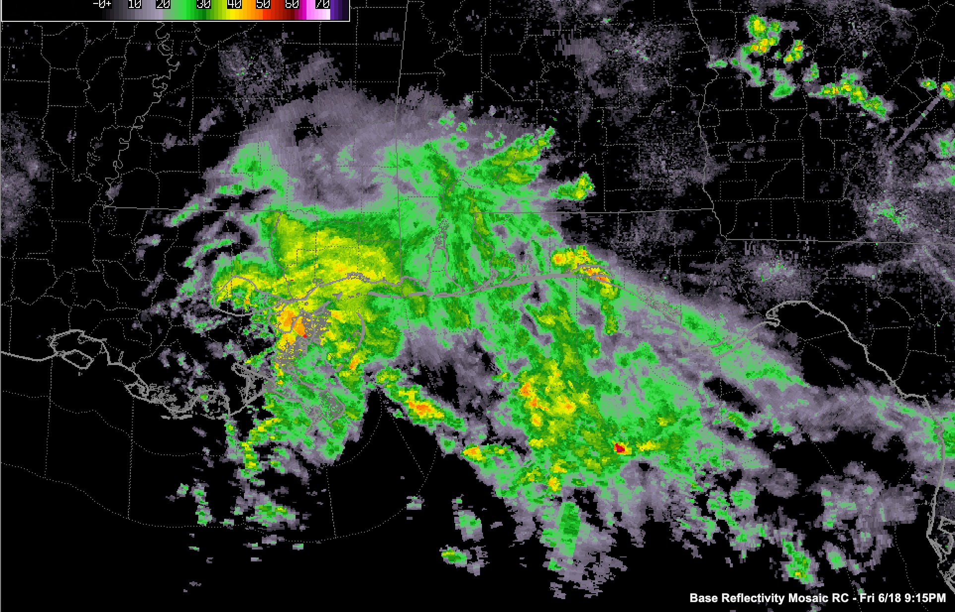
The system is running out of time to be classified as a tropical storm. Whether it is named or not, the impacts will be about the same. There are tropical-storm-force winds east of the center. Those will be coming ashore in the Tropical Storm Warning area from Morgan City to near Sandestin.
Moderate to heavy rain is overspreading southeastern Louisiana, southern Mississippi, Southwest Alabama, and Northwest Florida.
Tides are running 3-4 feet above normal on the western Mississippi coast at Waveland. At Shell Beach, LA, the tide is nearly 4 feet above normal.
Winds are gusting to 26 mph at Gulf Shores and 30 mph at NAS Pensacola. At Boothville LA, it is gusting to 24 mph.
Waterspouts are possible over the next hour or so in the waters off St, Bernard Parish. There is a continuing tornado threat later tonight and tomorrow north and northeast of the system as it lifts north and northeast, but that threat may be less than earlier expected.
Heavy rain will spread across South and South-Central Alabama later tonight and Saturday. Flooding is possible and flash flood watches are in effect.
Category: Alabama's Weather, ALL POSTS, Tropical
About the Author (Author Profile)
Bill Murray is the President of The Weather Factory. He is the site's official weather historian and a weekend forecaster. He also anchors the site's severe weather coverage. Bill Murray is the proud holder of National Weather Association Digital Seal #0001 @wxhistorianSubscribe
If you enjoyed this article, subscribe to receive more just like it.


