

Alabama Weather Update at 5:30 p.m.
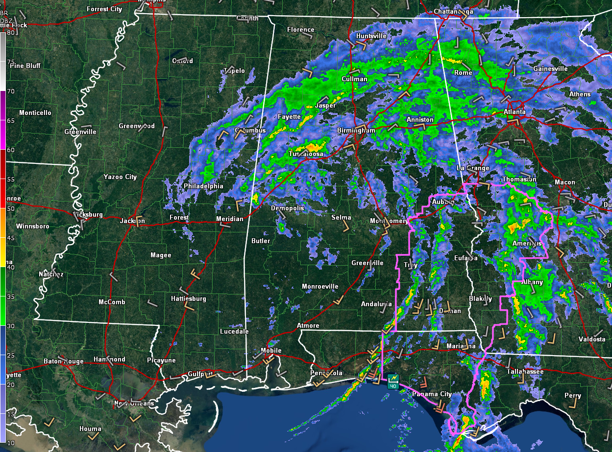
Light to moderate to occasionally heavy rain continues over the northern half of Alabama with showers and thunderstorms in the feeder bands over Southeast Alabama.
The heaviest rain over North and Central Alabama is over northern Tuscaloosa County. We are not picking up any lightning any longer. The heavier rain will rotate eastward across North Central Alabama including the Birmingham area, slowly diminishing after midnight.
The center of Tropical Depression is centered over Southwest Alabama, probably near Camden in Wilcox County. It is difficult to pinpoint from observations because there is a dearth of observing stations over Southwest Alabama.
Winds are light across the state now, averaging 6-12 mph but gusting to 15-20 mph at times.
The tornado watch continues for Southeast Alabama. In Central Alabama, the following communities remain under the watch: Barbour, Bullock, Lee, Macon, Pike, and Russell.
The flash flood watch continues for the following Central Alabama counties until 7 p.m.: Autauga, Barbour, Bibb, Bullock, Calhoun, Chambers, Chilton, Clay, Cleburne, Coosa, Elmore, Jefferson, Lee, Lowndes, Macon, Montgomery, Pike, Randolph, Russell, Shelby, St. Clair, Talladega, Tallapoosa, and Tuscaloosa.
Category: Alabama's Weather, ALL POSTS, Severe Weather, Tropical
About the Author (Author Profile)
Bill Murray is the President of The Weather Factory. He is the site's official weather historian and a weekend forecaster. He also anchors the site's severe weather coverage. Bill Murray is the proud holder of National Weather Association Digital Seal #0001 @wxhistorianSubscribe
If you enjoyed this article, subscribe to receive more just like it.


