

Noon Forecast Update: Eyeing Severe Weather Chances for Late Tomorrow Night
Happy Father’s Day to all the dads out there!
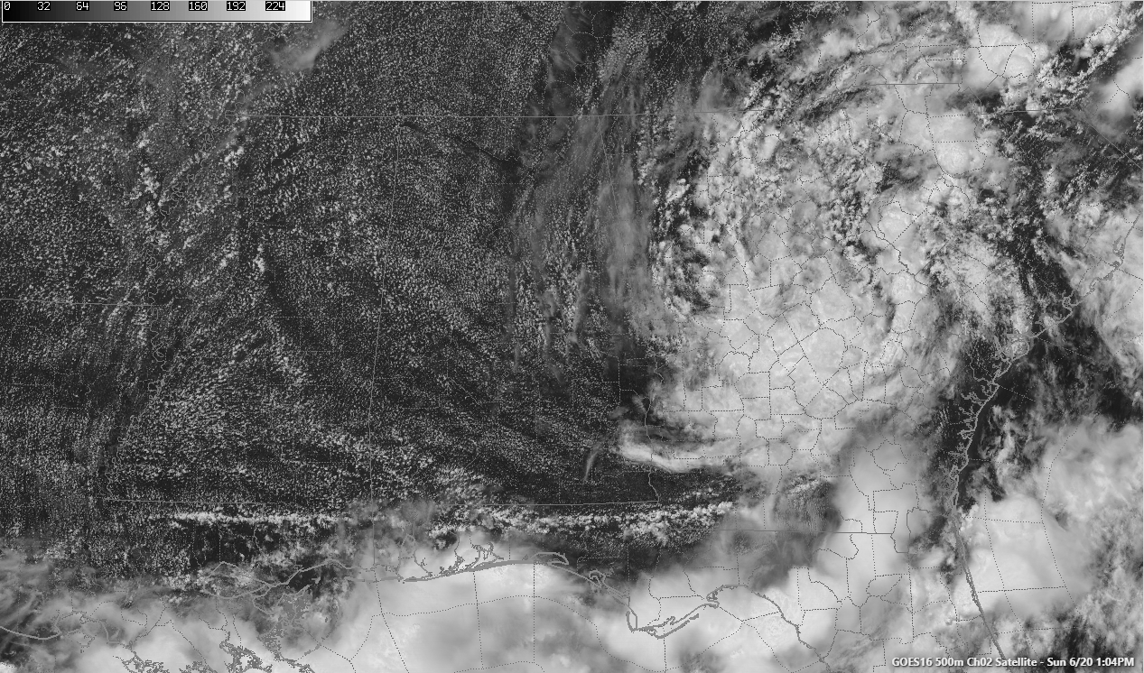
It is turning out to be a beautiful Father’s Day across Alabama after a day of wind, rain, and flooding. The source of yesterday’s adverse weather is now centered on the Georgia/South Carolina border, about to start its second life as a tropical storm. Claudette is expected to intensify over the next 24 hours and become a tropical storm again by tomorrow morning while still over eastern North Carolina.
You can see signs that that is already coming together with very gusty winds over southeast Georgia, and coastal South and North Carolina. This hour, winds are gusting to 37 mph at Fort Stewart and 36 mph at Savannah in Georgia. Charleston SC is reporting wind gusts to 30 mph. It is expected to pass about 175 miles east of Cape Cod on Tuesday, breeze by Nova Scotia on Tuesday night, and reach Newfoundland on Wednesday.
Skies have become mostly sunny across all of Alabama at this hour, with a very healthy cumulus field forming in the deep moisture left behind Claudette, a so so parting gift for her visit.
We don’t think we will see much in the way of showers this afternoon or evening, despite the deep moisture. Only isolated ones at best. High temperatures will rise into the middle and upper 80s.
The nearest rain to North and Central Alabama at this time is the departing showers over Georgia associated with Claudette and a neatly arranged line of storms extending from Southeast Louisiana, across COastal Mississippi, Coastal Alabama, and across the Florida Panhandle to southwestern Georgia.
Skies will be partly cloudy overnight with lows in the lower 70s.
A strong upper-level trough currently digging into the Northern Plains will swing over to the Great Lakes tomorrow, amplifying as it goes. It will be our next weather maker. The associated sharp cold front will be near Memphis by tomorrow afternoon. Ahead of the front, a passing disturbance will help spark a few afternoon showers and storms across Alabama in an atmosphere primed for development. Those could pack quite a punch, although I think that the SPC is thinking the overnight storms will be the ones to watch for severe weather. The main line of storms will reach Northwest Alabama by 10 p.m. and I-59 before 7 a.m. Some of these storms could be strong to severe with damaging winds the main threat. They should be going downhill by that time of day though and Central Alabama south of Birmingham could dodge severe weather. But the storms will fire again by afternoon over southern portions of the state and they could pack a punch as well.
The front will stall over South Alabama giving Central Alabama a couple of days of dry and warm conditions. The front will try to come back north by the weekend increasing our shower and storm chances again.
The GFS is trying to spin up a disturbance in the western Caribbean, Yucatan, southwest Gulf of Mexico by the end of the month. That looks plausible and we will be watching. It does correspond with the time that an upward pulse in the Madden Julian Oscillation will be passing through the area, which sometimes can aid tropical development.
Category: Alabama's Weather, ALL POSTS, Severe Weather, Tropical
About the Author (Author Profile)
Bill Murray is the President of The Weather Factory. He is the site's official weather historian and a weekend forecaster. He also anchors the site's severe weather coverage. Bill Murray is the proud holder of National Weather Association Digital Seal #0001 @wxhistorianSubscribe
If you enjoyed this article, subscribe to receive more just like it.


