

Flash Flood Watch for North Alabama Until Tuesday Morning
Earlier today, the NWS Huntsville issued a Flash Flood Watch for Cullman, Marshall, Jackson, and DeKalb Counties from 7pm tonight until 10am Tuesday.
The concern is that an additional 1-2″+ of rainfall could quickly lead to flash flooding in these areas that have already gotten significant rainfall from Claudette.
Here is a rainfall map over the past three days across North and Central Alabama:
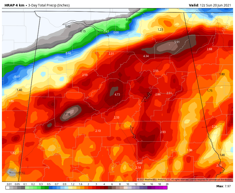
The NWS in Huntsville just added a late rainfall report: 2 miles NNW Rainsville in Dekalb Co., public report of 10.56 inches of rain. That’s a lot! There were several 8-9 inch reports from DeKalb County.
Of course, most of that occurred Saturday evening when convection exploded over Alabama as Tropical Storm Claudette crossed our state.
The storm has claimed a total of 14 lives in Alabama, including the 10 deaths in the tragic automobile multi-vehicle pileup on I-65 near Greenville Saturday afternoon, two people who died near Cottondale Saturday evening when a tree fell on their manufactured home, a woman who drowned when her car was washed into a creek in Fort Payne Saturday night, and a man whose body was recovered today after he fell into a creek in western Birmingham and was swept away.
Category: Alabama's Weather, ALL POSTS, Severe Weather
About the Author (Author Profile)
Bill Murray is the President of The Weather Factory. He is the site's official weather historian and a weekend forecaster. He also anchors the site's severe weather coverage. Bill Murray is the proud holder of National Weather Association Digital Seal #0001 @wxhistorianSubscribe
If you enjoyed this article, subscribe to receive more just like it.


