

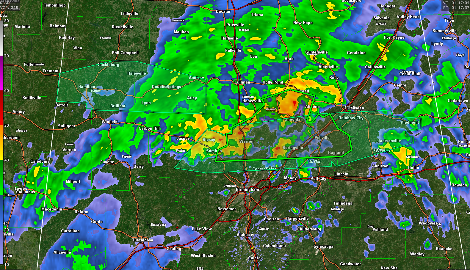
Flash Flood Warning for Parts of Blount, Jefferson, and St. Clair Counties Until 4 am
The National Weather Service in Birmingham has issued a
* Flash Flood Warning for…
Blount County in central Alabama…
Northeastern Jefferson County in central Alabama…
Northern St. Clair County in central Alabama…
* Until 400 AM CDT.
* At 113 AM CDT, Doppler radar indicated thunderstorms producing
heavy rain across the warned area. Between 1 and 3 inches of rain
have fallen. The expected rainfall rate is 1 to 3 inches an hour.
Additional rainfall amounts of 2 to 3 inches are possible across
the warned area. Flash flooding is ongoing or expected to begin
shortly.
HAZARD…Flash flooding caused by thunderstorms.
SOURCE…Radar.
IMPACT…Flash flooding of small creeks and streams, urban
areas, highways, streets and underpasses as well as
other poor drainage and low-lying areas.
* Some locations that will experience flash flooding include…
Gardendale, Rainbow City, Oneonta, Springville, Sumiton,
Blountsville, Cleveland, Dallas, Clay, Pinson, Argo, Warrior,
Kimberly, Ashville, Morris, Ragland, Locust Fork, Ohatchee, Steele
and Altoona.
Category: Alabama's Weather, ALL POSTS, Severe Weather
About the Author (Author Profile)
Bill Murray is the President of The Weather Factory. He is the site's official weather historian and a weekend forecaster. He also anchors the site's severe weather coverage. Bill Murray is the proud holder of National Weather Association Digital Seal #0001 @wxhistorianSubscribe
If you enjoyed this article, subscribe to receive more just like it.


